Secrets of North Iceland

North Iceland offers many different attractions. This part of Iceland is rich with history, dramatic landscapes and incredibly beautiful nature where villages are few and far between. The Arctic Circle is close and during the dark winter months the Northern Lights often light up the sky. Here’s our complete guide to North Iceland.
As you head out north from Reykjavik following road 1 mt. Esja (914 m) rises before you. The mountain is a popular outdoor area among locals and there are many great hiking trails there. Esja once was a volcano, the oldest part of the mountain is over 3 million years old. You can actually see that part, as you drive alongside the mountain, since it is the westernmost part. Look to your right as you pass the mountain, for that is the oldest part of Esja.
As you pass the oldest part and the road turn northwards once again, you might notice a farm to your right. This is the farm Esjuberg, where, according to the Icelanders Saga Kjalnesingasaga or Saga of the Kjalnesings, lived a rich sorcerous widow called Esja. Whether the widow had her name from the mountain or the mountain is named after her is unknown, though most scholars believe that the widow inherited the name from the mountain. Esja is one of the key characters of the Saga of the Kjalnesings and raised the main character Bui at her farm.
After a while you should see the Hvalfjord tunnel where you can get across the Hvalfjordur fjord. Keep following road 1 until you reach Borgarnes village.
Borgarnes
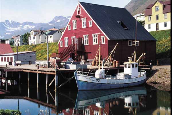
As you cross the bridge over Borgarfjordur fjord, you enter the small and cozy village of Borgarnes. As the story goes, the town stands where the settler Skallagrimur Kveldulfsson built his farm. Skallagrimur is the father of Egill, the warrior-poet, and the main character of Egils saga. You learn much about the Skallagrimur, Egill and the settlement in the Settlement Center. There’s also a quite good coffee house in the same building as the Settlement Center.
Finally, there’s a nice swimming pool in Borgarnes, one well worth the visit, especially when travelling with kids. There are water slides and both indoor and outdoor pools.
Borgarfjordur
When you have learned about the settlement it’s time to leave Borgarnes following road 1. After a while you might notice that the road passes along a pristine and clear river to your right, this is river Nordura, one of the most popular river for salmon fishing in Iceland. This area is mostly either used for agriculture or for summer houses.
Birch grew wild in this area when the settlers came, but now it is mostly confined to a few areas. You might also notice the strange yet regular cliffs along the road every now and then. These cliffs almost all align, due to the fact that during an ice age a heavy glacier covered the area and as it withdrew its weight filed and shaped the cliffs like this.
As you pass between two of these cliffs you should see a gray and black moss-clad lava field open up before you. This is Grabrokarhraun lava field, which came from the small volcano straight ahead, Grabrok. You are getting close to our next stop.
After you’ve entered the lave field you should notice a road to your right, that leads to Glanni waterfall. You can park the car at the parking lot and walk only a short distance to find this magnificent waterfall in river Nordura. During the summer months you should find an angler or two trying their luck catching salmon, and if your are lucky you might catch the glimpse of these priced fishes jump and swim up the waterfall.
The perfect place for picnic
Not far from the waterfall is Paradise hollow or Paradisarlaut, which is a perfect place for a picnic. The hollow is surrounded by lava at almost all sides, offering shelter from the wind (it tends to get windy in Nordurardalur valley, especially in the afternoon) and when the sun is shining the hollow can be a great place to rest your weary bones from driving.
After you’ve returned road 1 you keep driving north. The buildings to your left is the Bifrost university. Bifrost has the same name the rainbow bridge that the aesir, the old Nordic gods, supposedly used to travel between the Nine Worlds, like Asgard and Midgard. If you are interested in the old Nordic religion you might see many names, places and attractions in Iceland that have some relation to the old religion.
If you are ready for a short hike, we recommend that you make a stop at Grabrok volcano. The hike to the top of the volcano is not hard and offers a brilliant view of the lava field and the Nordurardalur valley. Once you’ve reached the top you might also notice the small lake to your south, which is perfectly hidden from the road by a low hill. This is lake Hredavatn.
To your north you see a pyramidal mountain, which is almost orange and a bit different than the surrounding hills and mountains. This is mt. Baula, the mountain’s color is due to its rhyolite rock composition and the mountain was formed over 3.4 million years ago.
Holtavorduheidi heath
Once you’ve explored Grabrok it’s time to move and drive once more north following road 1. The road ascends as you reach Holtavorduheidi heath. The reception for mobile devices isn’t that good on the heath, so please make a note of that, it’s time to listen to those Spotify playlists you downloaded before coming to Iceland (hopefully including the Iceland Travel Road Trip playlist, full of different genres of Icelandic music, there on your device).
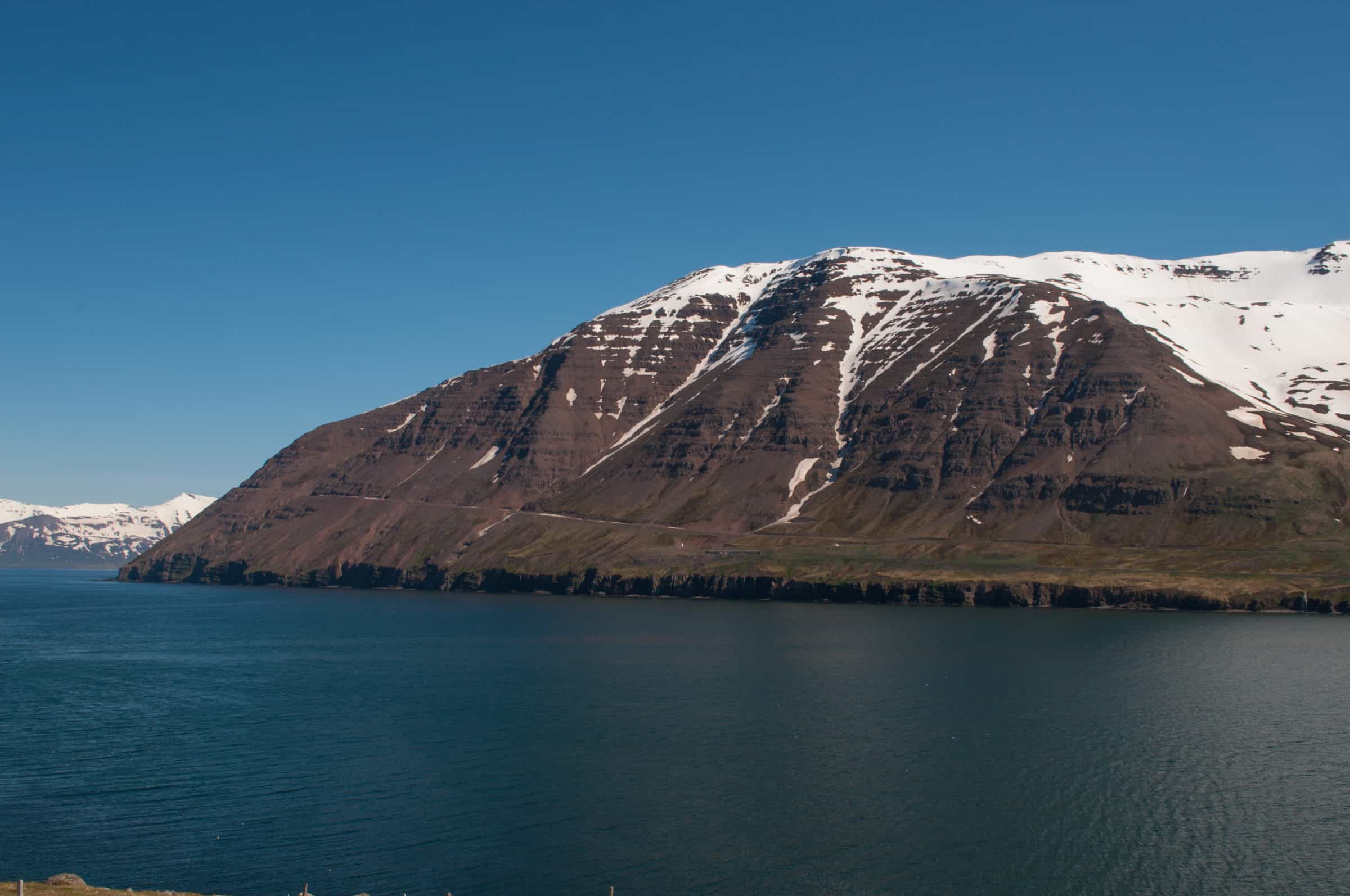
The heath itself, mostly moors with extensive and rather flat hills, is 407 meters high and if the weather is good you should be awarded with an awesome view of the surrounding lands. To your right you might glimpse Langjokull glacier and Eiriksjokull glacier. In front of you is the Hrutafjordur fjord and to your left is the basalt mountain Trollakirkja (1001 m), which is over 6 million years old.
As the story goes, when the settlers came trolls and giants used to live in mt. Trollakirkja (the name means troll church in Icelandic) but after Christianity was settled upon as state religion the trolls fled to the Westfjords, save for one female troll. She hated the new religion and tried to slaughter the Christians the first time a mass was sung in Hrutafjordur fjord by throwing a huge rock at the parish’s church, but missed. However, the rock slew many horses where it landed.
The western part of North Iceland
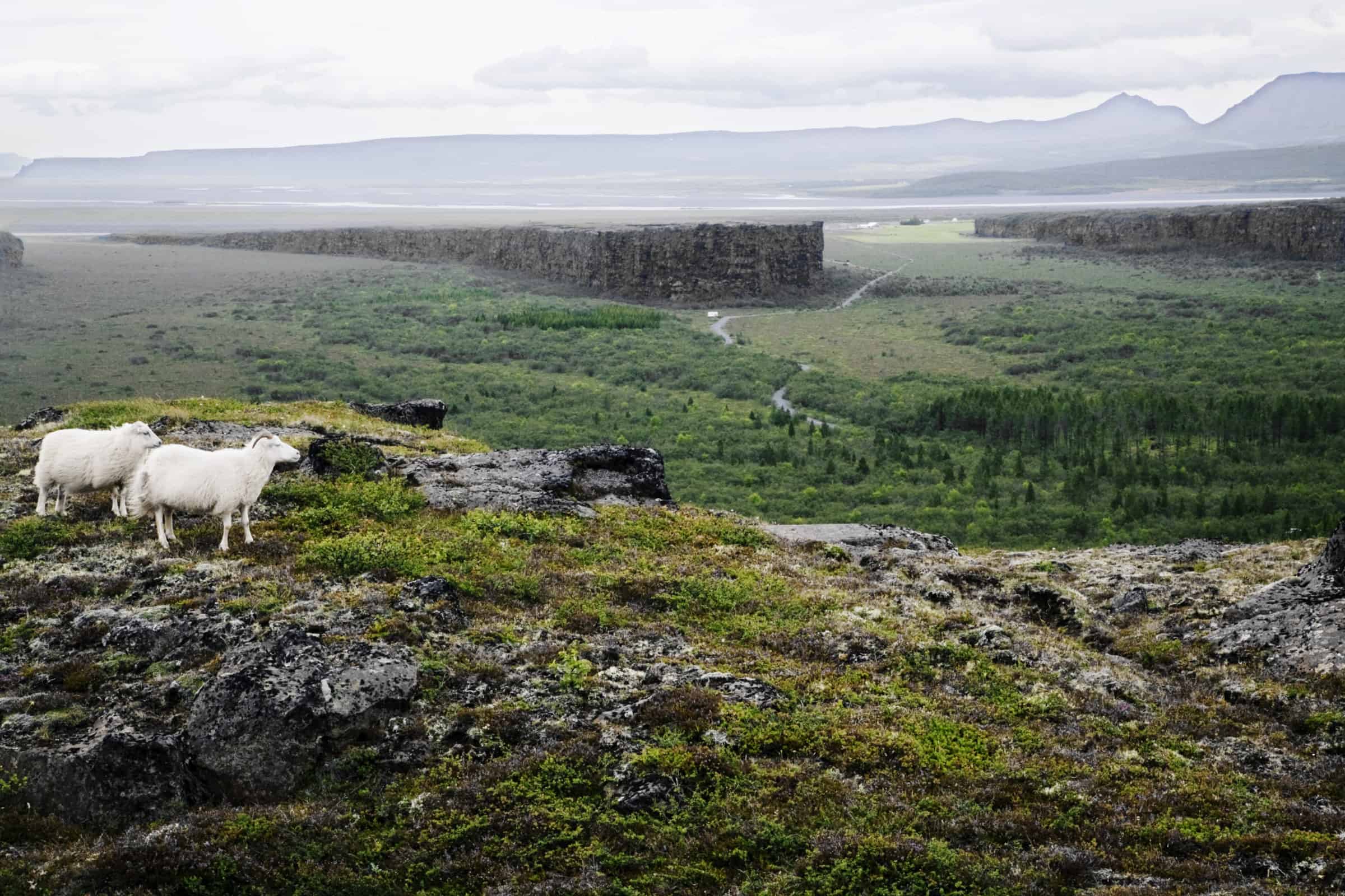
As road 1 descends from the Holtavorduheidi heath you enter the western part of North Iceland, an area characterized by rolling hills, deep fjords and fields of green. This part of Iceland is rich with history and was pivotal in the age of the Sturlungs, a time of unrest and civil war in the 12th and 13th century in Iceland. This is also an area rich with natural resources, you can find salmon and trout in almost all lakes and rivers, seals and seabirds by the coastline and fertile earth almost everywhere you look. No wonder you can find farmsteads even in the most remote locations.
Hrutafjordur fjord
In the Book of Settlements, or Landnamabok in Icelandic, is a tale of how Hrutafjordur fjord earned its name. As the story goes, one of the first settlers, Ingimundur the old Thorsteinsson, came looking for a good land to settle, discovered the fjord and found two rams there. Ingimundur thus decided that this deep and narrow fjord should be called Hrutafjordur or Fjord of the Rams.
Ingimundur, however, didn’t like the fjord and moved on to the east, until he found Vatnsdalur valley where he settled. Balki Blaengsson, one of Harald fairhair adversaries in the battle of Hafursfjord which is by many scholars throught to be one of the most decisive event in the history of Norway, was the first settler in Hrutafjordur.
As you descend from the heath you pass a rather large gas station to your left. Only a few dozen meters away you see a crossroad. Make left turn there and follow road 68 for a short while, or until you reach the tiny village of Bordeyri. The western part of the Hrutafjordur fjord area is called Baejarhreppur and has a population of about 100 and Bordeyri is, naturally, the only village in the area. This is the smallest village in Iceland, with population of 16, but used to serve the area as merchants made their way to the village, since the village had a good natural harbor.
Ingimundur the old is also responsible for the village’s name. As he was leaving Hrutafjordur after finding the two rams, a heavy fog came from the sea. He had to beach his ship and where he landed his men found a large sea driven tree trunk on the beach. Thus he decided that this beach should be called tree trunk beach or Bordeyri in Icelandic. Apparently, naming things wasn’t that complicated back then.
Backtrack to road 1 and turn left at the crossroads, follow the road northwards. On your way through the fjord you pass many farms, as this is rather good agricultural area. Most of these are sheep farms. To your left you soon see a large white building. This is Reykir, the local elementary school, or Heradskolinn ad Reykjum. If you turn left and follow the road leading to the school you also find a small museum dedicated to the people and livelihood of Hrutafjordur. We recommend, if you are interested in history and culture, that you take the time to explore this nice and cozy museum and learn a bit about how people of Hrutafjordur fjord made a living.
Once more on road 1 you turn left and drive on, heading for Laugarbakki and Hvammstangi.
Laugarbakki and Hvammstangi
As you reach the next fjord, called Midfjordur fjord, you should see a tiny village to you right, on the other side of the river. This river, called Midfjardara, is popular among fishermen. The small village is Laugarbakki and not far from it is a geothermal area, which provides enough hot water to heat up houses in both Laugarbakki and neighbouring Hvammstangi. You can find both handicraft center and a hotel in Laugarbakki, and we recommend that you stop by the farmer’s market in Grettisbol, where you can find various local products such as food and handicraft.
After you have maybe bought a handmade Icelandic wool mittens or even a sweater at the farmer’s market you return to road 1 and follow it for only a few minutes, or until you reach the next crossroads. Turn left and follow road 72 to find the village of Hvammstangi.
This friendly town is an ideal destination for the traveler. The town’s commercial history spans more than 100 years. In Hvammstangi you can find the Icelandic Seal Center’s exhibition, where you can learn about seals around Iceland. The center also houses Hvammstangi Tourist Info. Hvammstangi swimming pool and hot tubs are an excellent place to recuperate after a long day driving.
Seal watching on Vatnsnes peninsula
Drive north following road 711 as you leave Hvammstangi and drive along the Vatnsnes peninsula. This route offers not only a great view, but you also have chance to see seals and the abundant bird life along the peninsula. We recommend that you make sure you have good time to investigate this area, and spending time in the largest and most accessible seal sanctuary in Iceland, where the common seal (Phoca vitulina) can be seen at quite close range, is really worth it.
Hvitserkur
Driving along the Vatnsnes peninsula reveals the extraordinary rock formation of Hvitserkur which is a 15 meter (49 ft) tall cliff jutting out straight from the sea. It has a unique shape some say resembles a giant dinosaur or a cow enjoying a drink from the ocean. Sea erosion has carved out unique holes in the shape and often seals can be spotted enjoying the view.
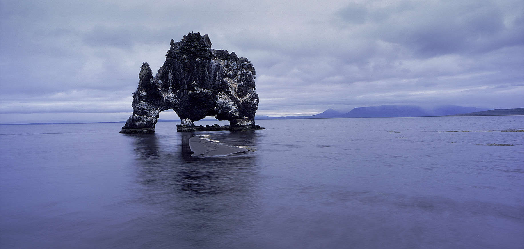
Hvítserkur is a beautiful cliff where many types of seabirds, especially gulls and fulmars, have made their nests for centuries. Their guano deposit has made it’s mark on the cliff, painting it white in many places. Hence the cliff is named Hvitserkur, which translates as White Shirt.
Once you’ve investigated Hvitserkur keep following road 711. To your left you should see a lake, which is called Sigridarstadavatn. Once you’ve passed it the road branches, make a left turn and follow road 717 until you see a parking lot by Borgarvirki, the viking fort.
Viking fort
The fort is on the top of a small basalt strata mountain and was mentioned in one of the Icelander’s Saga, Heidar-Viga saga.
According to the saga, the people of the area were under siege and the attackers planned to starve them out. The defenders had run out on food but overheard their enemies speculating on how much provision they had got left.
Then Víga-Barði, the defenders’ leader, came up with an idea. Only one piece of meat was left and they threw it out from the fortress. Their enemies came to the conclusion that they had plenty of provisions and left.
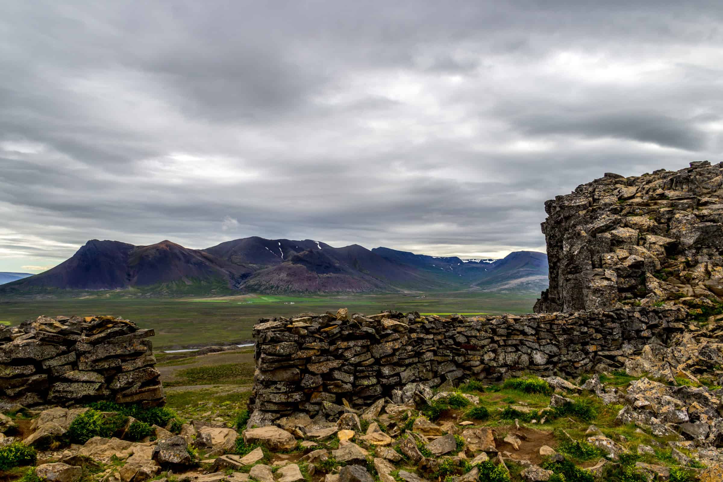
The climb to the fort is steep and can be tricky, so please keep that in mind. However, the view from the top is marvelous. There you can also see the ruins of at least two buildings. We don’t know much about this fortress other than a few literary references, but one can imagine that the chieftains of old maintained a guard there, especially during times of unrest.
Once you’ve explored the fort make your way back to the car and keep following road 717, until you reach road 1. Make a left turn and drive for a short while. After a few minutes you should see many small hills rise on either side of the road. You have reached Vatnsdalur. Make a left turn on road 721 and follow the road to Thingeyrarkirkja church.
Thingeyrarkirkja church
As you drive down road 721, to your left you should see a large lake. This is lake Hop. As you drive on the Thingeyrarkirkja church should come into view. Thingeyrarkirkja church stands on a small hill, visible for miles. It’s beautiful and well worth the stop. At Thingeyrar stood a monastery in the middle ages.
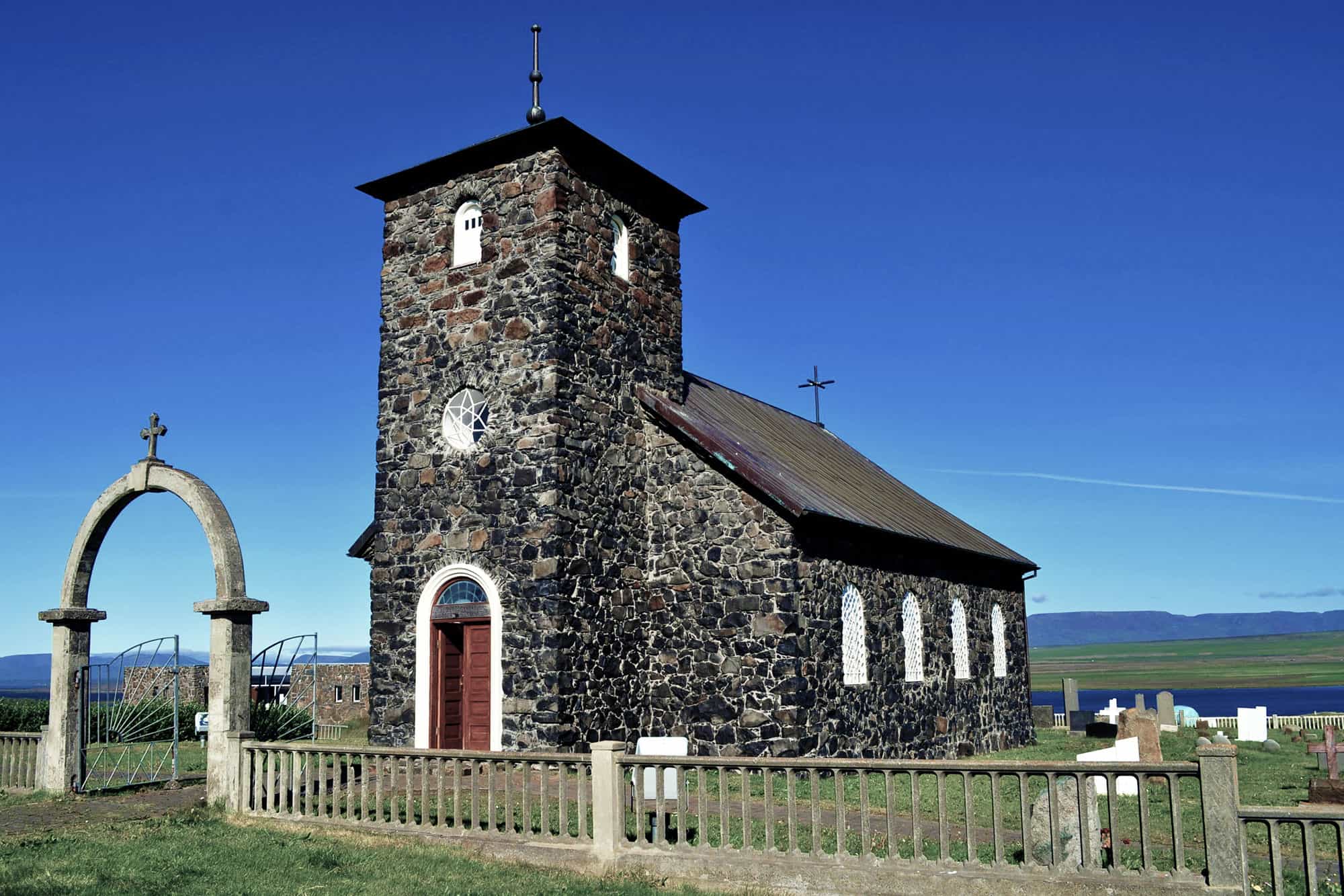
This small yet beautiful church was built in the 19th century and holds many artifacts, like the imported altarpiece, which came from Nottingham in the 15th century.
Once you have investigated the church follow the same road back to road 1, but instead of following road 1 once again, stop by Thristapar.
Thristapar
These three low hills, to the north and west of the innumerable Vatnsdalshólar hills, were the site of the last execution carried out in Iceland, on 12 January 1830. Friðrik Sigurðsson and Agnes Magnúsdóttir were beheaded for the murders of Natan Ketilsson and Pétur Jónsson at Illugastaðir in Vatnsnes. At the top of the middle hill is an execution scaffold, 20-70cm high and about 5x5m in area. On it is a stone commemorating the event. A sign stands by the road, and the execution site is a short walk away.
After you’ve seen Thristapar, drive across road 1 and keep driving on road 721 and explore Vatnsdalur valley.
Vatnsdalur valley
The first thing you notice are the many hills. These are Vatnsdalsholar hills, a cluster of hills of all sizes across the mouth of Vatnsdalur valley. Thought to have been formed by a catastrophic landslide. If you look to your left you can see the wound in the mountain side across the valley. These hills are considered to be one of the three “innumerables” things in Iceland along with the lakes in Arnarvatnsheidi and the islands on Breidarfjord in the west.
A large lake should be on your left. This is lake Flodid, fed by river Vatnsdalsa. Trout, arctic char and atlantic salmon live in the lake and the river, making both a popular spot among anglers. Mind you, of course you need permit to go fishing here.
To your left however is a small hollow, called Thordisarlundur. The locals grew it to commemorate the first person born in Vatnsdalur valley. Ingimundur the old’s wife gave birth to a baby girl shortly after they arrived in Vatnsdalur and even before they had built their farmstead, and as the story goes the girl was born in this place. The girl was given the name Thordis.
Vatnsdalur valley is a beautiful valley and good example of the many fertile valleys of North Iceland. As you drive on you should reach a bridge, cross it and follow road 722. After a short while you should reach the farm Hof.
Hof is raised on the place where Ingimundur the old was the first inhabitant more than 1100 years ago. Ingimundur the old was a firm follower of the old Nordic gods, the aesir. Once he had decided to where build his farmstead, he also build a temple in honor of the aeasir. Staying true to himself, ever the man of many words, he decided that his farm should be called Hof, which means temple in Icelandic. An archaeological excavation uncovered a large and ancient churchyard at Hof that dates from the early days of Christianity in Iceland, 10th and 11th century. Today Hod is a working farm with sheep, horses and a beautiful guesthouse.
As you drive on, following road 722 to road 1, make a note of the many signs by the road. These are mostly heritage signs, which link the locations in question to the settlement and the Vatnsdaela saga.
Blonduos
Once you reach road 1 again, make a right turn and follow the road eastwards. After a few minutes you cross a small creek, called Gilja river, and to your right you see an erected stone. This is Gullsteinn, an artwork to mark the place where the first Icelander became a Christian.
As you keep following road 1 you reach Blonduos, a village that stands on the either bank of Blanda glacial river. Blonduos is the largest urban area in the north-western part of Iceland. The employment is connected to agriculture, industry, services and fishing industry. If you are travelling with kids, there’s a splendid children playground to your left, just as you’ve crossed the bridge, you can’t help but notice it. There’s also a superb swimming pool with water slides and kiddies pool nearby. Finally, just east of town there’s a nice 9-hole golf course.
If you like crafts Blonduos has a great textile museum. If you wish to see it you need to make a left turn from road 1 and drive along Hunabraut. Take the first left exit, Arbraut and follow that road until you see the museum.
Leaving Blonduos you follow road 1 further east, but only for a few moments. Turn left and follow road 74 to find the small village Skagastrond.
Skagastrond and Skagi
As you leave road 1 you drive northwards on the Skagi peninsula. Skagi means peninsula in Icelandic, but we can’t say for certain if the name comes from Ingimundur the old, though it sure is in his style. The road passes between two small lakes, where you might find fishermen busy alongside golfers, because the local 9-hole golf course is right by the lakes. The peninsula is characterized here by high mountains and deep valleys, flat moorland and green fields.
After a while you might notice the village Skagastrond to your right. Make a right turn and enter the small fishing village. Once you’ve enter the village proper, directly in front of you, is a strange looking museum. This is Spakonuhof museum, a small museum dedicated to Thordis spakona, which was a local settler. But wait, there’s more, because you can have your fortune told in the museum, which is really fun, not to mention informative.
Just north of the harbor you find Spakonufellshofdi promontory (usually known as the Cape) is a popular outdoor recreational area. There is a choice of marked walking trails, and information boards give details on the flora and bird life of the area.
When you’ve had your fortune told, follow the same road back from the village. However, once you reach the crossroads just outside the village, make a left turn and follow the gravel road north. The Skagi peninsula is beautiful in its remoteness and hides many gems. After a while you should see a gravel road to your left, leading towards the coast where a modern lighthouse stands, in a small cove called Kalfhamarsvik. Park the car and walk towards the lighthouse, where you can see the awesome basalt rock formations. Make sure you don’t forget your camera.
After you’ve enjoyed the scenery in Kalfhamarsvik make your way back to road 745 and turn left. Follow that road and enjoy the view from the road. The peninsula up north is riddled with lakes and small creeks, where geese and swans make their nests. There are only a handful of farms that far north, so we recommend that you make a stop, turn off the car and just listen to nature.
Following road 745 allows you to drive around the peninsula, reaching road 744. Make a left turn once at the crossroads and head out towards Saudarkrokur.
The High North
You are entering the high north as the Skagafjordur fjord opens up before you. The high north is the area between Skagafjordur fjord and Eyjafjordur fjord, the peninsula that separates these two fjords is called Troll peninsula. This area is the setting of the Icelander’s saga Grettis saga (see below) and the main stage of the many historic events, especially during the age of the Sturlungs, a time of unrest in the 12th and 13th century.
As the road slowly descends to your left is the village of Saudarkrokur. Just before you make the right turn to enter the village there’s a road to your left. Make a left turn and follow road 748.
Saga of Grettir
As you drive down the road the steep island Drangey rises to your right. As the story goes the outlaw Grettir, spent the last three years of his life at Drangey. Grettir supposedly swam from the island to the western shore of Skagafjordur. There he bathed in a geothermal spring and fetched glowing embers to take back to his hiding place in the island. The pool, called Grettislaug, has been constructed with natural stones at this legendary bathing spot.
This is where we are headed, towards this legendary geothermal pool. Grettislaug is about 39°C (100°F) year round, though of course weather can influence the water’s temperature. There are dressing rooms and since the pool in on a private property, there is a small entrance fee. Bathing in the pool, with a spectacular view of Drangey island, you can almost feel the cold that the outlaw must’ve felt after swimming ashore, cold and tired.
The outlaw Grettir was considered a strong, formidable warrior, that could battle trolls and undead alike and there were few who dared to ride against him. He lived in Drangey island with his brother and their slave, after he was sentenced and deemed an outlaw.
One night their fire went out, so naturally Grettir decided to swim ashore and get fire. After he had bathed in the pool he walked naked to the nearest farm, Reykir, and went to sleep there, as he was tired. When the people who lived on the farm woke up they recognized him, where he slept. One of the girls said: “So may I thrive, sister! here is Grettir Asmundson lying bare, and I call him right well ribbed about the chest, but few might think he would be so small of growth below; and so then that does not go along with other kinds of bigness.”
Once you bathed in the geothermal pool find your way back to road 744 and enter the town of Saudarkrokur.
Saudarkrokur
Saudarkrokur village is quite busy, since this is not only a thriving fishing town but also a service center for the agricultural area surrounding it. The ‘downtown’ area of the village is quite charming. It’s loaded with a small collection of distinctive, traditional buildings where the past seems to be brought back to life, especially at Minjahusid Folk Museum. There you can observe workshop demonstrations by blacksmiths, carpenters and watchmakers. On the main street there is a general store that has been in operation since 1919.
Once you’ve explored the village head south following road 75. To your left is Ashildarholtsvatn lake, which is a great place to go birding. There’s also a few hiking trails around it, and if you have the time to explore this area. You have your shorebirds busy on one side of the like and moorland birds singing on the other side.
Keep following road 75 until you reach the Glaumbaer heritage museum to your left.
Glaumbaer
Ever since 1952 the turf farmhouse of Glaumbaer has served as the main exhibition for the Skagafjordur Heritage Museum. Within the authentic buildings, everyday tools are displayed in their natural environment. They bear witness to vanished times and the daily activities of people in Iceland’s past.
At the Glaumbaer site you’ll also find two 19th-century wooden houses, Gilsstofa and Ashus. The latter of these serves as a coffeehouse and museum store. Visitors can absorb the historical atmosphere while tasting delicious breads and pastries baked in traditional Icelandic fashion.
When you are ready to head out again, keep following road 75 until you reach Varmahlid.
Varmahlid and local crafts
Varmahlíð is one of the favourite rest places along highway 1, the main settlement has a lot to offer. Including the service station/restaurant/supermarket. In the same building is the information centre. Next door you can find local handicrafts, including Icelandic woollen goods and other arts and crafts.
On a good day it is fun to walk around the forest growth at Reykjarhóll up to the viewing platform where it is possible to get a really good view over the central fjord.
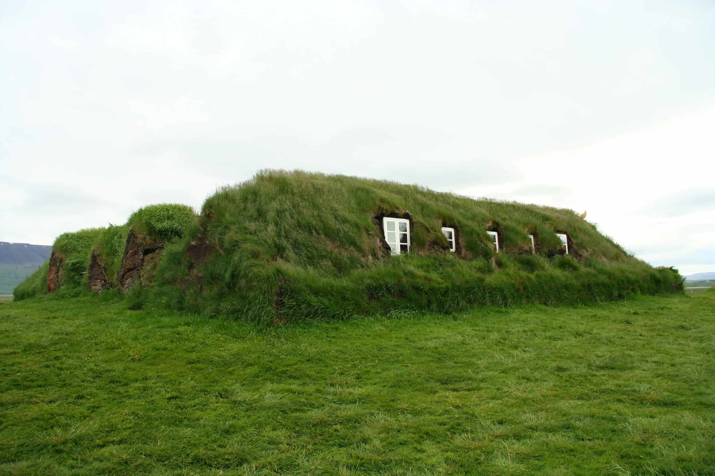
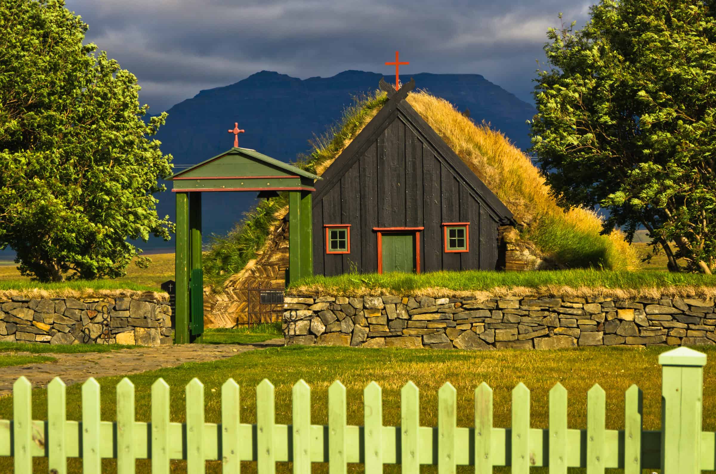
If you are interested in history we recommend you make a short detour. Follow road 1 south for only a few minutes, the make a left turn where you see a sign saying Vidimyrarkirkja. This road will lead you to a small, turfhous church, which is one of the few preserved turfhouse churches in Iceland.
Once you’ve explored Vidimyrarkirkja church find you way back to road 1, make a right turn and follow road 1 across the two rivers of Skagafjordur until you reach road 76. Make a left turn and follow that road.
Age of the Sturlungs
You are now entering the setting of many pivotal events during the Age of the Sturlungs. The Age of the Sturlungs or the Sturlung Era (Icelandic: Sturlungaöld) was a 42–44 year period of internal strife in mid-13th century Iceland. It may have been the bloodiest and most violent period in Icelandic history. It is documented in the Sturlunga saga.
This period is marked by the conflicts of powerful chieftains, goðar, who amassed followers and fought wars, and is named for the Sturlungs, the most powerful family clan in Iceland at the time. At the end of the era, the Icelandic Commonwealth ceased to exist and Iceland became a part of Norway.
Make sure you keep your eyes open for heritage signs, because there are a few of them on display at important sites.
Holar in Hjaltadalur valley
As you drive north following road 76 you should after a few moments come to a crossroad where you find road 767, leading to Holar in Hjaltadalur valley. Make a right turn and follow road 767 until you reach Holar.
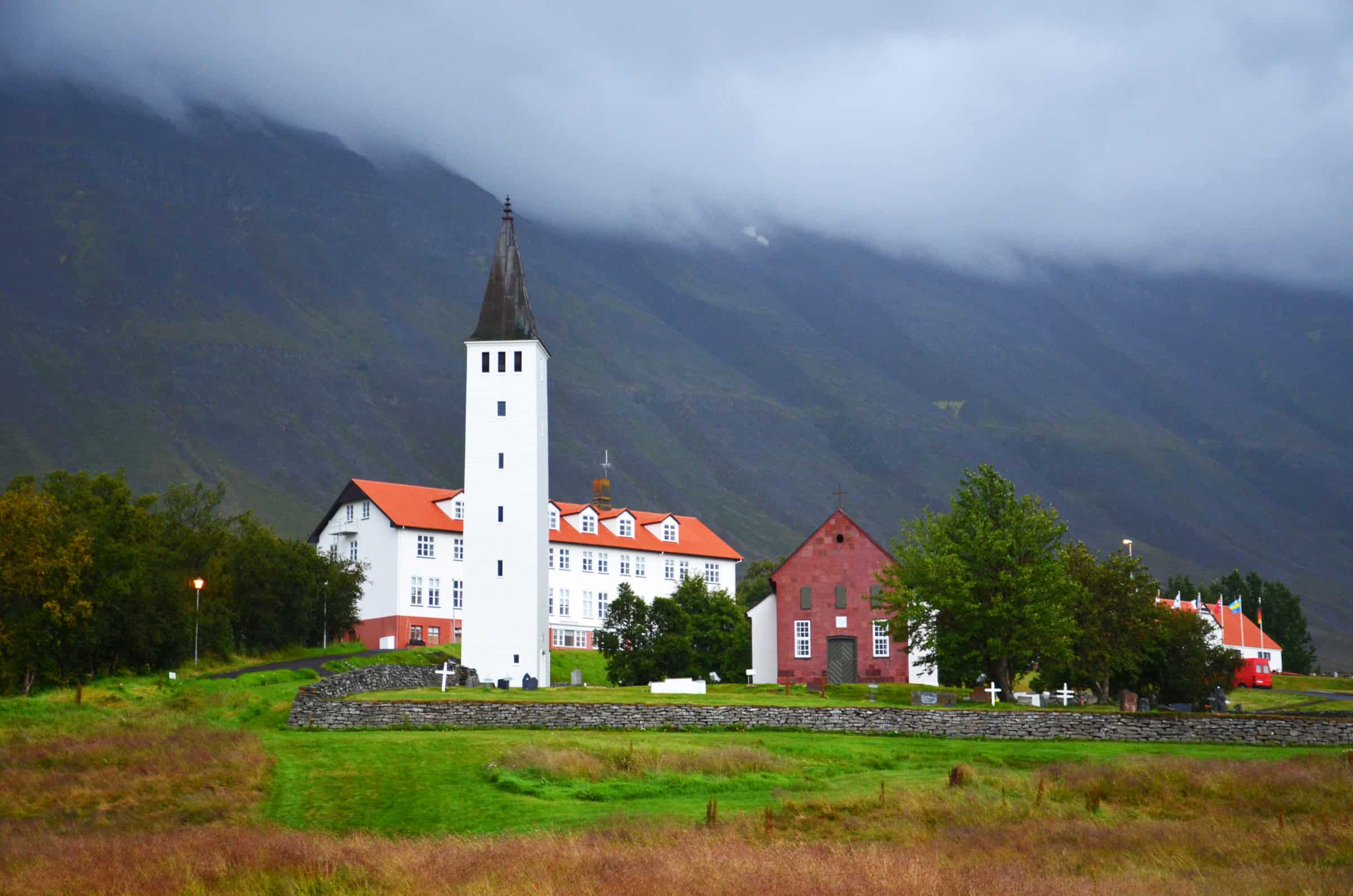
Holar is one of the most famous historical sites in Iceland and was, for many centuries, an Episcopal See. It was also the capital of North Iceland for over 700 years. There has been a church on the site from the 11th century, and the present Holar Cathedral was consecrated in 1763. It is the oldest stone built church in Iceland. Archaeological research has been carried out at Holar over the past years and more than 40 thousand items found, some of which are now on display in the old schoolhouse.
After you’ve explored Holar and the rich history of this place find your way back to road 76 and turn right. Head out for the small village of Hofsos. If you are interested in cars, we recommend that you make short stop and Samgonguminjasafn Skagafjardar museum, not far fram Holar. As you drive along road 76 northwards you should spot the museum to your right only a few moments after you leave Hjaltadalur valley.
Hofsos and the history of the Icelandic emigrants
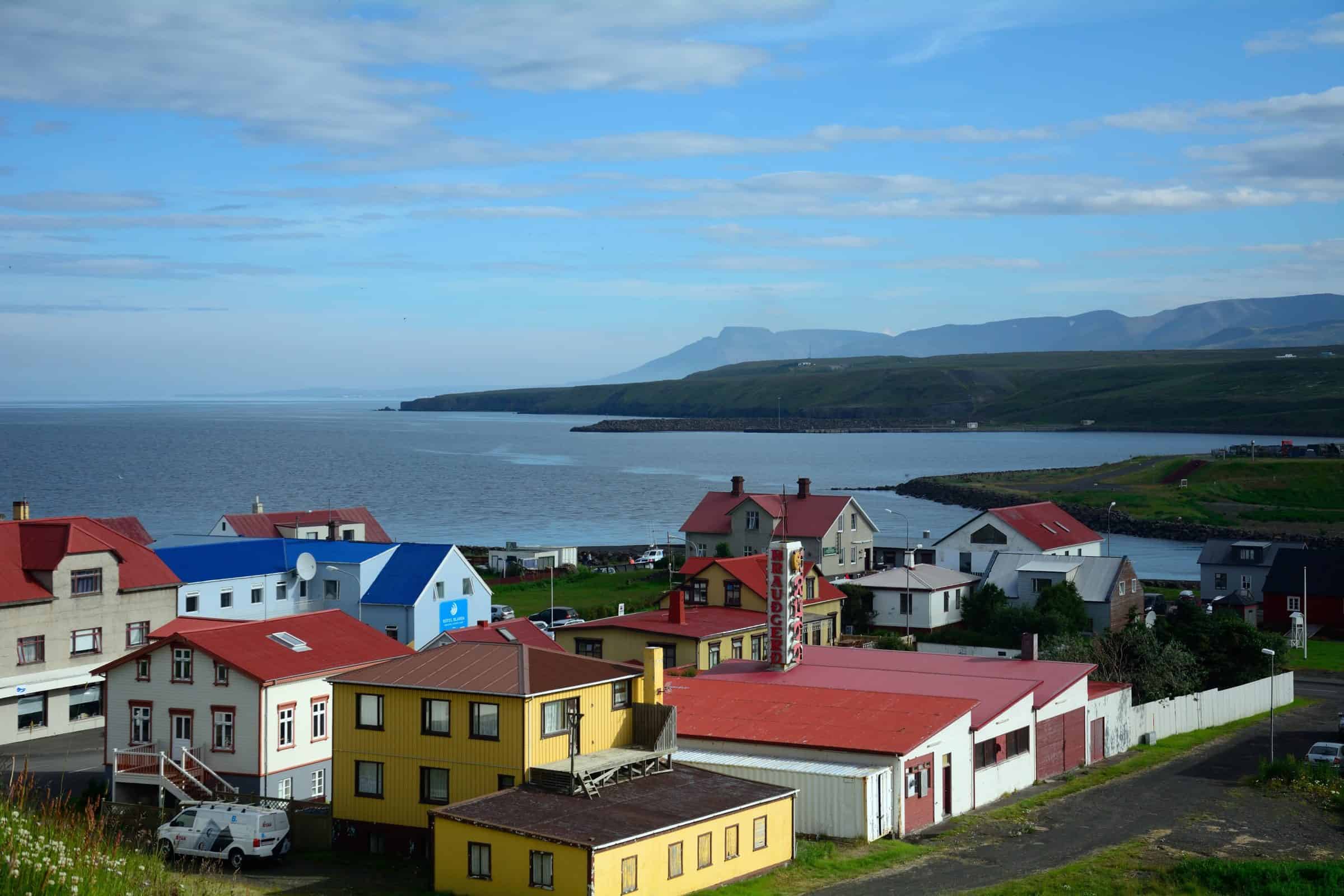
The fishing hamlet of Hofsos, halfway up Skagafjörður’s eastern shore, was a trading post as far back at the 1500s. Later it became a launching point for many of Iceland’s emigrants to North America.
The population of Hofsos is around 200. This small but beautiful village nests along the eastern shore of Skagarfjordur fjord. The town is an old trading port, one of the busiest ones in 17th and 18th century. Today the village houses services including accommodation in guesthouses, a restaurant, coffee-house, and a camping site. We recommend visiting the town’s local swimming pool. It is located on the cliff tops with spectacular views across Skagafjörður Fjord to Mt. Tindastóll.
Hofsos is also where you find the Icelandic emigration center. The permanent exhibit at the Icelandic Emigration Center (Vesturfarasetrið) in Hofsós details Icelandic emigration in the late 19th and early 20th centuries. There you can learn about the fate of settlements from Utah to Brazil. By 1914, 15,000 Icelanders— almost 20% of the population at the time—had left for the “New World”.
When you are ready to leave Hofsos keep follwing road 76 northwards.
Scenic route
You head once more north and this time on a really scenic route. To your left rises Thordarhofdi promontory, though at first it seems to an island it is not since to sandy beaches link it to the peninsula. By the promontory is a rather large lake, Hofdavatn, where you might see anglers trying to catch arctic char.
As you pass the Thordarhofdi you can see Malmey island, one of the three islands in the Skagafjordur fjord, along with Drangey and Lundey. It is located on the east side of the bay. Malmey is a long and narrow island, about 4 km long and about 1 km wide, and it is narrower at both the northern and southern ends.
To your right rise the mountains of Troll peninsula, where several peaks reach over 1000 meters above sea level. This is the part of the Iceland that has the highest elevation outside the central highlands. Several deep valleys that were carved by glaciers are mostly green and you might notice that this peninsula has far denser population that Skagi peninsula.
As you drive on you see a lake to your right. This is lake Slettuhlidarvatn, where you can often find anglers and fishermen, since there’s a good chance of caching trout or arctic char in it. You need permission to fish there, these are easily attainable at the farm Hraun.
So, if you brought a rod along try your luck. If you catch an arctic char we recommend making arctic char Sashimi, which simply delicious using freshly caught char. If you do get a trout, how about wrapping it in aluminum foil with butter, put it on a barbeque for a short while, some salt and voila! You can thank us later.
As you drive on you pass two more lakes, both which where you can see both huge variety of sea birds and shore birds. As you drive on the road reaches it’s northernmost point before turning southwards towards the town of Siglufjordur.
Siglufjordur
On a coastal fjord less than 40 kilometers (25 mi ) from the Arctic Circle, the humble town of Siglufjordur was from 1905-1965 the booming fishing capital of Iceland and for a time, the herring capital of the world. Over the years, marine resources dwindled and the once thriving ‘Siglo’ declined in quiet isolation.
Today, this historic village with a cheerful array of candy-colored houses and windswept wildflowers. There you’ll also find lively harbor. The town developing into Iceland’s next great undiscovered getaway with the opening of the Hedinsfjordur Tunnel in 2010.
While in Siglufjordur we recommend that you pay a visit to The Herring Era Museum, which pleasantly captures the ‘glory days’ in a trio of exhibitions set across three building located down by the delightful harbor. Also, there are many marked hiking trails through the area, where you can experience the rugged arctic landscape and the peaceful surroundings.
If you like hiking and feel up to it we recommend that you make a hike to Siglufjardarskard. The route offers a breath-taking view, filled to the brim with barren natural beauty, history and ghost stories. The rough mountain track is about 15 km in length, so make sure you have time to spare.
After you’ve enjoyed Siglufjordur village keep following road 76 through the two tunnels until you find Olafsfjordur village.
Olafsfjordur
Olafsfjordur is one of these small quaint Icelandic villages that at first sight seem rather focused on the fishing industry. But Olafsfjordur is so much more, because the town is a hiker’s dream, offering many great hiking trails. There’s also a nice 9-hole golf course and you can go fishing in lake Olafsfjardarvatn.
But it’s during the winter time that Olafsfjordur becomes the outdoor enthusiast’s paradise, because there are so many choices of activities to have. You can go skiin, both cross-country and downhill, skating, snowmobiling or hand-line fishing in the waters of lake.
As you are ready to leave Olafsfjordur follow road 82 and take the tunnel. Before the tunnel was build you had to drive across the small yet steep peninsula, called Olafsfjardarmuli (960 m), which is a basalt mountain. You can still see the road as it clings to the steep mountainsides, you can’t drive that road but it is still used as hiking trail as it offers a breathtaking view of the fjords.
In older times people believed that trolls lived in the mountain and you could even see the door to their home in one place called Tofugja gorge. The rock has a different color in one place and that location is called Halfdanarhurd or the Door of Halfdan.
Once you reach the other side of the tunnel you follow road 82 for a while until you reach Dalvik.
Dalvik and Hrisey
Dalvik is one of the many seaside towns in Iceland; a true fishing village located in the eastern part of Trollaskagi Peninsula. The harbor in town is a large fishing and commercial port, including the departure point of “Sæfari” boat which serves the island of Grimsey. Few minutes from Dalvik you’ll find Arskogasandur harbor, which is the starting point of the ferry “Sævar” which sails to the unique Hrisey Island.
Visiting Hrísey island is the perfect day-long detour. Take the ferry across and see what secrets this small islands holds. Much of the island is a dedicated nature reserve which supports some of the lushest vegetation in the entire country. There are plenty of hiking trails across the flat moorlands, covered in purple heather and rich in bird life.
Once you’ve returned you can enjoy the swimming pool in Dalvik and visit some of the nice restaurants. If you haven’t tried seafood in Iceland this is the perfect place to do so. There are a few them in town and close to the harbor, once even has a fake viking ship outside where you can sit and enjoy the food and the view of the harbor.
Keep following road 82 south along the Eyjafjordur fjord. According to the Book of Settlement, Helgi the lean Evindarson, born in Ireland, settled in Eyjafjordur. Helgi was a Christian but he also venerated Thor. Eyvindur, Helgi’s father, was a Swede and scholars say that many name ins Eyjafjordur bear witness to some connection to Sweden.
Enjoy the beer spa
Ok, this might sound a bit strange, but beer with us… If you like beer do we have a treat for you. After you have driven along road 82 for a while you come to an intersection where you can make a left to road 808. Follow that road and find the Bruggsmidjan Brewery. Not only do they offer some tasty beers, but you can also bathe in their beer spa! Yes, you read that right, beer spa. If you decide to try out a few beers, just remember that it’s illegal to drive under influence in Iceland.
Once you’ve bathed and feel all ready to drive again make your way back to road 82 and keep driving south.
Hjalteyri
Our next stop is the small village Hjalteyri. This was once a hub of activity and pivotal to the herring industry in Iceland. Today it has an aquaculture center where research is conducted into the feasibility of halibut culture. The buildings of the old herring factory are often used as a venue for art exhibitions during the summer months. Hjalteyri boasts some of the most interesting diver areas in the World, as the famous geothermal struts are right offshore. You can also go whale watching from Hjalteyri, which can be really great.
After you’ve explored Hjalteyri make your way back to road 82 and follow it until it merges with road 1. Make a left turn and follow road 1 until you reach Akureyri.
Jewel of the North – Akureyri
Often referred to as the ‘Capital of the North,’ Akureyri is Iceland’s second largest city. Located only 96 kilometers (60 mi) away from the Arctic Circle, it is a surprisingly green community with lush vegetation and delightful Botanical Gardens. The town boasts some of the finest timber buildings in the country, beautifully restored to their original glory.
Since Akureyri is a rather large town we recommend that you spend the night there and visit some of the many superb restaurants there, or you could of course go on a food walk which is a great way to experience the local cuisine.
During the winter months Akureyri is one of the most popular ski resorts and the slopes of Hlidarfjall resort, just above the town, teem with life. Akureyri has a great golf course and many people come during the summer to play golf in the midnight sun. You could also visit the botanical gardens or if you are more interested in history than seeing the arctic flora, you could visit the Akureyri Folk Museum.
If you are an aviation fan, you might be interested in seeing the Icelandic Aviation Museum, which is right by the airport (where else would you find an aviation museum?) Finally, the swimming pool in Akureyri is exceptional and if you are traveling with children make sure you pay it a visit.
There are many tour operators in Akureyri, offering many different and great tours. You can find a tourist information center in the large round building, Hof, in the town center.
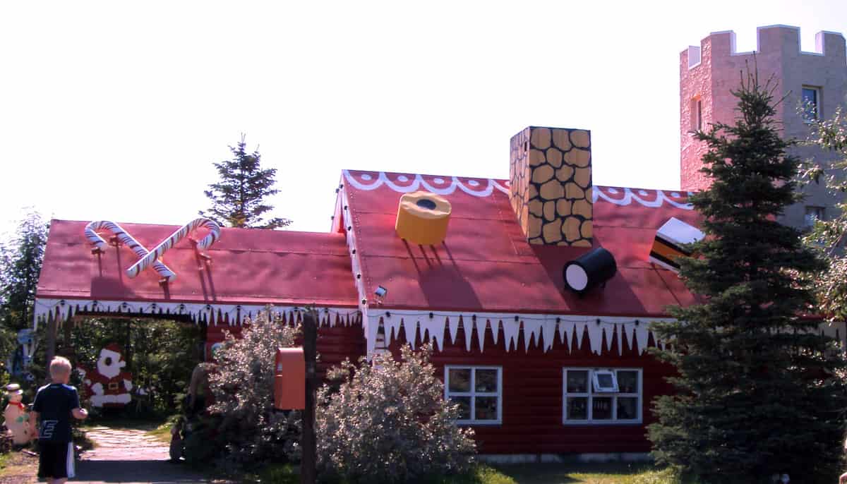
When you are ready to leave Akureyri follow road 1, but instead of crossing over to the other side, follow road 821 towards the airport. After a while you see a house to your right that seems almost like the house of father Christmas. Make a right there, for you have found the Christmas house.
Yule detour
You have a ginger bread house, Christmas carols and a burning log. Every thing you need to get into the right festive mood, even in the middle of July. There‘s also a castle tower you can go up in and see the world‘s largest advent calendar. In the Christmas garden you can buy waffles and toffee apples from a small hut. There‘s a store next to the Christmas house that sells Scandinavian design and food items.
After you have sung a carol or two and enjoyed a toffee apple keep following road 821 until you reach Hrafnagil village. Make a left turn and cross over to the other side of the valley following road 823. Once on the other side turn left and follow road 829 until you reach road 1 again. Make a right turn and keep following road 1 as you drive north along the shore of Eyjafjordur fjord. There are a few spots along the road where you can stop the car and enjoy the view.
Keep following road 1. As you get further from Akureyri you should see to the right side of the road rather large sculpture of a man in blue clothes and some lovely white houses, this is the Icelandic Folk and Outside Art Museum. If you like art this is a great place to stop.
Once you’ve checked out the museum keep following road 1 across Vadlaheidi heath and enter the eastern part of North Iceland.
The Eastern part of North Iceland
This part of Iceland, from Eyjafjordur fjord to Lake Myvatn, is by many considered absolutely breathtaking. It offers stunning, unearthly vistas where astronauts practice before landing on the moon, and serene beauty that has been many times the setting for films and TV show, like Prometheus and Game of Thrones.
Vaglaskogur forest and Fnjoskadalur valley
As you descend from Vadlaheidi heath you enter Fnjoskadalur valley, an agricultural area where Fnjoska river runs. This river is popular among fishermen and the longest spring fed river in Iceland.
To the right of the road is Vaglaskogur forest, which is the second largest forest in Iceland. For some this might seem an oxymoron, Icelandic forest, but according the Book of Settlements Iceland was mostly covered with woods when the settlers came. Cold weather, grazing and deforeststation however spoiled most forests in Iceland. There are many programs ongoing where farmers, companies and the state try and reforest the country. You can read about our participation in a program here.
To see Vaglaskogur forest turn right and follow road 833 south. After a few minutes you make a left turn at the forest gate. However, if you are travelling with kids, there is a petting zoo called Daladyrd just a little down the road, where you can get to know the Icelandinc farm animals.
Make your way back to road 1 and keep following it eastwards towards Godafoss waterfall.
Godafoss waterfall and the Godi of Ljosavatn
As you drive down road 1 you might notice a lake to your right. This is lake Ljosavatn, where Thorgeir godi lived around year 1000 ad. As the story goes, Thorgeir was a chieftain in this area and was chosen in Althingi year 1000 ad. to decide if Icelander should become Christians.
That year the country was divided, half of the nation had become Christians but the other half still venerated the old Nore gods, Thor and Odinn in particular. Thorgeir was a leader among the latter group and after a heavy debate that had almost escalated to outright warfare, both groups agreed that one person should make this decision. That responsibility was handed to Thorgeir.
He went to his camp and hid under his hide blankets for three days. When he emerged from his tent he declared that having one religion in Iceland would be the most practical solution. He decided that Icelanders should be Christians, but if you wished to venerate the old gods you were allowed to, as long as you didn’t do it publicly. Leaders of both groups agreed that this was a sound solution to this debate.
Thorgeir returned to Ljosvatn lake, now a converted Christian, where his farmstead stood, entered his temple and removed the statues depicting Thor and Odinn. He threw the statues into Godafoss waterfall, your next stop, and as the story goes, the gods were so enraged that they split the waterfall in two.
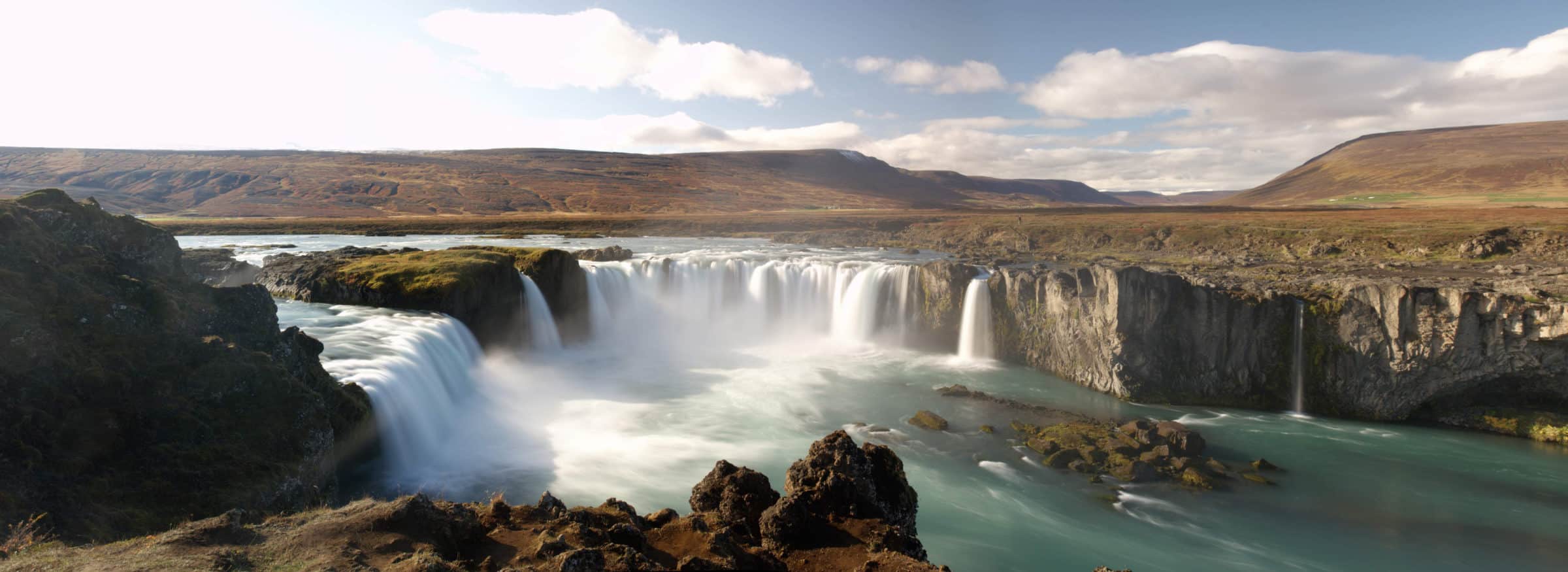
The Godafoss waterfall is one of the most spectacular waterfalls in Iceland. The water of the river Skjalfandafljot falls from a height of 12 meters over a width of 30 meters.
Once you’ve enjoyed the beautiful waterfall keep following road 1, for a while. As you see Lake Myvatn appear make a right turn at the crossroads and follow road 848.
Lake Myvatn
Lake Myvatn is one of the most spectacular places in Iceland. This pristine, clear fresh water lake is one of the largest lakes in Iceland and vibrant with life. The lake is a geological wonderland which has been sculpted by volcanic eruptions over thousands of years. It is thought to nest more species of duck than any other place in the world. Bubbling mud flats, volcanic craters, and newborn lava fields are among the sights of the striking Lake Myvatn region, which is a designated nature reserve.
There are many great hiking trails around the lake, make sure you have good time to stop there and explore all the sights and wonders of this majestic attraction.
As you drive along road 848 you should see to your left Skutustaðagigar pseudo craters. These pseudo craters were formed by gas explosions when boiling lava flowed over the wetlands. The craters are a popular site for birdwatchers and are protected as a natural wetlands conservation area. So, if you are into birding this place is a must-see.
Once you’ve seen the pseudo-craters keep following road 848. There are many great stops along the way, that offer superb photo-opportunities, and these are way too many to list here. As you drive along road 848 you come to a crossroad, where you can make a right turn to Dimmuborgir rock formations, which is your next stop.
Dimmuborgir
Dimmuborgir, on the east side of the lake, are a badlands of lava pillars, caves, rugged crags and towering rocks. Some of the rocks reach 20 meters (65 ft) in height, forming almost unearthly and alien castles and towers. This is a great place to visit and there are many great hiking trails. The hiking routes are all relatively easy and the longest one only takes a few hours to complete, and will offer you a chance to see many of the strange rock formations, like the Kirkjan. They also offer plenty of great photo opportunities. Make sure you don’t forget your camera in the car.
Here’s a fun fact! If you’re into metal music you might recognize the name of this attraction. The Norwegian band Dimmu Borgir is one of the most prominent metal bands out there. Whether they have their name from this attraction is hard to say, but in Nordic Christian lore Dimmuborgir is believed to be the place where Satan landed when he was cast out of the heavens. There he created the catacombs of hell. And if you know Dimmu Borgir, you also know that they are rather fond of lore like this.
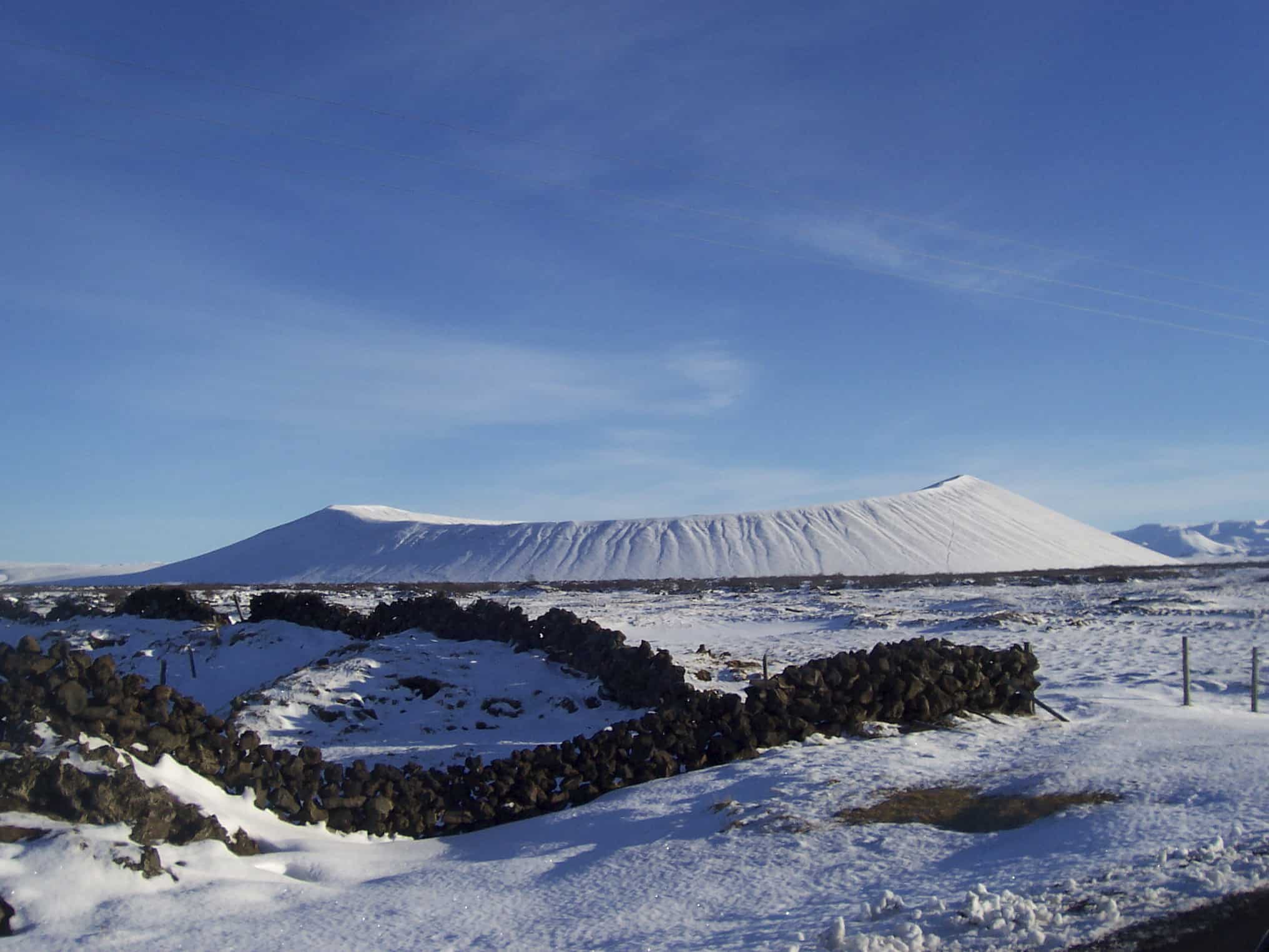
Once you’ve explored Dimmuborgir it’s time to head out again and follow road 848. The strange mountain to your right is mt. Hverfjall, and that’s your next stop.
Hverfjall hiking
Make a right turn once you see Hverafjallsvegur. Follow the road and park your car at the parking lot.
Hverfjall is 396 meter (1,300 ft) high tephra explosion crater. It is located near the eastern shore of Lake Myvatn in northern Iceland. Resembling a black ash cone of mammoth proportions, you can walk up the steep slopes and around the crater’s rim for otherworldly and awesome view of the surrounding landscape.
You can walk all the way to the top and enjoy a breathtaking view of the Myvatn area. You can also hike down into the crater itself, which leaves you with a rather strange feeling, since the landscape is alien and other-worldly.
After you’ve explored the mountain make your way back to road 848. Follow it until you reach the crossroads where road 860 intersects with road 848. Make a right turn and follow road 860.
Game of Thrones
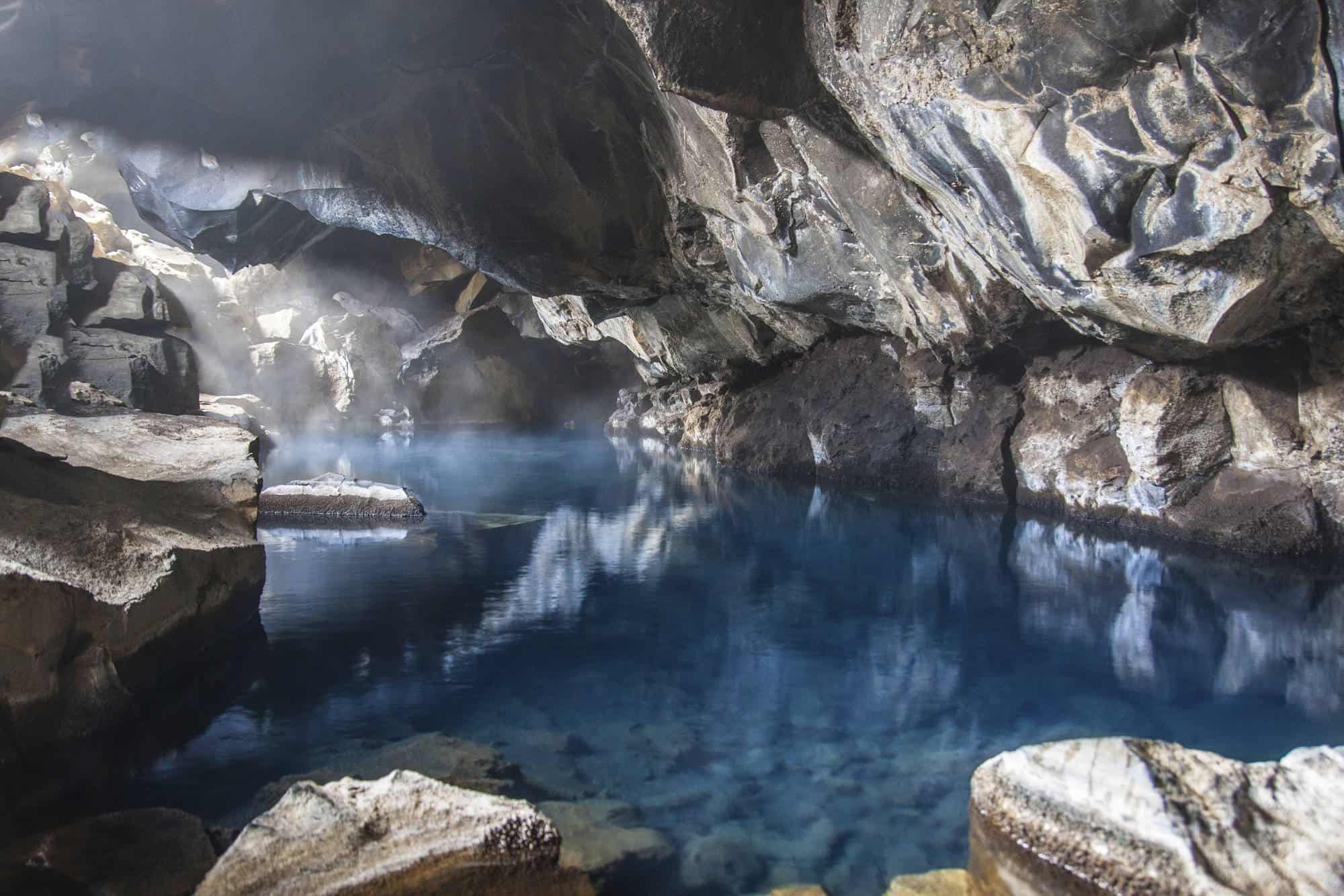
Are you a Game of Thrones fan? Do you remember the cave where John Snow and Ygritte made love? This is your next destination. Grjotagja is a small cave in the Lake Myvatn area, and was a popular bathing place at one time. However, geological activity in the period 1975-1984, caused the temperature of the water in the cave’s pool to rise to such a degree that it has not been possible to bathe there since. Also, the cave is private property and it’s strictly forbidden to bathe in the geothermal waters. Don’t worry, you will get a chance to bathe in a geothermal water very soon.
(No, John Snow and Ygritte didn’t bathe in the actual pool, it was all silver screen magic and all that).
You can park you car by the parking lot not far from the road and make a short hike to the cave. It’s well worth the trip.
If you are into spelunking there is another cave not far from Lake Myvatn, called Lofthellir. Make sure you check it out, because it has some awesome and beautiful rock formations and ice sculptures.
When you’ve explored the cave and made a few Instagram posts using all the right Game of Thrones hashtags (hey, don’t forget tagging us, using #icelandtravel), keep following road 860 until you reach road 1. Make a right turn and follow road 1 for only a few hundred meters. You are now entering the Myvatn Geothemal Aream, which explains why the scenery is changing colors. Make a right turn again and follow the road towards Myvatn Nature Baths.
Spa and geothermal power
We hope you brought swimsuits along. Now it’s time for a relaxing soak.
The baths can get a bit crowded during high season, but if you are there either around noon or after dinner, you should be able to avoid the busiest hours.
Once you’ve bathed and feel ready to take on the next leg of this journey backtrack to road 1 and turn right. As you leave the green and dark terrain of Myvatn area behind you are now entering almost Mars-like environment. The pass is covered with reddish dirt and bubbling mud pools, making the scenery as if cut from a 80’s sci-fi film. And the smell! There’s nothing like it. This sulfuric martian landscape that looks far better than it smells.
As you cross over the pass you should notice a parking lot to your right. If you feel you can brave the pungent smell park the car there and walk amidst the boiling mud pits and fumaroles.
As you head on keep following road 1. If you are interested in learning more about the geothermal power, make a left turn not far from the parking lot, and follow that road towards Krafla Geothermal Center.
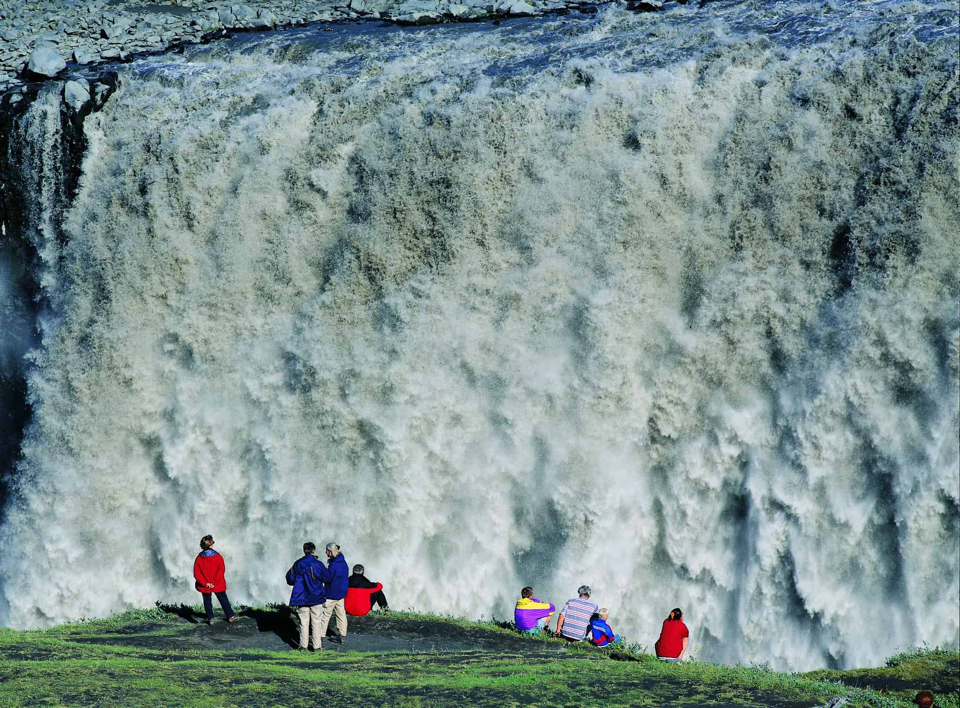
The most powerful waterfall in Europe – Dettifoss
Follow road 1 for a while now. To your left is Krafla volcano, that erupted a few times late in the 20th century, and to your right you can see desolate lafa fields where mt. Herdubreid and mt. Askja rise over the landscape. Far south is Vatnajokull Glacier, hiding many if Iceland‘s most active and powerful volcanoes.
Make a right turn once you see road 862 and follow it until you reach the parking lot for Dettifoss waterfall. You should be able to see the spray from the waterfall long before you reach. It is so immensely powerful. There’s a short hike from the parking lot to the waterfall, but be extra careful. The ground is slippery due to the perpetual spray.
When you reach the bridge over the glacial river Jokulsa a Fjollum, be ready to make a left turn once you see road 864. Follow that road for some time. To your right is the farm Grimsstadir a Fjollum, which is a guesthouse and offers a camping ground. Stopping there, if not for the view, is well worth it. To your south is a lonely mountain (no, not The Lonely Mountain, no need to go look for thirteen dwarves and a hobbit making their way over there), which is the tuya Herdubreid (1682 m.), that is considered by many locals the most beautiful mountain in Iceland.
Keep following road 864, until you see the parking lot for Dettifoss Waterfall to your right. Park your car and enjoy the view from the other side. Once you’ve experienced the raw power of the waterfall keep driving north, until you reach road 85. Turn left and drive for a short while until you reach Asbyrgi.
Asbyrgi
Asbyrgi (Shelter of the Gods) is the remarkable horseshoe-shaped canyon. Viking settlers believed to be a hoof-print formed by Sleipnir, Odin’s eight-legged flying horse from Norse mythology.
Geologists believe it was formed as the result of a catastrophic flood from the nearby Jokulsa glacial river. Some people say that it is the capital of the Hidden People in Iceland. Whether that is true, well, you have to decide that for yourself. if you lose something or find a strange looking baby in your car, don’t say we didn’t warn you…
All jokes aside, Asbyrgi is located in Jokulsargljufur within the Vatnajokull National Park, Asbyrgi has 100 meter (330 ft) high cliffs which form a 1 kilometer (.5 mi) wide ring of protective shelter around the rich vegetation and forest. The forest is a protected area. There is camping near the canyon’s entrance and you can climb the canyon itself. For more than half of its length, the canyon is divided through the middle by a distinctive rock formation called Eyjan (“the Island”), from which hikers may enjoy spectacular views.
There’s visitor center for Vatnajokull National Park in Asbyrgi, where you learn more about the remarkable story of this incredible place.
Head out following road 85 for a few minutes, make a right turn following road 862 to Hljodaklettar. Please note that this road can get bad in certain weather conditions, so be cautious and make sure that your car is properly equipped.
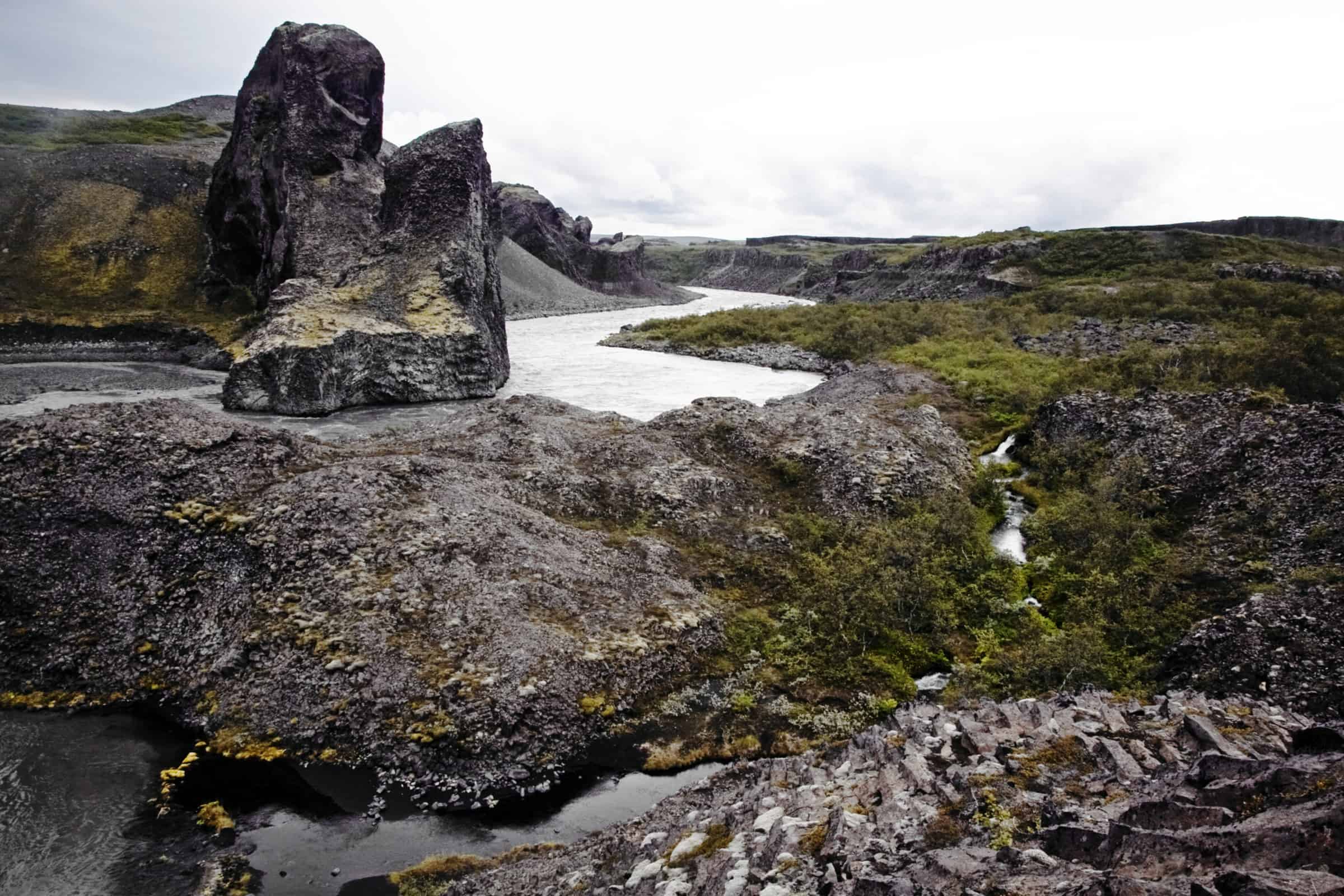
Hljodaklettar
As you follow road 862 southward you are surrounded by fields where wild arctic flora reigns supreme. After a while you should see a road to your left, follow it to the parking lot at Hljodaklettar.
Hljodaklettar are a bizarre looking group of crater plugs, the remains of ancient volcanoes. They have been heavily eroded by the foaming glacial river, depicting basaltic columns in different positions. They create all kind of patterns – swirls, spirals, rosettes and honeycombs. This is what makes them unique in the world. It is a great experience to walk among the cliffs and strange rock formations. It’s easy to imagine being on an alien planet in a far off solar system.
There are many hiking trails in Hljodaklettar, make sure you have time to enjoy the many strange rock formations. Don’t forget to bring a camera along.
After hiking through the area backtrack to road 85 and follow it west, towards Husavik.
Manarbakki museum
As you follow road 85 you pass a small lake to your right shortly after leaving road 862, this is lake Skjalftavatn. This is a man made lake and prior to the creation of the lake in 9174 he area was a sand and gravel desert. After a few minutes the road sharply ascends and clings to the side of a steep hill. This is Tjornes peninsula and as you drive on you should see your next destination, Manarbakki Museum.
The Folk Museum at Manarbakki, set in a series of black and white turfhouses, focus a little more on the 20th century than other museums of this type. Once you pass the wood carving of the limbless nude at the gate, expect diverse arrays of confectionery wrappers, porcelain dogs and brightly colored Icelandic folk art.
After you’ve enjoyed the museum, keep following road 85 towards Husavik.
Whale watching capital of the world – Husavik
Set along the eastern shore of Skjalfandi Bay, Husavik is a delightful town that has come into its own as a tourism destination in recent years. The plankton and fish-rich feeding ground of the surrounding waters have allowed the town to establish itself as the undisputed ‘Whale Watching Capital’ of Europe boasting astonishingly high success rates.
Husavik is one of the best places in the world to see whales in the natural surroundings. Whales are often encountered within 20 minutes of leaving the harbor. They include such magnificent species as the elusive humpback whale and the enormous blue whale.
If you have time to spare, we also recommend that you check out the church in Husavik. It stands out, to say the least. There’s also a nice swimming pool there. Also a good museum where you can learn more about the whales and even see a skeleton of one in full size.
As you leave Husavik follow road 85 for a while and head towards Akureyri.
Ystafell – something for the car fanatic
Shortly before you reach road 1 and follow it the rest of the way to Akureyri, you should see the Ystafell Transportation Museum to your right. If you like cars, this is a must-see.
The Transportation Museum at Ystafell is the oldest car museum in Iceland and has one of the largest collections of cars in the country.
After you’ve checked out all the amazing vehicles at Ystafell, follow road 85 until you reach road 1. Make a left turn and head out for Akureyri.
Back to Akureyri and Reykjavik
Once you’re back in Akureyri you’ve explored the eastern part of North Iceland and you deserve a good break. Perhaps you could go out to dinner, there are many good restaurants in Akureyri. Or you could drive all the way back to Reykjavik.