The Stunning South Coast

The South Coast of Iceland is one of the most stunning places on Earth. It’s so diverse and colorful. You have glaciers, volcanoes, green fields, wild nature, geysers, waterfalls, lagoons and incredible mountains. It’s no wonder that this part of Iceland has for long been the most popular route by tourists and locals alike.
As you follow road 1, or the Ring Road as it is commonly known as, east from Reykjavik you quickly find yourself surrounded by stunning vistas. Mt. Vifilfell rises before you, a majestic volcano named after one of Ingolfur Arnarson’s, Iceland‘s first settler, freed slaves, Vifill. As the story goes, once Arnarson had decided on where to build his farmstead, he set his slaves free and gave each of them land where they could build their own farms. Vifill decided to build his farm at Vifilstadir, which is at the easternmost part of Gardabaer.
To your right you can see Heidmork Nature Reserve. The reserve is in Leitarhraun lava field, which is an enormous 5000 year old lava field that came from the volcano Leiti, which is a part of the Blafjoll mountain ridge. Also a part of the same ridge is the volcano Thrihnjukagigur. You can actually go inside that volcano and see how a volcano looks from the inside. The tour takes about 4-5 hours as you enter the volcano by a cable car. Trust us, this is so worth it. Just make sure you book a tour in an advance.
Geothermal energy exhibition
The road rises as you drive further east, and you find yourself on Hellisheidi heath. The area is a geothermal hot spot, you are surrounded by volcanoes and in the middle of many overlapping lava fields, the youngest one being Svinahraunsbruni, just over 1000 years old.
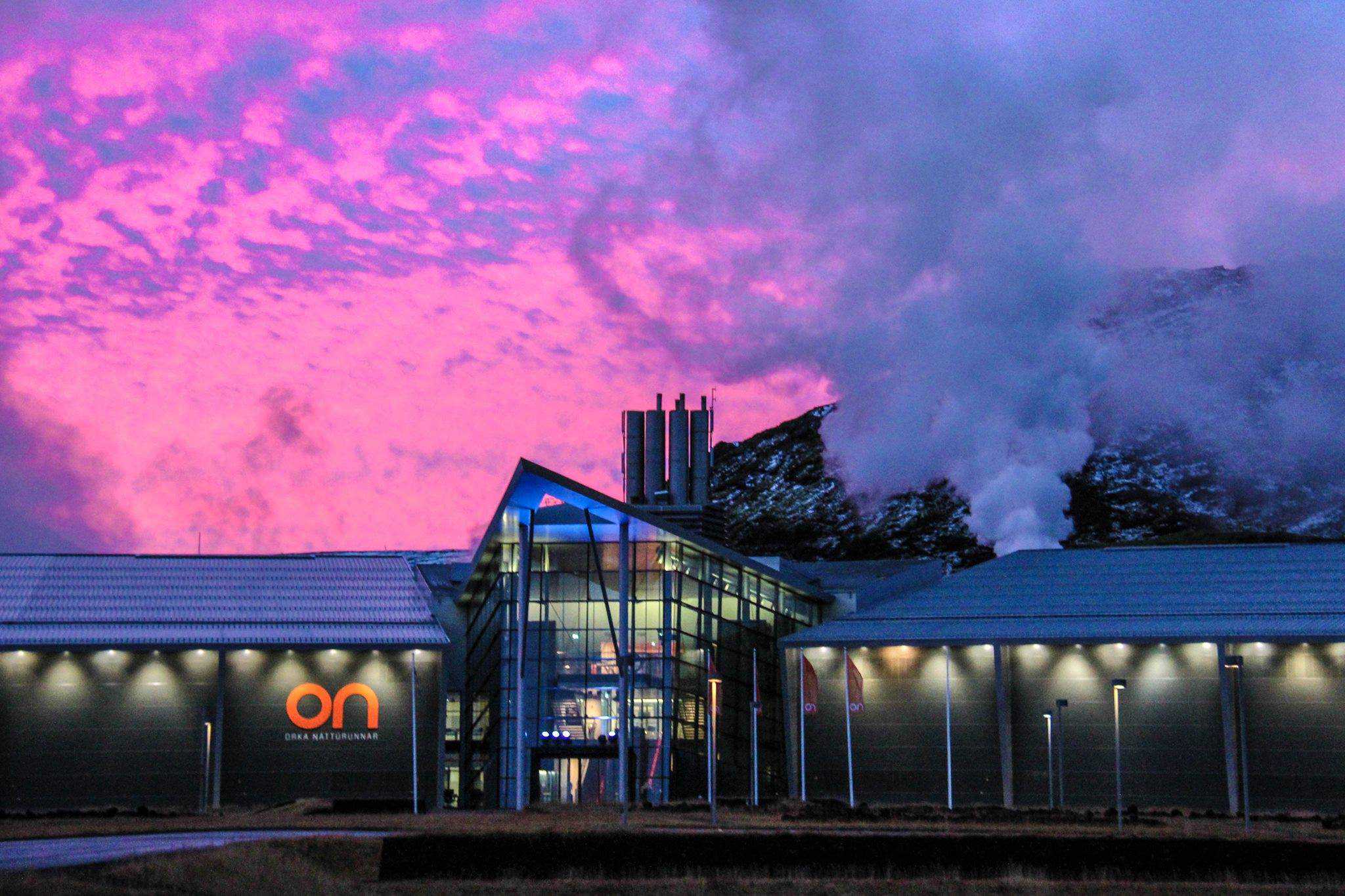
If look to your left you might see a modern looking building in a haze of steam. This is Hellisheidi geothermal plant and you should make left turn, for the main building hosts a superb geothermal energy exhibition on geothermal energy. You can even get to see the turbines, which are used to create electricity. If you visit the power plant on a clear day, make sure you check out the view from the 2nd story balcony, for it is breathtaking. From there you can see how the lava fields of the heath overlap each other.
As you head out again you might discover the strange sulphuric smell as you reach the heath’s highest point. To your left are many hot springs, which release gases and are the cause of the smell.
Make sure that you stop by the view point just before you head down from the heath. On a good day it offers you a great view of the lands below and you even might see as far as Westman Islands.
Western part of the South Coast
As you find your way down from Hellisheidi heath the small but beautiful town Hveragerdi comes into view. There’s a geothermal hot spring area almost in the middle of the town, which the locals have found a great use for. They use the hot water to keep their greenhouses warm and it is so efficient that you can even find bananas that have grown in these greenhouse. Mind you, Iceland has Europe‘s largest banana plantation according to our sources!
We recommend that you make stop in Hveragerdi. The locals offer a few tours, where you can learn more about the geothermal hot springs or even go for a hike and bathe in one of the many warm springs and creeks around the town. Perhaps you’d rather go on a bike tour and learn about the hot springs in Hveragerdi.
A quick and very tasty detour
You can drive further east from Hveragerdi to find the town of Selfoss, but we’d like to tell you about a short detour, one that has yet failed to deliver. If you turn south from the roundabout at Hveragerdi, following road 38, to find the small village Stokkseyri, you’ll discover something that’s is simply divine. The Icelandic langoustine. If you like seafood and especially lobster, this one is a must-have.
Look for a small restaurant called Vid fjorubordid. Either go for the langoustine soup or simply go for a bowl of langoustine lobster. You’ll thank us later.
But wait, there’s more! Stokkseyri houses a few exhibitions and you’ll find some of these in the large warehouse beside the restaurant. There’s a Ghost center, where you can rediscover your fear for the undead. If you are jumpy or easily scared, perhaps this one is not for you. There’s also an Elves, Trolls and Northern lights museum, which are quite good.
Selfoss and Olfus
Selfoss has been rapidly growing for the last few years, much faster than the national average. The people of Selfoss base their livelihood on small industries, commerce, services rendered to the agricultural surroundings and tourism. The most prominent feature of the town is the suspension bridge crossing the glacial river Olfus. If you decided to not go for the langoustine, we recommend that you stop by the small hot dog stand beside the bridge, if for no other reason than to simply try an Icelandic hot dog.
The glacial river is the same river as where you can find Gullfoss waterfall. However, the river is called Hvita river where you find the waterfall, but Olfus in Selfoss. There’s a reason for this, Hvita river merges with the river Sogid, which falls from Thingvallavatn lake.
If you are interested in engineering and hydro-power, we recommend you make another detour. Follow road 35 on the western bank of Olfus, then turn right on road 36 once you’ve crossed Sogid river. After a short drive you should see the first part of Sogsvirkjun hydro-electric power plant, Ljosafossstod. During the summer you can exhibition open in Ljosafossstod.
Beyond Selfoss
East of Selfoss you’ll find many green fields and most of the land flat. The reason for this is that the land was until early 20th century a mire but after an irrigation system was built the land became very fertile, making this one of the best agricultural land in Iceland. If you look to your left you should see a pyramidal mountain, this is the volcano Hekla, the most active volcano in Iceland. Don’t worry, Hekla is closely monitored and we should get a heads-up before anything happens.
You should soon see a great canyon where river Thjorsa rushes towards the sea. Thjorsa is the longest and second-most volumnous river in Iceland. This white-water river has its source in Hofsjokull glacier. Make sure you turn right just before you cross the bridge over the chasm where the river runs, to find Urridafoss waterfall. This short detour will bring you up close with the raw and majestic power of Thjorsa river.
Detour for all you Game of Thrones fans
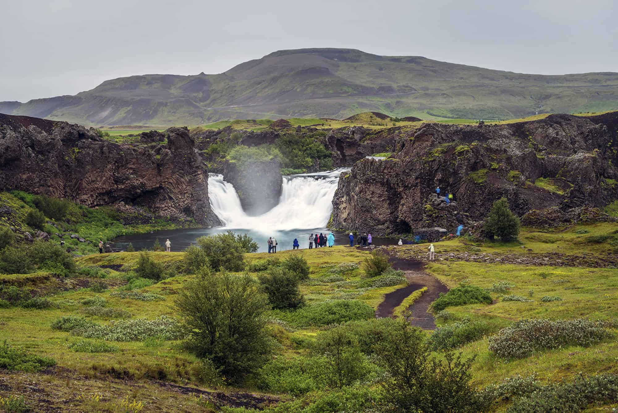
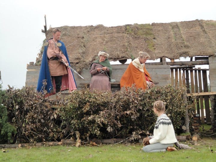
Ok, this one is a rather long one. If you follow road 30, turning left a little before you reach Thjorsa river, and turn left after a while to follow road 32 you’ll find the incredible beautiful Thjorsardalur. There you can find two locations where the TV series Game of Thrones were filmed, Hjalparfoss waterfall and a viking farmstead replica. Both these are well worth the time it takes to make this detour.
After exploring these two great attractions make your way back to road 1, following road 26.
The deep south
Once you’ve crossed Thjorsa river you’ve entered the deep south. The first town on your way is Hella, which stands by river Ranga. We recommend that you stop by and check out the swimming pool, especially if you are travelling with children. The pool has two great slides and a large pool for children. And even better, the hot tube offers you a great view of both. You should be able to see Eyjafjallajokull glacier loom over the landscape, the infamous volcano with the unpronounceable name that stopped all air traffic in Europe 2010. Just beyond Eyjafjallajokull glacier rises Myrdalsjokull glacier, the glacier that hides the volcano Katla.
A little east of is another detour and this time for the history buffs. If you follow road 264 for a while you’ll end up at the farm Keldur, where the National Museum of Iceland owns and runs old turfhouses, which are among the oldest houses in Iceland. The turfhouses are great to behold and it’s amazing to see how Icelanders used to live. Even more interesting is the old escape tunnel that was discovered in the 20th century and dates back from 11th or 12th century.
Hvolsvollur and the Saga Valley
The saga of Njall and Gunnar, Njals saga, is one of the most beloved saga among Icelanders. Hvolsvollur and the Saga Valley is the setting for that great saga, which tells of the friends Gunnar, Njall and Njall’s sons. It is a tale of settlers, feud and how one evil act begets another. You can learn more about this great story in the Saga Center in Hvolsvollur.
There is a lovely green area in the center of town where you can stretch your legs, let your kids play and enjoy a picnic and each summer you find there an outdoor exhibition by local area photographers. You can also visit the Lava Center exhibition, where you can learn about eruptions, earthquakes and lava.
The puffins of Westman Islands
If you are into birding do we have a treat for you. As you reach river Markarfljot turn left and drive down road 254 and take the ferry to Vestmannaeyjar Islands. The ride take about 20 minutes and offers you not only a great view of the Westman Islands archipelago, but also gives you the first glimpse of the many different sea bird species that make the islands their home. So, stay outside and bring the camera along.
The main island of Heimaey has a population of about 4000. In 1973 an eruption buried the fishing village in lava and ash. Needless to say, the eruption forced the islanders to evacuate and the eruption destroyed many buildings. We recommend that you check out Eldheimar Exhibition and explore this Pompeii of the North. There’s also a nice swimming pool in Westman Islands, so it’s not a bad idea to bring the swimsuit along. And finally, make sure you check out the many seafood restaurants in Heimaey, you won’t be disappointed.
A waterfall you can walk behind
As you exit the ferry and find your way back to road 1 you cross river Markarfljot, then you should see the first waterfall in the deep south. This is Seljalandsfoss, the waterfall you can walk behind. Park your car by the parking lot and enjoy this magnificent waterfall. Please note, that the waterfalls in the deep south are very popular among tourists, so that be prepared that there will many people there, especially during the high summer season.
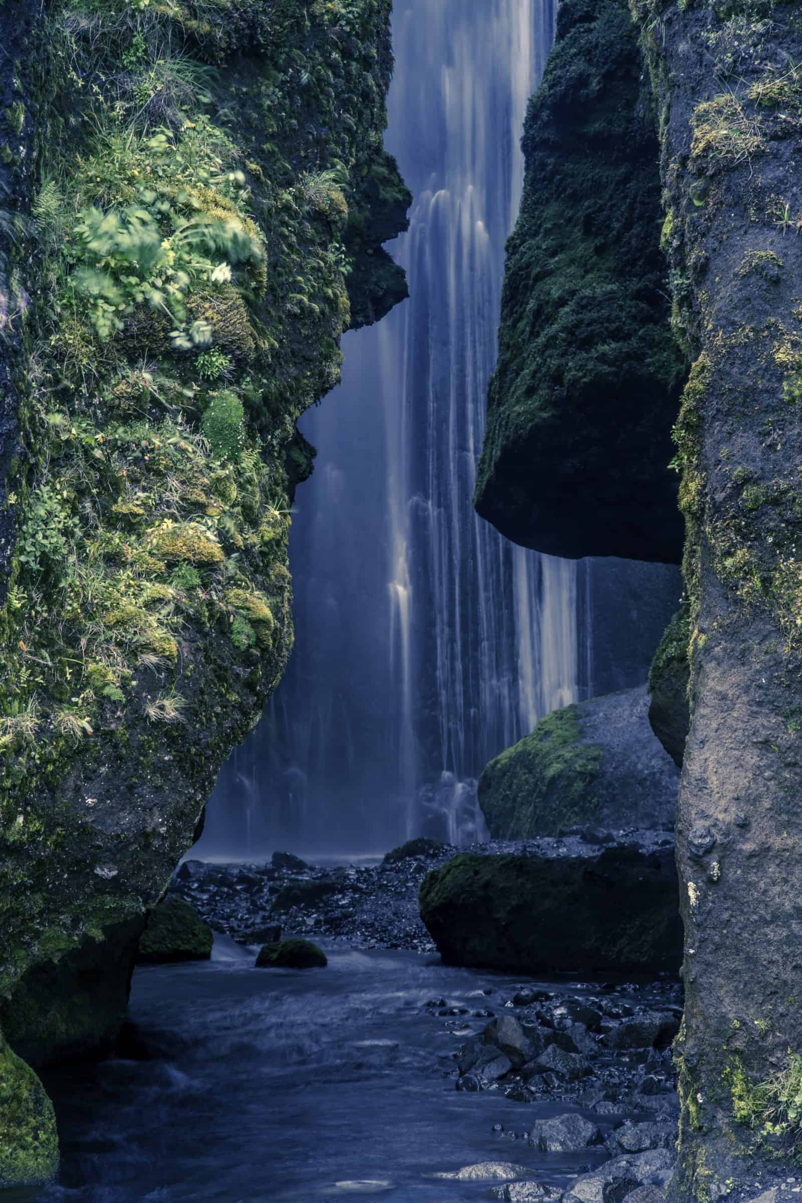
There is, however, one waterfall close by Seljalandsfoss that not many know about or go to see. Which is a shame, because it is beautiful. If you look left while facing Seljalandsfoss you might see a couple of houses and a camping lot. If you walk over there you’ll find a narrow gorge. In it you’ll discover the waterfall Gljufrabui. Just make sure you’re wearing waterproof shoes.
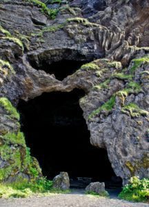
Leaving Seljalandsfoss and Gljufrabui waterfalls behind you don’t need to drive for a long time for our next stop. The mountainside to your left is riddled with waterfalls and some days, when it is windy, you can see that the water never hits the ground. Also, hidden in the mountain side, is a small cave with a story, the cave is called Paradisarhellir or Paradise Cave. In the early 1900s novelist Jón Trausti stayed on the nearby farm of Þorvaldseyri while writing his book Anna of Stóra Borg, which was based on local tales from the 16th century. Hjalti, the lover of Anna at Stóra Borg (and later her husband) is said to have hidden out in Paradísarhellir cave from Anna’s father, who disapproved so violently of their relationship that he tried to have him killed.
Look for an exit to your left. Follow the tracks up the steep hill. It’s a bit of a climb to get to the cave, most people should be able to make it but care must be taken. There’s a rope fixed to the rock that makes the climb easier. The cave offers a great view over the lands below.
The Eruption 2010
This whole area was covered with ash in the Eyjafjallajokull eruption 2010. Today you don’t see much of it, though every now and then, if it hasn’t rained for days, you might see the wind pick some up. As you head further east there are a few stops we recommend. If you are hungry, there’s a small and cozy restaurant by the farm Steinar 4, called Gamla Fjosid. It’s homely and offers good food.
A little further you’ll find the Eyjafjallajokull Erupts exhibition. This small volcano exhibition is run on a family farm and offers some great insights into what it looked and felt like living under erupting volcano.
A green swimming pool and some caves
We hope you brought swimming suit along, because as you leave the exhibition you only need to drive for a few minutes before you exit road 1 and turn left on road 242 to find the Seljavallalaug swimming pool. You need to park your car and walk for a little while, but, trust us, it’s worth it. The pool was built in 1923, making it one of the oldest swimming pools in Iceland. What makes the swimming pool special however is the fact that the water sometimes turns green in it. This is in large part due to harmless algae that grows on the sides of the pool.
When you’ve bathed and dried off it’s time to head out east again. Follow the same route back to road 1. After a short while you should get closer to the farm Drangshlid. There are many strange rock formations jutting from the green fields, many of which have caves that have been used in centuries past as houses for sheep. And what’s even more interesting, the largest one was used a setting for the famous Icelandic viking film As the Raven flies by Hrafn Gunnlaugsson. Feel free to stop and have look at the houses.
And now some more waterfalls
Skogafoss is your next stop. This magnificent and powerful waterfall is a favorite among tourists and locals alike. Park you car that the parking lot and make the walk up the stairs to the view point. On a clear day you might see as far as the Westman Islands. Be advised, the stairs are a challenge, so bring a bottle of water along. This is also the perfect place for a picnic. As with Seljalandsfoss, this waterfall is very popular among tourists, so during high season it might get crowded.
Not far from the waterfall is Skogar museum. The regional folk museum is well known throughout Iceland for being the best of its kind with a collection of artefacts from local curator Thordur Tomasson. The unique collection of mementos of this region’s past is housed in beautifully preserved old turf-roofed houses known as Byggdarsafnid Skogar.
Glacier exploration
As you leave Skogar you drive once more further east, following road 1. After a short while you should see road 221 to your left, leading north towards the glacier. Following it you’ll find Solheimajokull glacier. There are many ways to explore the glacier, but we recommend that you simply book a short glacier hiking tour with an expert guide. It is well worth it and you’ll learn so much about glaciers in a short time.
Little further east is a parking lot and a hiking trail leading south towards the coast. An old plane wreck can be found there, which has become a popular photostop among tourist. The hike there takes about an hour.
The black sand beach
After you have taken off you Jedi suit and found road 1 again you head out for Dyrholaey and the black sand beach. Dyrholaey is another mountain, like Petursey, that once was an island, but is now on dry land, so to speak. Make a right turn to road 218 and follow it till you reach the parking lot. From there you can follow the marked trails and gain a superb view of the black sand beach and the Arch below. Please do not leave the trails.
After leaving Dyrholaey and following road 218 back to road 1 you head further east until you see road 215 to your right. If you follow it you’ll find yourself in Reynisfjara, the black sand beach. There are some incredible basalt rock formations to be seen on the beach near Halsanefshellir Cave. You can also see Reynisdrangar sea stacks from here.
Please be aware, this is no ordinary beach and the waves here are extremely dangerous. Steer clear of the water and, if travelling with children, make sure you hold their hand at all times. Do not approach the water.
Follow the road back to road 1 and drive east towards the village of Vik.
The eastern part of the South Coast
Few other places in Iceland offer as many contrasts in nature as Vík with the iconic Reynisdrangar cliffs jutting out from the sea, and the Dyrholaey unique stone arch that marks the western edge of the district. The lush green pastures, rich birdlife, and glacial rivers all sit under the shadow of Myrdalsjokull glacier and the ominous Katla glacier-volcano, which is one of Iceland’s most active. Vik is also one of the best places in Iceland to go exploring ice caves.
There are a number of wonderful hiking trails in the area as well as a campground with a natural cave that serves as a kitchen for travelers with a grill and fireplace. The nearby freshwater Heidarvatn Lake makes for excellent trout fishing and there is salmon fishing and horseback riding as well. One of the most enjoyed experiences in the area is a ride on an amphibious boat, which enables you to literally drive out to sea.
Black Sand desert
Heading out from Vik you drive along road 1 for a while. The land is flat and the road straight, with green and purple lupine growing on either side of the road. This wasn’t always so, because these sands used to be black sand desert and hard to cross. The sand is simply black volcanic outwash.
A short detour for the Star Wars fan
If you are into Star Wars the next stop might interest you. Driving along road 1 you’ll see a mountain rise to the right side of the road. This is mt. Hjorleifshofdi, which served as the setting for the planet Lah’mu. This is the place where Orson Krennic captured Galen Erso, and Jyn barely managed to escape the clutches of the Empire, to be saved by Saw Gerrera.
Making a right turn at road 219 will allow you to drive to the base of the mountain. The mount is named after the viking settler Hjorleifur Hordmarsson, the blood brother of Ingolfur Arnarson. Hjorleifur was slain by his slaves shortly after they arrived in Iceland. The slaves were Irish (called Westmen) and fled to Westmen Islands (hende the name) where Ingolfur found them and killed them all.
You can hike to the top of the promontory, where you can find the burial mound of Hjorleifur along with many seabirds nesting, especially fulmar. Be aware, do not go too close to his nests, since they can spew a foul stinking vomit on you, making the ride further east a little less enjoyable.
Moving on
As with most deserts, there aren’t many changes in the scenery as you head further east. As you cross the sands you might see on your left on one place many small rock formations. These are what Icelanders call Varda, where you stack stones on one another and use it to mark routes in old times. This place, called Laufskalavarda, is more of a tourist varda, since no routes crossed the sands in ages past.
As you cross one of the glacial rivers you see that the scenery abruptly changes. No more black sands or purple lupine, but a massive moss clad lava field. This is Eldhraun, huge lava field created in the Laki eruption. Please do not walk on the moss, it’s very fragile and takes decades to heal.
Follow road 1 until you reach a sign that says Hunkubakka to your left. Make a left turn there and follow the road to Fjardargljufur, which is massive ancient river canyon, about 2 million years old. Park your car and follow the hiking trails and enjoy the panoramic view.
Kirkjubaejarklaustur
After you have found your way back to road 1 and head once more east, you’ll find a small village called Kirkjubæjarklaustur. There are many great attractions in Kirkjubaejarklaustur. If you follow road 203 after the roundabout you’ll find two of these. First you’ll find a place called Kirkjugolf or Churchfloor to your left.
Kirkjugolf (The Church Floor) is in the field just east of Kirkjubæjarklaustur. It’s an approx. 80 m² expanse of columnar basalt, eroded and shaped by glaciers and waves. There has never been a church there but the plane looks as though it’s man made. Columnar basalt is formed when lava flow gets cooled and contraction forces build up. Cracks then form horizontally and the extensive fracture network that develops results in the six sided formation of the columns.
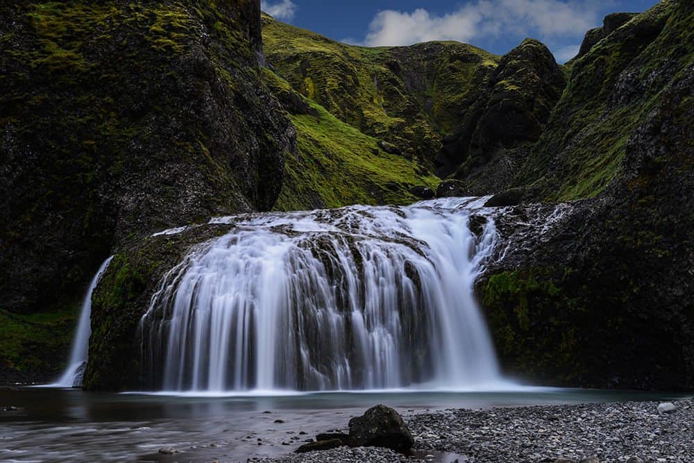
A little further north you’ll find a small river, where you can park your car. There’s a trail leading along the river to a small but beautiful waterfall, called Stjornarfoss waterfall. In hot days you might see locals taking a bath in the pool beneath the waterfall.
There’s also another waterfall worth mentioning in Kirkjubaejarklaustur village. If you turn back to the roundabout and the take the next exit, road 205, you can see Systrafoss waterfall behind Klaustur-Hof Guesthouse. Systrafoss is in fact two waterfalls, side by side, cascading down the steep mountain side.
Lomagnupur mountain
As you leave Kirkjubaejarklaustur you head east along road 1. Ahead of you rises mountain with steep sides, one named Lomagnupur, which are 688 m high palisades that tower south of Björn, west of Núpsvötn on Skeiðarársandur. West of Lómagnúpur is the farm Núpsstaður.
Lómagnúpur is mentioned in Brennu-Njáls saga, in a rather peculiar role, where it appears in the dream of Flosi Þórðarson at Svínafell, but Flosi was the deviser of setting fire to Njáll Bergþórsson’s farm. Flosi dreamed that he was at a farm by Lómagnúpur, he walks out and looks to the mountain. The mountain opens up and a giant clothed in goatskin and with an iron rod in hand steps out. He recites the names of the 25 men that plan to burn down Njáll Bergþórsson farm. He then bangs his rod against the ground and steps back into the mountain. All of the men that the giant names are later killed in revenge for burning down Njáll’s house.
The giant of Lómagnúpur can be seen on Iceland‘s coat of arms. It is one of Iceland‘s four guardian spirits, and guards the south coast from evil forces. All of Núpsstaður land is listed as natural remnants.
Between the deserts
Ahead of you is another black sand desert, called Skeidararsandur. The great glacier Vatnajokull, the largest glacier in Europe, looms over, with mt. Hvannadalshnjukur, the highest mountain in Iceland, towering over the landscape. Vatnajokull is enormous and you might want to explore it further. We recommend that you explore some of the ice caves in Vatnajokull.
There are many great photo opportunities along the road, but be advised, road 1 is for Icelanders what motorways and highways are to you. So, park your car where you can exit the road completely and take every precaution.
Stop at the Skaftafell National park
After a while you should see road 998 to your left. Make the turn and follow the road to find Skaftafell and Vatnajokull National Park. Although flanked by glaciers, Skaftafell is actually among the areas in Iceland that receive the least amount of snow. Precipitation usually comes with southerly wind directions that also bring a relatively warm air from the ocean. So most of the time, the precipitation is rain rather than snow. As a result, most of the hiking trails in the lowland areas of Skaftafell are clear of snow all year round.
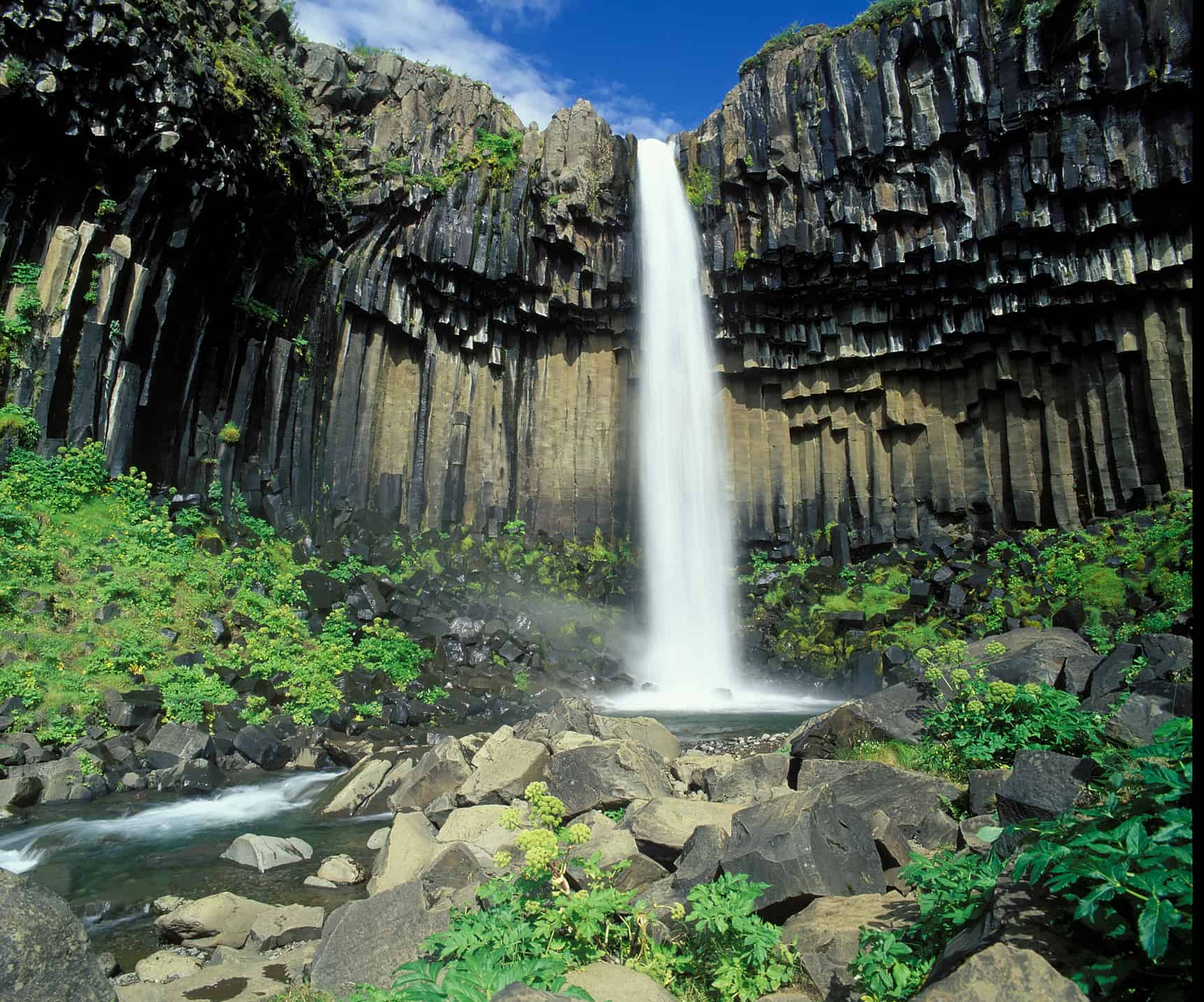
Skaftafell is the perfect place for hiking as there are many trails in the park. We recommend that you take the short walk up to Svartifoss waterfall, the view is breathtaking, since the waterfall is bordered on both sides by tall black basalt columns resembling the pipes of a giant organ.
The beautiful glacial lagoons
Leaving Skaftafell behind you head back to road 1 and turn once more east. As you drive along the glacier you might spot the enormous effect it has had on the landscape, the way the mountain sides are cut by water and the huge silt walls left by the receding glaciers.
After a 40 minute drive from Skaftafell the majestic Jökulsárlón glacier lagoon awaits. But note that there are more than one glacial lagoon along the road. You could stop by Fjallsarlon, which is a little closer to Skaftafell than Jokulsarlon glacial lagoon. Fjallsarlon glacial lagoon is also a little less known, so if you are trying to steer away from the biggest tourist crowds you might find Fjallsarlon to your liking.
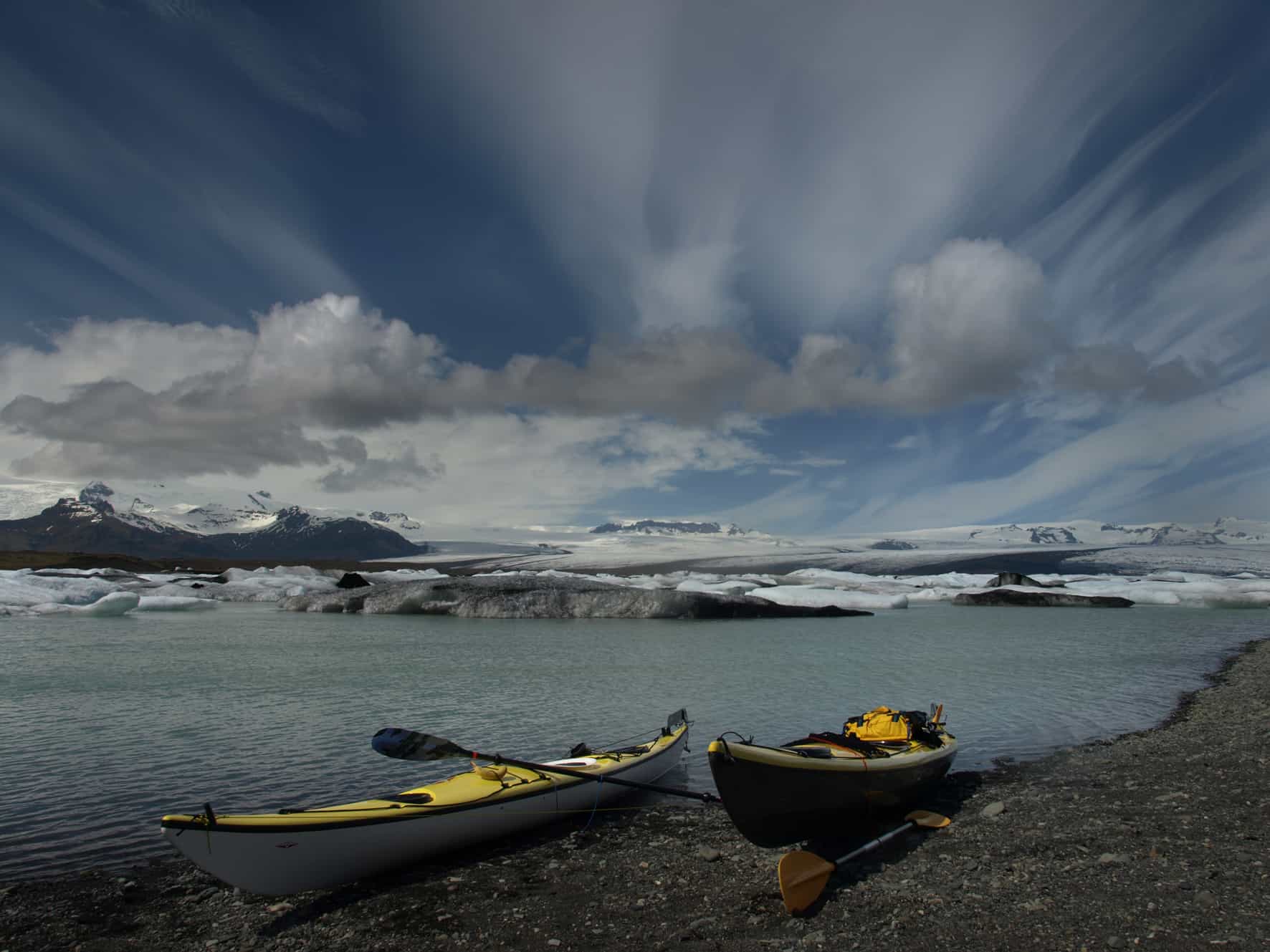
Jokulsarlon glacial lagoon is constantly changing, where blue, white, turquoise and black streaked icebergs shift and creak about in an icy dance. The icebergs are 1,000-year-old chunks of the retreating Oraefajokull glacier that have broken off and are floating out to sea.
The lake has grown at varying rates because of melting of the glaciers. It is now 1.5 kilometres away from the ocean’s edge and covers an area of about 18 km2. It recently became the deepest lake in Iceland, at over 248 metres, as glacial retreat extended its boundaries.
The mystical lagoon is enormous and has provided the backdrop for many major feature films and programs including ‘Batman Begins’ and most recently ‘Game of Thrones.’
Just below the famous Jokulsarlon glacier lagoon you will find a black volcanic sand beach sprinkled with icebergs of all sizes. These iceberg look like giant pieces of diamond sitting on the black beach, which is why many tourist call the beach the Diamond beach. Why not end your stay at Jokulsarlon with a surreal walk and some great photos to share with people at home.
Head back home or go further east
From here you either turn and head back to Reykjavik. Or you might want to explore Iceland even further east, and trust us, there’s also so much to see there.