The Wonderful Westfjords

The Westfjords in Iceland are a remote and unspoiled diamond, a unique and extraordinary area where the land is characterized by deep fjords, steep mountains and beautiful green valleys. If you wish to find serenity, peace and tranquility, this is your place to go.
As you head out for the Wonderful Westfjords from Reykjavik following Road 1, Mt. Esja (914 m/2999 feet) rises before you. The mountain is a popular outdoor area among locals, and there are many great hiking trails there. Esja once was a volcano; the oldest part of the mountain is over 3 million years old. You can actually see that part as you drive alongside the mountain; look to your right as you pass the mountain, and you will see the oldest part of Esja.
As you pass the oldest part of Esja and the road turns northwards once again, you might notice a farm on your right. This is the farm Esjuberg where, according to the Icelandic saga Kjalnesingasaga (Saga of the Kjalnesings) a rich and sorcerous widow called Esja lived. Whether the widow took her name from the mountain or the mountain is named after her is unknown, though most scholars believe that the widow inherited her name from the mountain. Esja the sorceress was one of the key characters of the Saga of the Kjalnesings; she raised the main character, Bui, on her farm.
After some driving you should see the Hvalfjord tunnel, which you can use to get across the Hvalfjordur fjord.
Borgarnes
As you cross the bridge over Borgarfjordur fjord, you’ll enter the small and cozy village of Borgarnes. As the story goes, the town stands where the Viking settler Skallagrimur Kveldulfsson built his farm. Skallagrimur was the father of Egill, the warrior-poet, and the main character of Egill’s Saga. You can learn more about Skallagrimur, Egill, and Iceland’s settlement at the Settlement Center in Borgarnes. There’s also a quite good coffee house in the same building as the Settlement Center.
There’s also a nice swimming pool in Borgarnes, one well worth the visit, especially when traveling with kids. There are water slides and both indoor and outdoor pools.
There are two different ways to reach the Wonderful Westfjords. One way is to make a left turn at the roundabout as you are about the leave Borgarnes and follow Road 54 north towards Budardalur. However, this guide will focus on the other way, where you’ll take Road 1 and also explore a bit of North Iceland on the way to the Wonderful Westfjords.
Borgarfjordur
Once you’ve finished learning about Iceland’s settlement, it’s time to leave Borgarnes via Road 1. After a while you might notice that the road passes along a pristine and clear river on your right. This is Nordura, one of Iceland’s most popular salmon fishing river. This region is Borgarfjordur, an area popular both for farming and for vacation cottages. Birch trees grew wild in this area when the settlers came, but now trees are mostly confined to a few areas. You might notice strangely-shaped cliffs along the road every now and then. These cliffs almost all align, due to the fact that during the Ice Age a heavy glacier covered the area. As the glacier retreated, its heavy weight helped carve the cliffs into these unusual shapes.
As you pass between two of these cliffs you should see a gray and black moss-clad lava field open up before you. This is Grabrokarhraun, whose lava flowed from the small Grabrok volcano straight ahead. You are getting close to our next stop! After you’ve entered the lava field you should notice a road to your right that leads to Glanni waterfall. You can park the car at the parking lot and walk just a short distance to see this magnificent waterfall flowing from the river Nordura. During the summer months you might see an angler or two trying their luck catching salmon. If you are lucky, you might even catch a glimpse of these much-prized fish jumping and swimming up the waterfall.
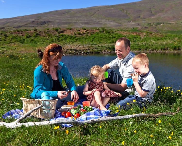
The perfect place for a picnic
Not far from the waterfall is Paradise Hollow, which is a perfect place for a picnic. The hollow is surrounded by lava on almost all sides, offering shelter from the wind (it tends to get windy in Nordurardalur valley, especially in the afternoon. When the sun is shining, the hollow can be a great place to take a break from driving and rest your weary bones.
After you’ve returned back on Road 1, keep driving north. The buildings on your left are Bifrost University. Bifrost is named after the rainbow bridge that the Aesir (the old Nordic gods) supposedly used to travel between the Nine Worlds, which included the worlds of Asgard and Midgard. If you are interested in the old Nordic religion you might notice that many names, places and attractions in Iceland have some connection to the old religion.
If you are ready for a short hike, we recommend that you make a stop at Grabrok volcano. The hike to the top of the volcano is not hard and offers a brilliant view of the lava field and the Nordurardalur valley. Once you’ve reached the top you might also notice the small lake to your south, which is perfectly hidden from the road by a low hill. This is Lake Hredavatn. To your north you’ll see a pyramid-shaped mountain, which is almost orange in color and stands out from the surrounding hills and mountains. This is Mt. Baula; the 3.4 million year-old mountain’s color is due to its rhyolite rock composition.
Holtavorduheidi heath
Once you’ve explored Grabrok, it’s time to drive once more north, following Road 1. The road ascends as you cross over Holtavorduheidi heath. The reception for mobile devices isn’t that good on the heath, so please make a note of that. This might be a great time to listen to those Spotify playlists you downloaded before coming to Iceland (hopefully including the Iceland Travel Road Trip playlist,full of different genres of Icelandic music, there on your device).
The heath itself, mostly moors with extensive and rather flat hills, is 407 meters (1335 feet) high and, if the weather is good, you should be awarded with an awesome view of the surrounding area. To your right you might glimpse Langjokull glacier and Eiriksjokull glacier. In front of you will be the Hrutafjordur fjord and to your left will be the basalt mountain Trollakirkja (1001 meters/3284 feet), which is over 6 million years old.
As the story goes, when the Viking settlers came trolls and giants used to live on Mt. Trollakirkja (the name means “troll church” in Icelandic). After Icelanders accepted Christianity as the national religion, all the trolls fled to the Westfjords, save for one female troll. She hated the new religion and tried to slaughter the Christians the first time a mass hymn was sung in Hrutafjordur fjord by throwing a huge rock at the parish church, but she missed. Unfortunately, the rock slew many horses where it landed.
Strandir
You’ll descend from Holtavorduheidi heath and into the western part of North Iceland, an area characterized by rolling hills, deep fjords and fields of green. This part of Iceland is rich with history and was pivotal in the age of the Sturlungs, a time of unrest and civil war in the 12th and 13th century in Iceland. This is an area rich with wildlife; you can find salmon and trout in almost all lakes and rivers, and seals and seabirds by the coastline. There is fertile soil almost everywhere you look, and it’s no surprise you will be able to see farmsteads even in the most remote locations.
The north, however, is not your destination but the remote and secluded Westfjords. So let’s travel onwards!
Hrutafjordur fjord
In the Book of Settlements, or Landnamabok in Icelandic, is a tale of how Hrutafjordur fjord earned its name. As the story goes, one of the first settlers, Ingimundur “the Old” Thorsteinsson, came looking for some good land to settle. He discovered the fjord and found two rams there. Ingimundur decided that this deep and narrow fjord should be called “Hrutafjordur” or “Fjord of the Rams”. Ingimundur, however, didn’t like the fjord and continued exploring to the east until he found Vatnsdalur valley, where he settled. The first settler in Hrutafjordur was actually Balki Blaengsson, one of Harald Fairhair’s adversaries in the battle of Hafursfjord (many scholars consider this battle to be one of the most decisive events in Norway’s history).
Why stop at Bordeyri
As you descend from the heath you’ll pass a rather large gas station to your left. Only a few dozen meters/feet away you’ll see a crossroads. Make a left turn there and follow Road 68 for a short while, or until you reach the tiny village of Bordeyri. The western part of the Hrutafjordur fjord area is called Baejarhreppur and has a population of about 100 and Bordeyri is, naturally, the only village in the area. This is the smallest village in Iceland, with a population of only 16 people. At one time in Iceland’s history, it was a popular rest stop for merchants since the village had a good natural harbor. In the village center is a small store/coffee house where you can buy hot, fresh Icelandic waffles (vöfflur), which we heartily recommend you try.
Ingimundur the Old is also responsible for the Bordeyri’s name. As he was leaving Hrutafjordur after finding the two rams, a heavy fog came from the sea. Ingimundur had to beach his ship, and where he landed his men found a large tree trunk that had drifted from the sea onto the beach. Thus he decided that this beach should be called “tree trunk beach,” or Bordeyri in Icelandic. Apparently, naming things wasn’t that complicated back then.
Keep following Road 68 north. To your right the large gulf of Hunafloi opens up, and you’ll notice the landscape to your left is characterized by fjords, valleys and rolling mountains. You are now entering Strandir. It’s one of the first parts of the Westfjords you’ll see and one of the most remote areas in Iceland.
Sheep farming museum
If you are driving with kids, the next stop should interest you: a sheep farming museum along the shores of Hunafloi as you drive towards Holmavik village.
The Sheep Farming Museum (open during the summer) is an interesting and entertaining exhibition about the Icelandic sheepbreed and sheep farming. The exhibition provides diverse entertainment for visitors of all ages. Your children can enjoy themselves in kid-friendly room with toys and colour books while the grown-ups view the exhibition. The museum also has a small science room where you can take a look at various things through a microscope. One of the main attractions in the Sheep Farming Museum are the lambs, which you can help feed with milk from a bottle.
There’s also a small coffee shop where you can try out authentic Icelandic cakes and bread. You’ll also find a handicraft-and souvenir store, where you can buy locally-made items.
Once you’ve fed the lambs, keep following Road 68 towards Holmavik village.
Sorcery and witchcraft in Holmavik village
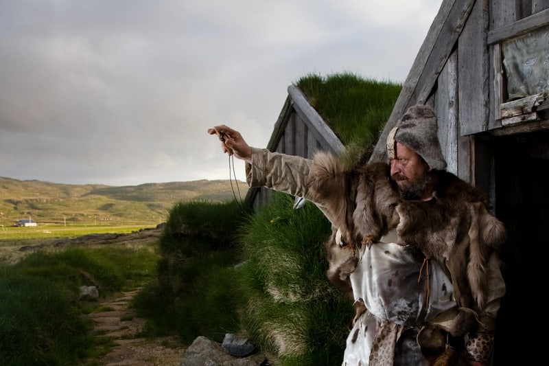
The fear of witches and sorcery in the Middle Ages was just as big here in Iceland as in the rest of Europe, but there was one distinct difference. In Iceland more men than women were executed for witchcraft. These men were burned at the stake; the few women who were condemned for witchcraft were drowned. The Westfjords were especially famous for their sorcerers, wizards, and so there were rampant witch hunts here.
Holmavik, the small village to your right, hosts an award-winning Sorcery and Witchcraft museum, and we fully recommend that you make a stop there and check out the museum.
The beautiful village also boasts a decent swimming pool and a good golf course. You can also go on a whale watching tour, since there are many whales in the Hunafloi bay area. Once you’ve seen the whales , we recommend that you find your way to the small restaurant Cafe Riis and try out their pizza– it’s more than worth it! If you are not in the mood for a pizza, Cafe Riis’ fish soup is also very good.
Aquaman and the Justice League in Djupavik – detour suggestion
As you bid farewell to Holmavik, head out along Road 61 for a few minutes. When you reach the intersection where Road 643 crosses Road 61, make a right turn. You are now entering one of the most remote parts of Iceland. During the winter most of the few farms you pass become locked in snow. You will probably notice how the road clings to the steep mountain sides in many places; this road is often impassable during the winter’s darkest months.
When Road 643 intersects with Road 645, make a left turn and keep following Road 643. In a few moments you should see a small cottage to your left. This is the Sorcerer’s Cottage and a part of the Sorcery and Witchcraft Museum in Holmavik and well worth the stop. There you can see how Icelandic sorcerers used to live.
The drive to Djupavik is a breathtaking one. The road sits in the side of a steep mountain, so make sure that you drive slowly. The view, however, is spectacular all over Hunafloi bay area. On a clear day you can see across the bay to Skagi peninsula and Skagastrond village.
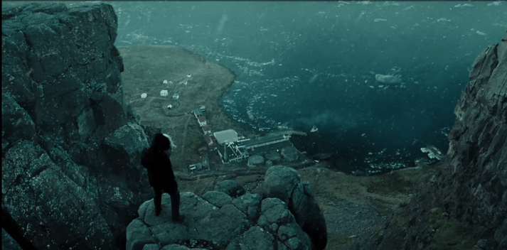
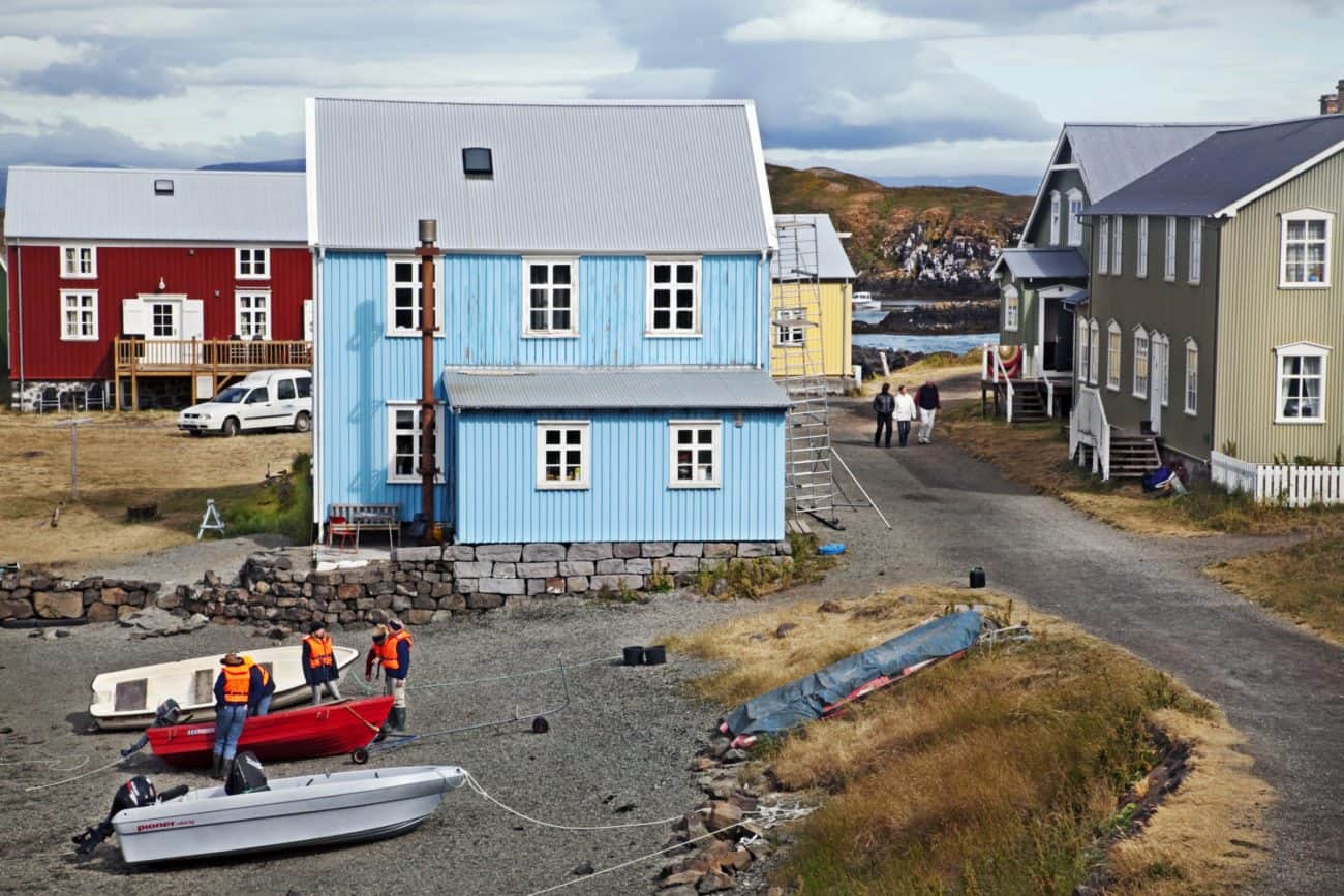
Djupavik fjord is a secluded and beautiful fjord, where there once stood a herring factory and a small village. Now you will only find the ruins of the factory there, along with a single guesthouse. If you are interested in superhero movies, this is the place used in the scene where Bruce Wayne sought out Arthur Curry, or Aquaman, in the Justice League movie.
Djupavik is peaceful and solitary place. Seeing the ghosts of the both the herring factory and the village that once stood there is also a sharp reminder of how strong Reykjavik’s gravitational pull was on rural Icelanders seeking work opportunities. While in Djupavik, it almost seems like you can hear the sound of the factory and smell the herrings. You can experience this effect all over the country, but probably nowhere as vivid as in Djupavik and the surrounding area.
Krossneslaug swimming pool
If you keep following Road 643 you will leave Djupavik fjord and come to Nordurfjordur fjord. You will pass by a few small and picturesque farms along the road. In Nordurfjordur is a small café, a gas station and a little shop. The café offers a superb view of the small harbor, and their soup is also quite good.
Once you’ve explored Nordurfjordur, keep following Road 643. After a few minutes you should reach Krossneslaug swimming pool, built in 1954. This place is a hidden gem, so to speak. The pool is small but has one of the best views in Iceland. The pool is well-maintained, and natural springs provide a continuous source of hot water to feed this open-air pool down on the pebble beach. Krossneslaug geothermal pool is just by the shoreline, its walls barely a couple of meters from the icy waters of theAtlantic.
Drangsnes
Once you’ve bathed and basked in the glorious view, return to Road 643. Follow the same route back until you reach where Road 645 crosses Road 643, just south of the bridge over Bjarnarfjardara River. Make a left turn and drive along Road 645. You are now driving along Drangsnes peninsula. After a few minutes, you will see where a small church stands. It is built of timber and clad with corrugated galvanized iron. This is Kaldrananes church, originally built in 1851, and it is the second oldest building in the area. Surrounding the church is a small graveyard. In recent years the church has been renovated, including the construction of a surrounding wall.
Keep following Road 645 over Drangsnes peninsula. To your left is the Hunafloi Bay and to your right is Kaldrananes moor. There you can find incredible vistas, where arctic heath, beautiful lakes and glacier-scarred landscapes greet you. Though there isn’t any road here, you can find hiking trails leading there to the right of the road a little north of Drangsnes.
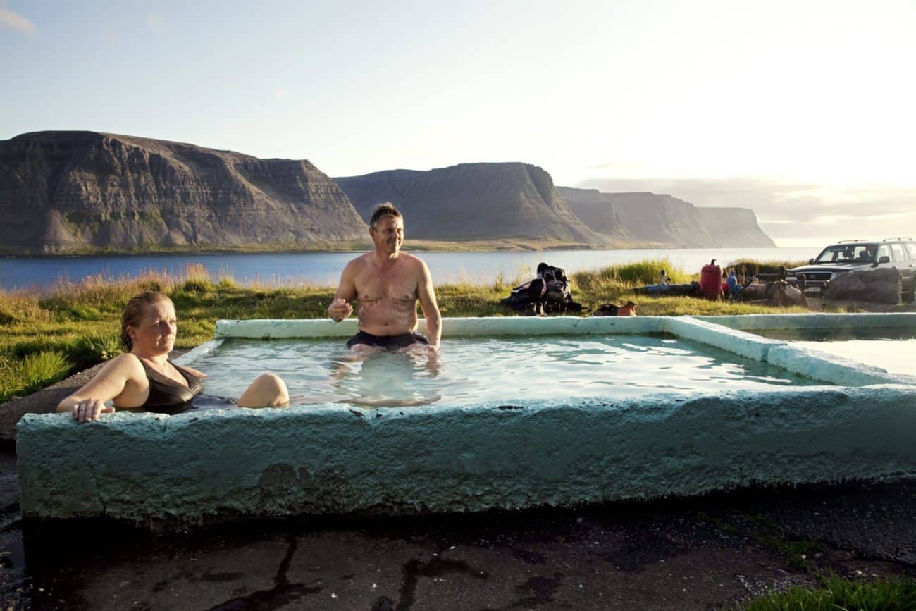
Drangsnes is a small village at the southern tip of Kaldrananes peninsula. Just outside the village is a large island, Grimsey. A giant supposedly formed Grimsey by trying to dig the Westfjords apart from the rest of Iceland. The island is the biggest attraction in Drangsnes. A short boat ride will bring you close to the island’s rich bird life, including puffins and fulmars. The island also has an interesting side story about fox farming. While you are in Grimsey, we also highly recommend that you check out the goethermal hot tub pools. The hot tubs can be found near the shore, and a dip in them is the perfect way to blend in with the locals.
Isafjarðardjup fjord
As you leave the easternmost part of the Westfjords, you’ll head back to Road 61. Crossing Stadara River, you will make a right turn and start your ascent to he Steingrimsfjardarheidi Heath. To your right is Mt. Stadarfjall. As the story goes, the first settler in this fjord, Steingrim the Troll, used to live in a farmstead called Trollatunga. When he died he was laid to rest in a barrow, Steingrimshaugur, which is on top of the the mountain. According to legend, the settler’s spirit is supposed to watch over the fjord, and no man will ever drown in in the seas around Steingrimsfjord fjord that are visible from the the mountain’s cairn.
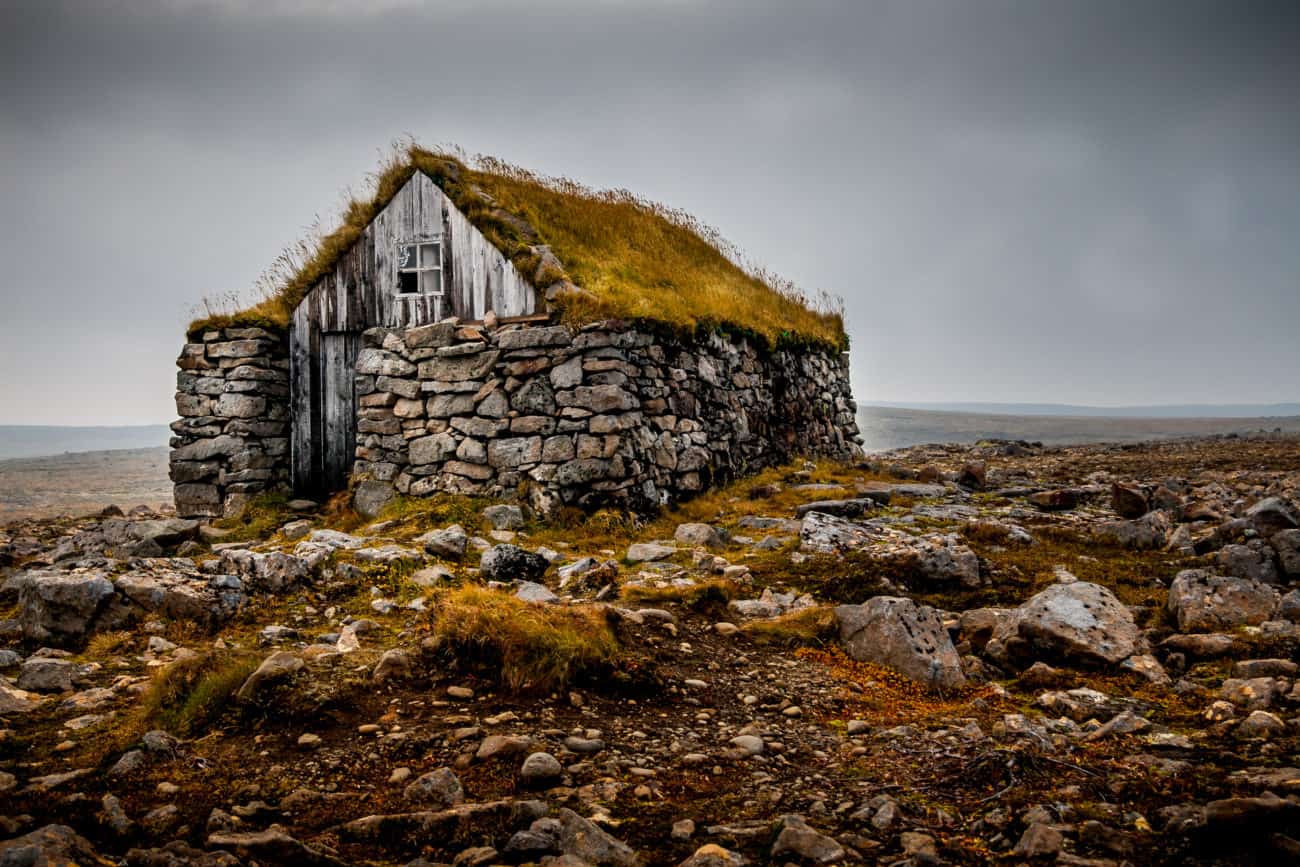
Follow Road 61. The heath is magnificent and enigmatic, rising more than 430 meters (1411 feet) above sea level and riddled with small lakes. On a clear day it offers splendid views, but more often than not, the heath is clad in dark fogs. That, along with the many ghost stories and legends surrounding the area, make the heath almost dreamlike and alien. Shortly after you reach the heath you will see an old hut. This is what we Icelanders call a “sæluhús” (shelter). There were houses like this on many heaths and moors where travelers had to go, especially in areas where the weather could change dramatically in only a matter of minutes.
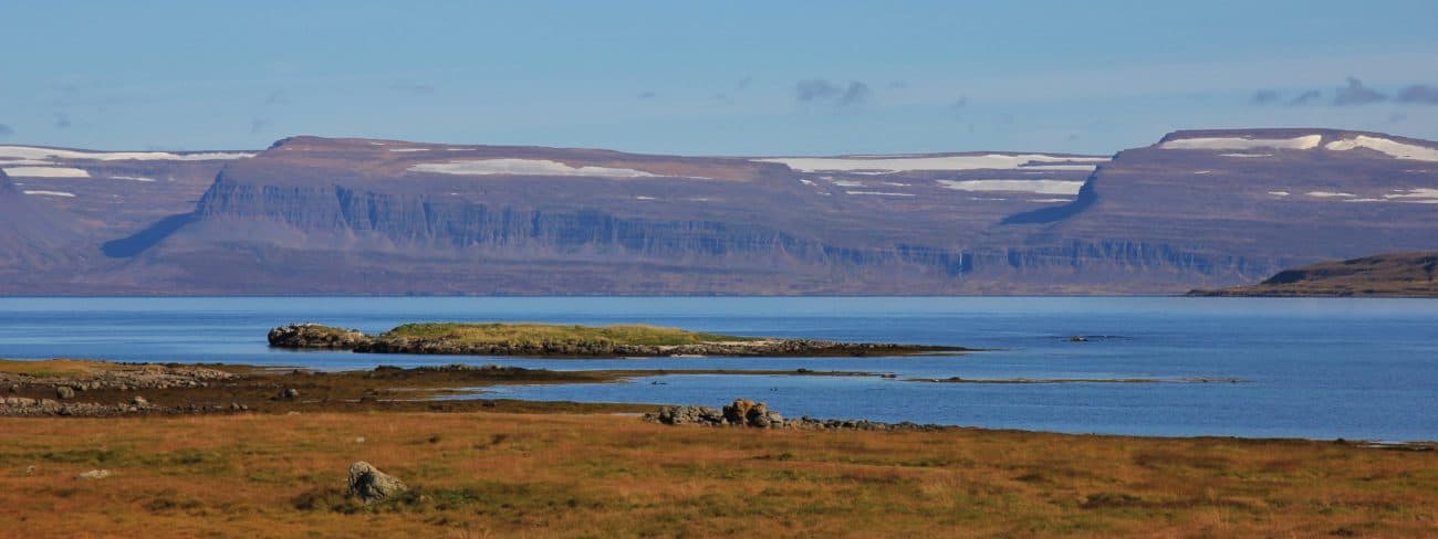
As you descend from the heath you will enter the Isafjardardjup fjord area. Deep fjords, steep mountains and green farmland characterize this area. You will find rivers in almost all valleys, most of which hold salmon, trout and even arctic char. The land is ancient here, much older than the western or southern part of Iceland, and you can see how glaciers during the Ice Ages molded the valleys and the fjords.
The first fjord you will drive along is Isafjordur fjord. On a bright day you can see see ocean birds dive and dive again, eating small fish. A short valley is at the end of the fjord, where a clear river runs. In the steep mountains , a pair of eagles have nested in the last few years, so you might get lucky and see them as they fly along the mountainsides.
Reykjanes peninsula
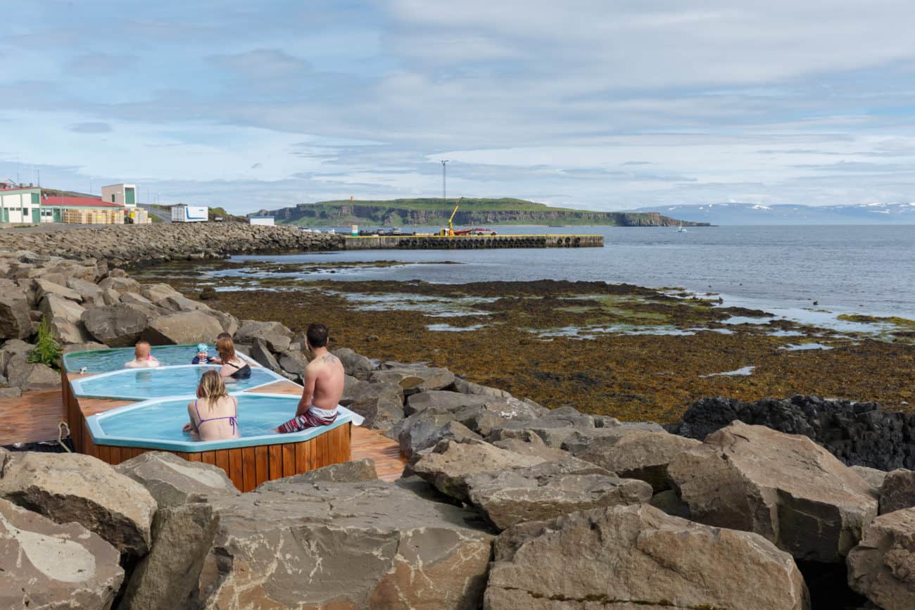
Just as you reach the opening of Isafjordur fjord, you will see a small peninsula called Reykjanes. There you can find a decent hotel and a camping site. There’s also a very nice geothermal pool, with a superb view over the eastern part of Isafjardardjup area. There is a short hiking trail as well, making this a nice spot for a picnic. It takes about an hour and a half to walk the trail, but it offers a few nice photo opportunities.
After the stop, keep following Road 61. The next fjord is called Mjoifjordur, fjord and it was bridged not so long ago. The fjord is quite long and has steep mountains on either side. At the bottom is a nice valley where there once were a few farms. Only one remains, though there are still a few farms in the fjord. If you wish to explore Mjoifjordur, make a left turn where Road 633 intersects with Road 61 and follow road 633. If you decide to make the detour, make sure you keep an eye out for Horgshlidarlaug pool. It is a small local pool. You need to first ask for permission to enter the pool at the Horgshlid farm (you’ll see the farm just before you reach the pool itself). It’s a great experience, especially when you have the pool to yourself, listening to the birds and the waves wash against the rocks.
Before the fjord was bridged people needed to drive along Mjoifjordur, but since the bridge was built the fjord has actually become even more serene and peaceful. The bridge connects each side via a small island called Hrutey. The name in Icelandic means “Ram Island”, which might indicate that the locals used to ferry sheep onto the island to graze there. Before the bridge was built, archaeologists excavated the area and discovered a couple of ruins. Neither ruin seems to have been used for sheep farming.
Ogur
Keep following Road 61. After a few minutes drive, you’ll leave Mjoifjordur fjord. You should see on your left a valley called Laugardalur valley. This is one of the main settings of the Icelandic literary work Fostbraedra Saga. Bersi, the father of one of the main characters (Thormodur), lived in the farm Laugabol, which is just west of the first lake and on the northern side of the valley. Laugabolsvatn Lake and the Laugardalsa River are both good for fishing. You can catch trout, salmon and arctic char.
Just a little north of Laugardalur valley, you will find the tiny Ogur community. There you can visit a great little café. You can also enjoy a fun kayak tour around the area, a great way to explore and to take in the scenery.
Once you’ve enjoyed the pleasantries of Ogur, keep following Road 61. Ahead of you are a few deep fjords, none of which have bridges. The first fjord is Skotufjordur, where you can find the small cottage Litlibaer. The hut is beautiful and well preserved and is a great picnic spot, offering not only a great view but also superb photo opportunities.
Across the fjord is the Snaefjallastrond reach, a scenic and remote part of the Westfjords. The waterfall you can see is called Mongufoss, which is named after Galdra-Manga, who was accused of witchcraft in 1662 but not found guilty in Thingvellir. Manga was a wife to the local priest, which made the case even more scandalous at that time.
The second fjord is Hestfjordur, and the third one is Seydisfjordur (which share the same name as another fjord in East Iceland). There are a few places in Iceland that have the same name, which has confused some travelers. There was once a man who had just arrived in Iceland, picked up his rental car and drove off to find his hotel in Laugarvegur street in Reykjavik. Unfortunately for him there is a street with the same name in Siglufjordur fjord, which is way up north in Iceland. His GPS system led him over 600 kilometers (373 miles) and 7 hours to the wrong address. But, fortunately, he said to a local newspaper that he had quite enjoyed the ride.
Once you leave Seydisfjordur behind you, you will find Alftafjordur fjord. As you reach the fjord, you will see a small village across the fjord. This is Sudavik. The mountains are quite steep here and rise high above the fjord. At the bottom you might see a few large rocks, which are oddly placed. These are called Dvergasteinar or Dwarf rocks. As the story goes, there once lived a dwarf in the mountains in Alftafjordur fjord who had a problem with one of the farmers. Dwarves are, of course, not well known are known for their great diplomatic skills (at least according to The Hobbit by J.R.R. Tolkien), and this dwarf decided to pelt the farmer’s farmstead with rocks. However, the dwarf wasn’t all that good at throwing rocks. Today you can see these rocks in a few different places: one in the sea, the second one on the shore and the final one by the farm Dvergasteinn. The final rock is called “Dvergur” or “dwarf.”
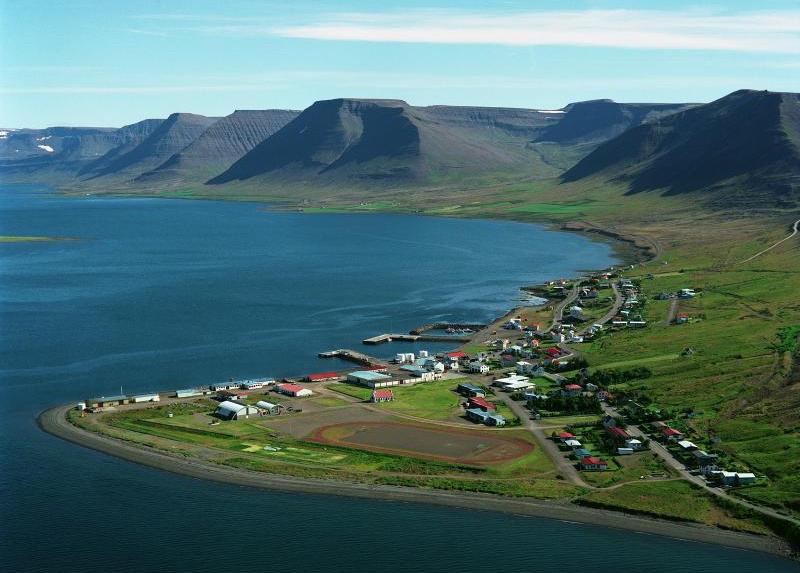
Sudavik
Sudavik is a small and beautiful village on the north shore of Alftafjordur fjord. However, it has a tragic history. In January 1995 an avalanche hit the village, bringing down 15 houses, where 26 people lived. Tragically, 14 died, and 8 of them were children. The weather at the time was abysmal, a heavy snowstorm, which made it very difficult for rescuers to get to the avalalanche site, let alone find survivors. The last person to be found alive was a 12 year-old boy, 23 hours after the avalanche fell.
It’s hard to imagine the effect that a disaster like this has on a small community. Many survivors moved away, yet others stayed on, not wanting to leave this beautiful village But all survivors were left with scars and wounds the took years to heal.
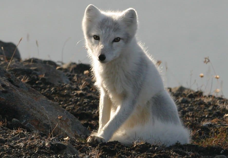
Today, Sudavik is a quaint and nice little village where you can find a small museum dedicated to the arctic fox species, numerous hiking trails, a camping site and couple of nice cafés and restaurants. There’s also a beautiful memorial dedicated to those that died in the avalanche which we recommend you visit.
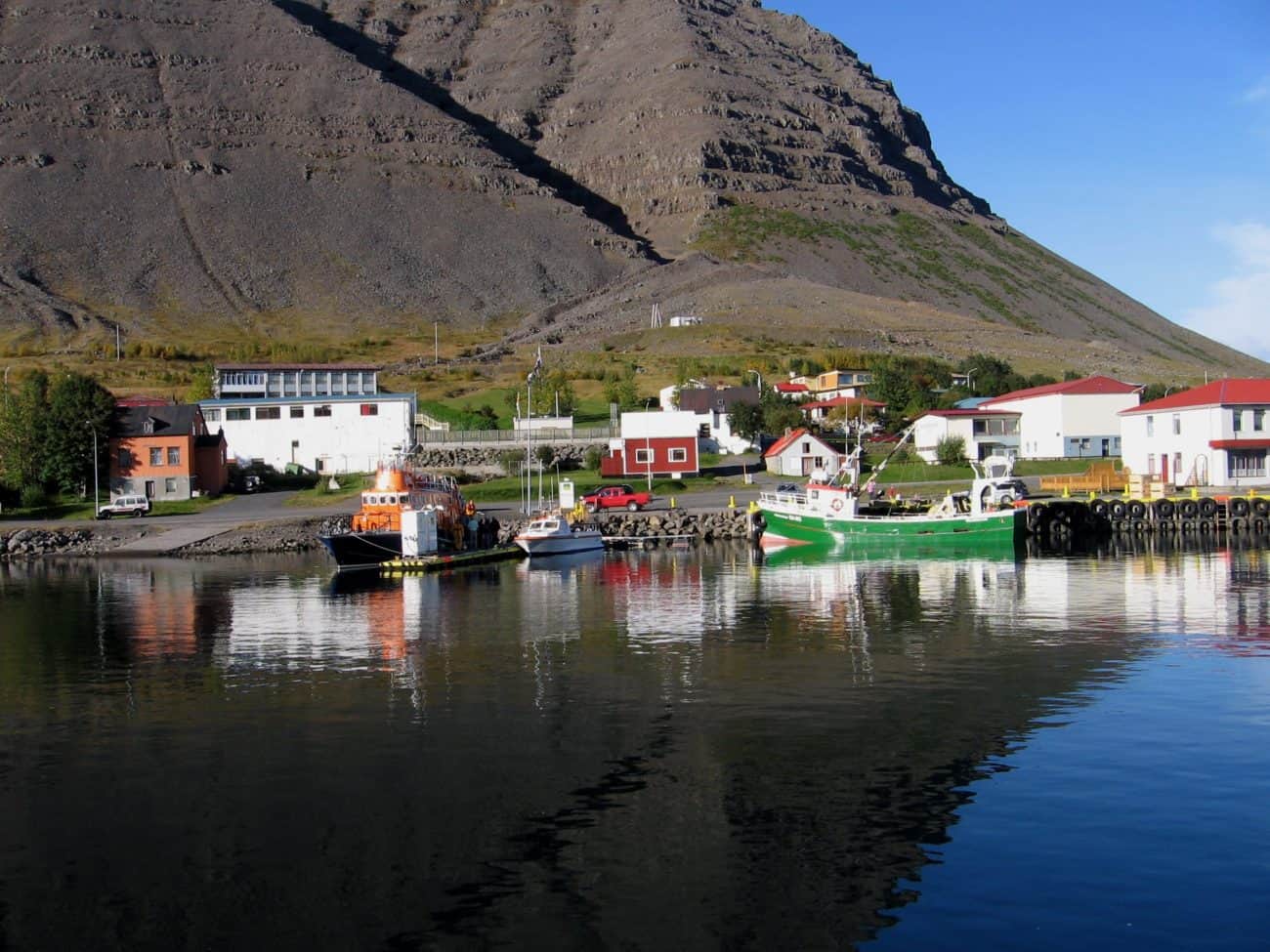
Isafjordur
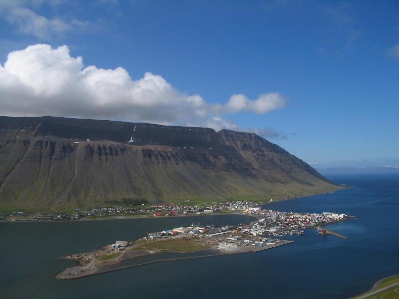
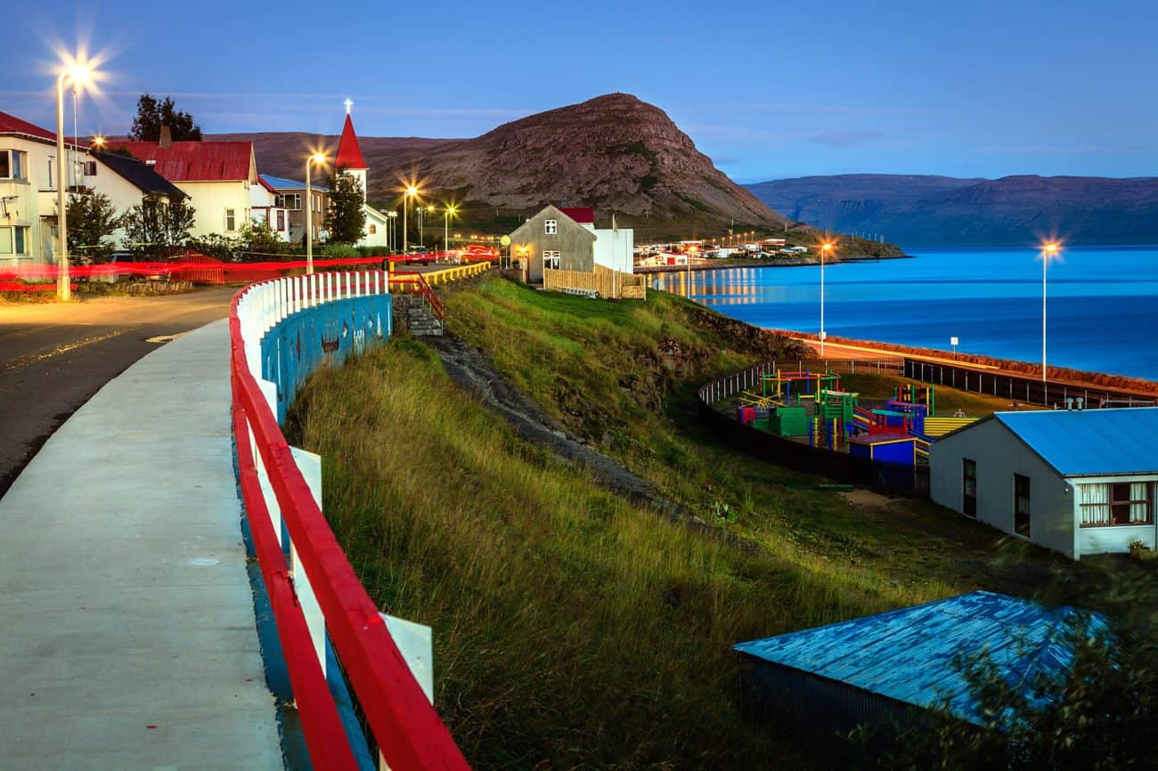
Next up is Isafjordur town. Once you leave Sudavik, keep following Road 63. Drive through a short tunnel to see a short fjord and the largest town in the Westfjords. Isafjordur town is a great place to visit, with a few great hotels there and guesthouses. There are also a few day tours and activities to choose from. The oldest part of the town is also a joy to behold; it has many old and restored houses that are both beautiful and give a you a good idea how what the town looked like a century ago.
If you decide to stay for a night or two in Isafjordur , we have a few recommendations. First of all, find a small café called Gamla Bakariid, or the Old Bakery. It is, as the name says, an old bakery that offers great pastries and breads. If you see a green old automobile, the bakery should be close by. Secondly, there’s a seafood restaurant down by the harbor called Tjoruhusid, that has a great menu. Even if you don’t like seafood, we still recommend that you give it a chance, since the dishes they serve are absolutely marvelous.
Finally, if you are into history you will find the Westfjords History Museum close by the Tjoruhusid. You will learn about what it took to live in the Westfjords in the old days, a truly eye-opening experience.
Hnifsdalur & Bolungarvik
Keep following Road 61 and leave Isafjordur to the east. The road clings to the side of a mountain, just as so many roads in the Westfjords do. In a few minutes, however, you will find yourself in a small village called Hnifsdalur. The name, which translates as “Knife’s valley,” is believed to refer to the mountain range just above the village, which does indeed resemble a knife.
Following Road 61 you will enter a tunnel leading north-east. Before the tunnel was built, the locals had to make a precarious trip on a dangerous road along a steep mountain side called Oshlid on one side and a sheer drop to the ocean on the other. This road was very often hit by avalanches and rock falls. The new tunnels have made the lives of the people in this area much easier.
On the other side of the tunnel, you will find a small fishing village called Bolungarvik. This is one of Iceland‘s oldest fishing outposts. According to the Book of Settlements, Bolungarvik was settled by two siblings, Thuridur Sundafyllir and her brother, Thjodolfr. As the story goes, they had a falling out and, since they were both accomplished sorcerers, they laid a curse on each other. Thuridur cursed her brother to turn into a monolith on which all birds would defecate. Thjodolfr, however, turned his sister into a block of stone, and she would stand forever where the wind blew the most. Yes, we Icelanders can be a bit dramatic! Both of these pillars have collapsed now; the pillar that was said to be Thuridur broke in half in 1936, and legends say the very same night Thjodolfr’s pillar sank into the sea.
The mountain opposite to the tunnel is called Mt. Tradarhyrna. It is 640 meters (2100 feet) high and mostly made of tertier basalt. In winter, the chance of avalanches is quite high, and you can see defensive walls built in the mountain side just above the village. In Bolungarvik, there are a few interesting activities we recommend. If you are into angling, this is a great place to try sea angling. We also recommend the very nice natural history museum in Bolungarvik and the Westfjords Botanical Garden near the center of the town.
If you are driving a 4X4 vehicle and looking for a great view point, here’s a small tip for you. Find a road called Skolastigur that leads north. Follow it until you reach a crossroads where you can’t continue straight forward. Make a right turn and follow Road 630. Make the first right turn, one that leads to the Latrar Air Station. This is a radar station. The view from the top is simply breathtaking. However, be very careful, especially when traveling with kids. The cliffs below are 700 meters (2297 feet) high. Please note that this road is only open in the summer.
Once you’ve explored Bolungarvik, return the same way back to Isafjordur.
Sudureyri
To leave Isafjordur village, follow Road 60 to the tunnel leading west. Once inside the tunnel, make a right turn at the intersection. The tunnel opens to reveal a deep fjord called Sugandafjordur, with steep mountains on either side. Follow Road 65 to find the picturesque fishing village Sudureyri. This is one of the best places in Iceland for sea anglers. Travelers from all over the world visit the village to try their luck at catching cod and halibut, some of which grow to be enormous. Since Sudureyri is a fishing village, you can expect that near the harbor the air will smell of sea and fish, and you’ll hear the squawks of seagulls that fly above. Of course, all their squawks translate as: Mine! Mine!
If you are not into angling, we recommend that you try out some of the seafood restaurants in Sudureyri. The fish is as fresh as it gets, and the dishes are simply wonderful. There’s also a nice outdoor swimming pool in the village situated not far from the church.
Leaving Sudureyri, you’ll follow Road 65 back to the tunnel and, at the intersection in the tunnel, make a left turn to follow Road 60 westwards.
Flateyri
As you leave the tunnel, you will see a white sand beach, Holt Beach, and a beautiful fjord. Holt has golden sands sand , and it might almost remind you of the sunny beaches in Spain. However, to be honest, it rarely gets as warm in Onunarfjordur fjord as it does in Spain. You also won’t see hundreds of people lying in the sand and enjoying the sun, as the beach is a protected eider duck nesting area. Holt Beach is the venue for a sand castle competition held every August, which attracts hundreds of participants each year. While you are at Holt Beach, take a moment to lie down, close your eyes and listen to the breathing of the waves and the birds chirping and singing.
Mountains, characterized by bowl-shaped valleys, line either side of the fjord. These valleys were left by the Ice Age glaciers. All these mountains were created by eruptions, and you can see how different lava fields stacked upon one another, resulting in high, flat-topped mountains. South of the beach, at the bottom of the fjord, is Mt. Hestfjall ( 702 meters/2303 feet high) The famous Icelandic Saga, The Saga of Gísli, takes place in the Westfjords. Vesteinn Vesteinsson, the blood brother of the main character Gisli, lived on a farm near Hestfjall.
Following Road 64 north along the eastern shore of Onundarfjord, you will find Flateyri village. High above the village, you can see an avalanche-deflecting dam in the shape of the letter “A.” Tragically, an avalanche hit the village in October 1995, destroying 29 homes and killing 20 people.
There are a few things you should explore in Flateyri. The old village bookshop has been turned into a museum. Visitors can learn about the history of the village while buying second hand books and viewing the old merchant’s home. An international doll museum and the popular Nonsense Museum can also be found in Flateyri. Finally, there are a couple of nice restaurants, taverns and cafés in Flateyri worth visiting.
Nupur Botanical garden
Once you’ve explored Flateyri, follow Road 64 back to the intersection with Road 60 and make a right turn. As you leave Onundarfjordur behind, the road slowly climbs to Gemlufallsheidi heath. The heath is at its highest point 283 meters (928 feet). Once you start your descent and start glimpsing Dyrafjordur fjord, keep an eye out for informational signs, for you are now entering the setting of the famous Icelandic Saga, The Saga of Gisli. At Gemlufallsheidi heath, Gisli’s blood brother, Vesteinn, received a word from Gisli that he suspected Vesteinn would be in danger if he came to Dyrafjordur. Vesteinn answered, “All waters now flow to Dyrafjordur fjord, and I will ride on.” Needless to say, he was murdered while in Dyrafjordur at Gisli’s farm.
Dyrafjordur fjord is a picturesque narrow fjord accentuating the majesty of the surrounding mountains. The fjord is more than 30 kilometers (19 miles) long and about 10 kilometers (6 miles) wide at its widest point. In the fjord, on either side, are two distinct mountains: Mt. Sandafell (362 meters/1188 feet high) and Mt. Myrafell (312 meters/1024 feet high). Many Icelanders feel that these two mounts form a sort of gateway to the fjord. Hence is the fjord is named “Dyrafjord fjord,” which translates as “Door Fjord”. However, the Book of Settlements claims that the fjord is named after the Norse settler Dyri.
Once you reach the fjord, make a right turn where Road 624 intersects with Road 60. After a few minutes drive, you should see a sign pointing towards Nupur and Nupur Botanical Garden. Nupur was once a large and prominent farmstead. In 1907, a school was established there and was in full use until 1992. Not far from the school is a botanical garden. This garden, called Skrudur, opened in 1907. Since this garden was first of its kind in Iceland, today all beautiful gardens are called “skrudgardens” or “skrúðgarður” in Icelandic.
Ingjaldssandur
Leaving Nupur, keep heading northwards and following Road 624. The road will make a sharp turn to the right into a valley called Gerdhamradalur. Crossing over Sandheidi heath, you will suddenly find yourself in a secluded and sheltered valley called Ingjaldssandur. There used to be many farms in Ingjaldssandur and, in the 18th century, over 100 people lived here. Today there are only a handful of farmers who live here — no wonder, since almost all winter the valley is only reachable by boat or by snowmobile.
At Saebol, the easternmost farm in the valley, is a small church, built in 1928. It has many great artifacts, like an ancient chalice and a paten, which are worth viewing. Also, the small valley beyond Saebol farm is called Skaladalur valley, and there’s a short hiking trail that leads to it from the farm. If the weather is good, having a picnic here is splendid. The remoteness and serene peace of the place makes this secluded valley unique. If you are lucky, you might catch a glimpse of an arctic fox.
Once you’ve explored Ingjaldssandur, make your way back to Road 60 and follow it until you reach Thingeyri village.
Thingeyri
Thingeyri is a small but cozy village. Like in most other seaside villages in Iceland, the culture and industry through the centuries has been shaped by the sea. Thingeyri provides various services to the surrounding countryside as well as to its visitors: a small shop, post office, bank and a swimming pool at the local sports hall.
Simbahöllin, a homelike café specializing in Belgian waffles, is located in a beautifully-renovated old Norwegian house built in 1915. Another point of interest is the oldest functioning mechanic workshop in Iceland, established in the year 1913.
One of Iceland’s most scenic golf courses is just a stone’s throw from Thingeyri. It has views of Westfjords Alps as a backdrop, including the highest mountain of the peninsula, Kaldbakur (998 metres/3274 feet).
Keep following Road 622 north from Thingeyri. You will pass two wide valleys and a small airport, before reaching Haukadalur valley.
Haukadalur
This scenic valley is the main setting for the The Saga of Gisli. The story focuses on a family of Norse settlers, especially Gisli . He becomes an outlaw after murdering his brother-in-law. There are a few noteworthy places in Haukadalur valley which relate directly to the saga, and it is obvious that whoever wrote the saga knew the valley well. North of the road is a small pond where, as the saga goes, the people of Haukadalur valley used to meet during winter and compete in ancient form of hockey. The men competed while the women sat atop the small hill overlooking a pond. This is where Gisli quietly recited a courtic metre stanza verse, where he admitted to murdering his brother-in-law. Unfortunately for Gisli, his sister overheard him and told her late husband’s brother.
Svalvogar & Fossdalur – Detour for hikers
If you have ample time and love to hike, here’s a little tip for you. If you hike along Road 622 you’ll find it a beautiful route with many superb photo opportunities. The road is almost at sea level and leads to a small cove called Svalvogar. Locals call the route the Dream Road for its its incredible scenery.
This is a 49 kilometers (30 mile) circular route. It usually starts and finishes in Thingeyri village and comes back past the Westfjord‘s tallest mountain, Mt. Kaldbakur. The route follows a narrow coastal track until you reach Fossdalur valley, where you will head south into the valley and the so-called Westfjords Alps. This is one of the most beautiful hiking trails in Iceland, but you need to give yourself enough time to complete it. Also, since the route is at sea level, you need to take tide times into consideration, since the track disappears underwater during high tides Finally, weather can also change quickly in these parts, so be well prepared and make sure you ask a local if the route is safe to travel.
Many locals enjoy taking this route on mountain bikes, and there are tour operators in the Westfjords that can take you on guided tours along this immensely beautiful route.
Once you’ve explored Haukadalur and done some hiking, head back to Thingeyri and follow Road 60 south. The road clings to the mountainside; if you suffer from vertigo, just keep your eyes on the road and soldier through.
Southern Westfjords
The southern part of the Westfjords area is even more remote than the rest of the Westfjords. The secluded beauty of this area has made it a favorite among many Icelanders, who seek out the area to experience the silence and the tranquility.
Road 60 turns to gravel in this area, so be careful when driving. Gravel roads are not as easy to drive as paved, especially in rain, so we recommend that you take it slow. After all, the scenery is breathtaking in these parts, and the attractions aren’t going anywhere.
The road ascends to Hrafnseyrarheidi heath. This road is usually not open during winter but, you’ll probably notice when driving along Arnarfjordur fjord, that tunnels are being built to replace the heath road. The tunnels will make the area more accessible through the year. The road is composed of many twists and turns, so please drive carefully. Once you’re at the top of the heath, you can enjoy a splendid view of the area if the weather is good. It’s more than worth it to stop for a few minutes and enjoy the view.
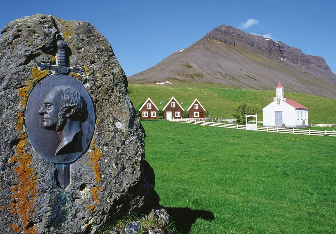
Hrafnseyri
As you finally descend from Hrafnseyrarheidi heath, keep following Road 60. To your left are small renovated turf-roofed farmhouses. This is Hrafnseyri, a museum dedicated to Jon Sigurdsson, who was one of the most prominent 19th-century politicians fighting for the independence of Iceland.He was born and raised at Hrafnseyri. Not far from the drive-way to the houses, you can find a memorial stone with a bas-relief image depicting Sigurdsson. (There’s also a statue showing him in Austurvollur square in Reykjavik.)
In Hrafnseyri, there’s also a small church. At one time, there were many small churches like this all around Iceland. Many of them have now been taken down. Hrafnseyri church was built in 1886, and though it has been knocked off its foundation twice during storms, it mostly looks the same.
You will also find a nice little coffee shop in Hrafnseyri that serves a delightful blueberry cake which we can safely say is highly recommended.
There has been a farm in Hrafnseyri since the time of Iceland’s settlement. Recent archaeological excavations have revealed the remains of old longhouses south of the church and an old cemetery, both dating to the early 11th century.
According to the Book of Settlements, Arnarfjordur fjord was settled by the Norseman Orn. He settled in Tjaldanes peninsula. A year later another Norseman came named An, along with his wife, Grelodur. At first they settled in Dufansdalur valley, but she didn’t like it and said that the ground didn’t smell right. They bought Tjaldanes peninsula and settled in Eyri, as the place was named back then. Grelodur liked that place much better and said that the grass smelled like honey. When An died, he was laid in a barrow in the mountain towering over Hrafnseyri, Mt. Anarmuli.
Later in the 12th century, Hrafn Sveinbjarnarson lived there. Hrafn was one of the leaders who made his mark during the Age of the Sturlungs. He traveled far, journeying to England, Spain and even Italy. Hrafn was quite talented. He is considered to be the first medical doctor in Iceland. He was said to be quite handsome, with dark hair. He was also a good swimmer and skilled with bow and arrow. Hrafn was also a fine smith, well spoken and learned in the ways of the law. He lived in turbulent times and, due to political strife, Hrafn was executed on the 4th of March 1213.
Dynjandi waterfall
Once you’ve explored Hrafnseyri museum, keep following Road 60 towards Dynjandi waterfall. The road clings to the steep mountains on either side of Arnarfjordur fjord. After a little less than half an hour’s drive, you should see a spectacular, multi-tiered waterfall come into view. Make a left turn at the intersection and follow the short road towards the parking lot.
Dynjandi waterfall is actually a collection of waterfalls, and it’s more than worth it to spend some time there. Dynjandi waterfall is the largest waterfall in the Westfjords. Many locals say that it is the most majestic and most beautiful waterfall in Iceland. (Though not all Icelanders agree on that point.) Still, it’s fair to say that the waterfall is a gorgeous sight. Dynjandi has been preserved as a natural monument since 1981. Please respect the fragile nature and stay on the walking paths.
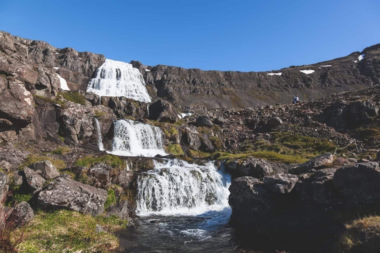
It’s an easy hike from the parking lot to see the first three waterfalls. However, the climb to the topmost waterfall can be difficult, and we recommend that you wear waterproof shoes.
Not far from the parking lot, you can see ruins of an old farm. It was inhabited until 1951. As the story goes, the wife of the farmer who used to live there couldn’t stand listen to the constant roar of the thunderous waterfall. Having a picnic near the farm’s ruins is very nice, especially on a clear summer day.
Return to Road 60, once you’ve enjoyed the waterfalls.
Geirthjofsfjordur fjord – hike
Ahead is the Dynjandisheidi heath. The road is at its highest point at 500 meters (1640 feet) above sea level, and often the heath is clad in heavy fog. When the fog hits, it is easy to imagine why people of bygone days had many different stories and legends about trolls, giants and other mythical creatures hiding in the fog. Shadows cast by large rocks, cliffs and mountains quickly come alive as you travel through the fog.
Once you’ve crossed the heath’s highest point, you should see a large informational sign to your right and a small parking lot. If you stop there, you will find information about Geirthjofsfjordur fjord and how it relates to the saga of Gisli. His wife, Audur, moved there after Gisli was sentenced for the murder of this brother-in-law. Gisli also hid in Geirthjofsfjordur when he was not on the run.
There’s a hiking trail leading from the parking lot to the fjord, which is serene and beautiful to behold. The hike takes a few hours, and though it is a bit steep at times, it is more than worth the effort. The fjord is lovely and offers a great chance to feel the special remoteness. Not to mention, if you are into Icelandic sagas, this the setting where one of the most independent women of the sagas lived and made her stand… more than once.
When you return from the hike, keep following Road 60, but make a right turn at the intersection and follow Road 63 towards Bildudalur village.
Bildudalur – Monster Museum
Arnarfjordur fjord branches into five different fjords, Geirthjofsfjordur fjord among them. The other fjords are Bildudalsvogur, Fossfjordur, Reykjarfjordur and Trostanfjordur. Together these fjords are called the Sudurfjords (The Southern Fjords). The scenery is typical for the Westfjords: steep, flat-topped basalt mountains and lush valleys at the bottom of the fjords.
Road 63 zigzags (that’s a verb, right?) down from Dynjandisheidi heath into Reykjafjordur fjord. There are two valleys in Reykjarfjordur, called Nedri- and Fremri-Reykjarfjordur. There’s also a small swimming pool in the fjord. If you have time to spare, it’s simply awesome to spend a blissful half an hour swimming in a pool in an obscure, uninhabited fjord. It’s just as relaxing as it sounds.
Keep following Road 63 and cross the other two fjords. The next valley is called Otradalur valley. This is where Eyjolfr the Grey lived. He was hired to collect the bounty for Gisli’s head in the Saga of Gisli. Though Gisli managed to elude his pursuers, Eyjolfr finally managed to capture and kill the outlaw in Geirthjofsfjordur fjord. You will find an informational sign about the fjord not far from the road.
Next up is Bildudalur village. Bildudalur is a pretty village on the shores of Arnarfjordur with a dark and scary secret. The history of sea monster sightings in Icelandic history, folk culture and literature is waiting to be discovered in the Icelandic Sea Monster Museum.
Although the population of Bildudalur is only about 200 residents, music and culture has flourished there for decades. The village hosts an annual folk music festival with workshops that guests can attend. Bildudalur is also the location of Iceland’s only steam-punk festival. The village is also becoming a popular destination for artists seeking inspiration from the spectacular scenery.
There’s a good coffee shop in Bildudalur, called Vegamot. As with many villages in the Westfjords, the fish is as fresh as it gets. Therefore we recommend that you try out Vegamot’s fish ‘n chips.
Once you’ve explored the Monster Museum and tried out the fish ‘n chips, follow Road 619 north. The road takes a turn to the west towards the Ketildalir valleys.
The Ketildalir valleys
On the southern shore of Arnarfjordur fjord you’ll find a row of short valleys. Surrounded by steep basalt mountains, most of which are flat-topped and reach as high as 600 meters (1969 feet), these valleys show vividly how Ice Age glaciers formed and sculpted the land in the Westfjords. Fossils can be found in the many crevasses and gorges lining the mountain sides, some of which date as far back as to the Tertiary Period.
The best known of those valleys is probably Selardalur, a very popular destination because of the sculptures and buildings raised by the Naïve artist Samuel Jonsson. Samuel is referred to as “the artist with the infantile heart”.
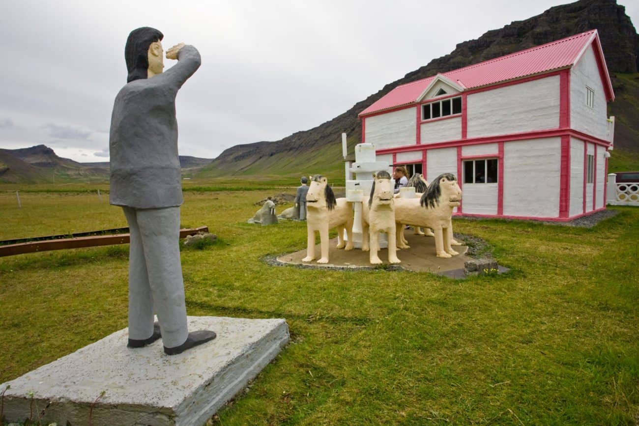
When he retired at the age of 72 in 1958, he pursued his dreams and became an artist. Mostly he created sculptures from concrete and carried the sand on his back from the shore to his farm Brautarholt. In his backyard, among other things, he has replicated the Lions Court in Alhambra.
Head back, followingRoad 619 to Bildudalur village. Follow Road 63 west towards Talknafjordur fjord, crossing Halfdan heath.
Talknafjordur
As you descend from Halfdan heath, make a left turn at the intersection and follow Road 617 to find the village Talknafjordur, a small fishing village. In recent years Talknafjordur, like a few other villages in Iceland, has seen quite prosperous times due to salmon farming.
Talknafjordur is also a great place for anyone interested in sea angling. Many tour operators offer tours where you can go and try your luck at this great sport, perhaps even catching a cod or two. There’s also a small café a little north of the town, called Café Dunhagi, where you can have some great dishes. Be sure to ask the hostess about her ingredients. She forages for some natural ingredients, which provide both a great story and a great taste.
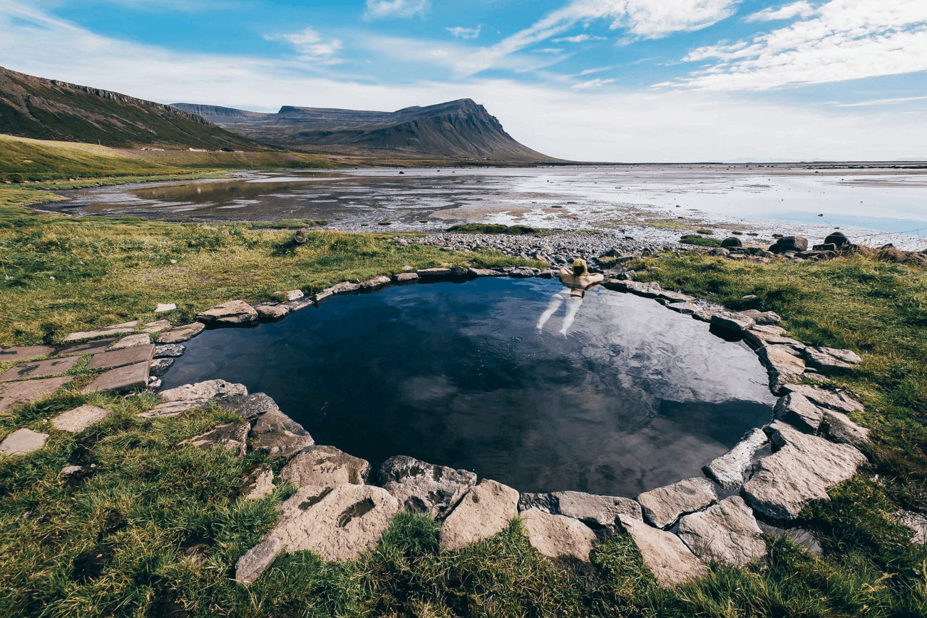
Keep following Road 617 to find a local favorite, Pollurinn Hot Pool.
Pollurinn
A local must-see is “Pollurinn“ or ” the pool.” It is a geothermal pool located in the hill-side close to the village itself. The hot water flows unfiltered from the ground, resulting in greenish algae floating in the water and sticking to the edges of the pool. The stunning views of the fjord, mountains and the ocean will, without a doubt, take your breath away. With rustic changing facilities, swimming here does not come any more natural than this!
Once you’ve enjoyed the bath and the view, follow Road 617 back to the intersection and turn right, following Road 63. The road follows a valley called Miklidalur and climbs to 170 meters (558 feet) before descending toward Patreksfjordur fjord.
Patreksfjordur
Patreksfjordur fjord was named by its first settler, Orlygur Hrappsson, who was a Christian. Today the economy in Patreksfjordur is booming, thanks to salmon farming. For the first time since the 1980’s, the village has seen an increase in population in recent years.
A favorite local tourist attraction is a pirate exhibition depicting the stories of pirates that raided the Icelandic shoreline in the 15th and 16th century. The natural beauty of the area offers many exciting hiking options and is the last place for you to stock up on supplies before heading to the nearby Latrabjarg bird cliffs or the wonderful beach at Breidavik. Stukuhusid restaurant is also very nice, especially for the homemade cakes; the view from the restaurant is also breathtaking.
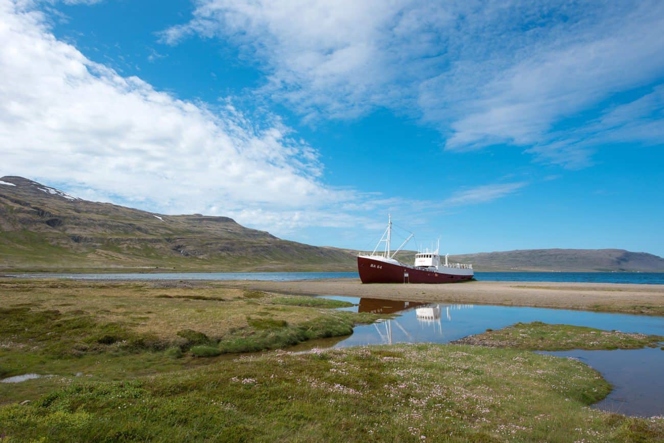
Once you’ve explored Patreksfjordur follow Road 62. At the bottom of the fjord, at the intersection, make a right turn and follow Road 612. Not far from the intersection is a beached trawler. This is Gardar BA 64, the oldest steel ship in Iceland. This is a perfect place for a picnic,and there’s even a bench with a table nearby. Be careful if you want to explore the ship’s interior because there are many sharp and broken objects everywhere.
Keep following Road 612 towards Orlygshofn, which is a short valley ending in rather a large lagoon on the southern side of the Patreksfjord Bay. The valley is named after the first settler of the area, Orlygur the Old, son of Hrappur. As the story goes, Orlygur was raised in the The Minch, near Scotland, by Bishop Patrick (hence the name of the fjord). Orlygur sailed his ship into the lagoon and fastened it to a large rock (which many have searched for, but no has found it yet). Orlygur only stayed in Orlygshofn a single winter before moving south to Kjalarnes peninsula, where he built a farmstead and a church.
Hnjotur
At the farm Hnjotur in Orlygshofn, you will find the Egill Olafsson museum. The museum preserves local history through a potpourri exhibition of farming and fishing equipment and other unique objects of historical interest collected by the museum’s namesake, Egill Olafsson.
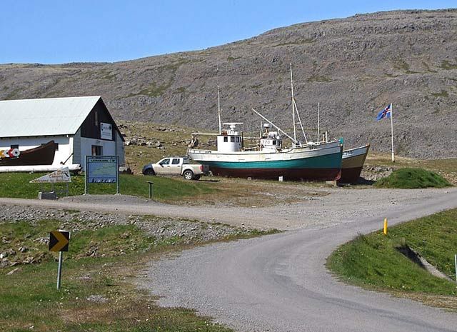
This museum is among the most interesting in the country, and we can fully recommend taking the time to explore it. The museum displays a unique collection of old items from the Southern Westfjords. The museum also shows the history of fishing, farming and everyday life in the area.
Keep following Road 612 once you’ve explored the museum and Orlygshofn.
Breidavik and Hvallatur
Since Road 612 is a single lane gravel road, please drive slowly and carefully. The heath, Hafnarfjall, is not always accessible for driving, so make sure you check with a local before heading this way. After about half an hour, you will see a large white sand beach to your right. This is Breidavik beach. There’s also a camping ground and a guesthouse in Breidavik. You can park your car at the guesthouse and follow a hiking trail to the beach.
Here is a photo tip for you: stand and take pictures at the midpoint of the beach, and your photos will look like you are standing in a desert!
Breidavik used to be a fishing port, and there are many ruins to be found there that relate to that era. You can find many of these ruins above the fields east of the main buildings.
Once you’ve explored the beach, head back for your car and return to Road 612, turning right when at the intersection. After a short while, the road descends sharply, and will you find yourself amidst a few summer houses. This is Hvallatur.
Hvallatur used to be a rather large fishing port called Brunna. As you leave behind the summer houses, the ruins of the fishing port will be straight ahead. You can still see stones in the hills where fish was dried, and there are also ruins of old houses and walls. During the 18th century, there were as many as 20 fishing boats there. There’s an informational sign to the left of the road, near Karnafit. Stopping there and listening to the waves and smelling the salty air is also more than worth it.
It’s interesting that people from all over West Iceland came to both Hvallatur and Breidavik to fish, since these were very good fishing ports. They would travel all this way and across many heaths, to fish in these remote coves.
Keep following the gravel road to find Latrabjarga sea cliffs.
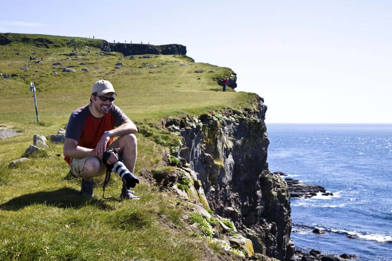
Latrabjarg
Latrabjarg is Iceland’s largest sea cliff, stretching 14 kilometers (8.75 miles) and peaking at a height of 441 meters (1,447 ft). This majestic cliff’s claim to fame is that it is the westernmost point in Europe and hosts Iceland’s greatest concentration of seabirds.
The cliffs also make a stunning viewpoint for Aurora Borealis during Northern Lights Season, but hikers should beware as the cliff edges are fragile, and it is a long drop to the beautiful beaches below. If you are traveling with children, make sure you hold their hands at all times.
Thousands of Iceland’s iconic puffins frolic about, as well as gannets, guillemots, razorbills, white-tailed eagles, red-throated loons, arctic terns, redshanks, snipes, auks, murres, kittiwakes, fulmars, snow buntings, and ringed plovers. This is a birder’s paradise.
Once you’ve explored Latrabjarg make your way back by following Road 612 to where Road 612 intersects with Road 614, leading to Raudisandur beach. Make a left turn and follow Road 614.
Raudisandur beach
If you suffer from vertigo, perhaps this is not the detour for you. The road might not look like much to begin with, but as you draw nearer to Raudisandur beach, the road clings to a very steep mountain side and precariously winds downwards.
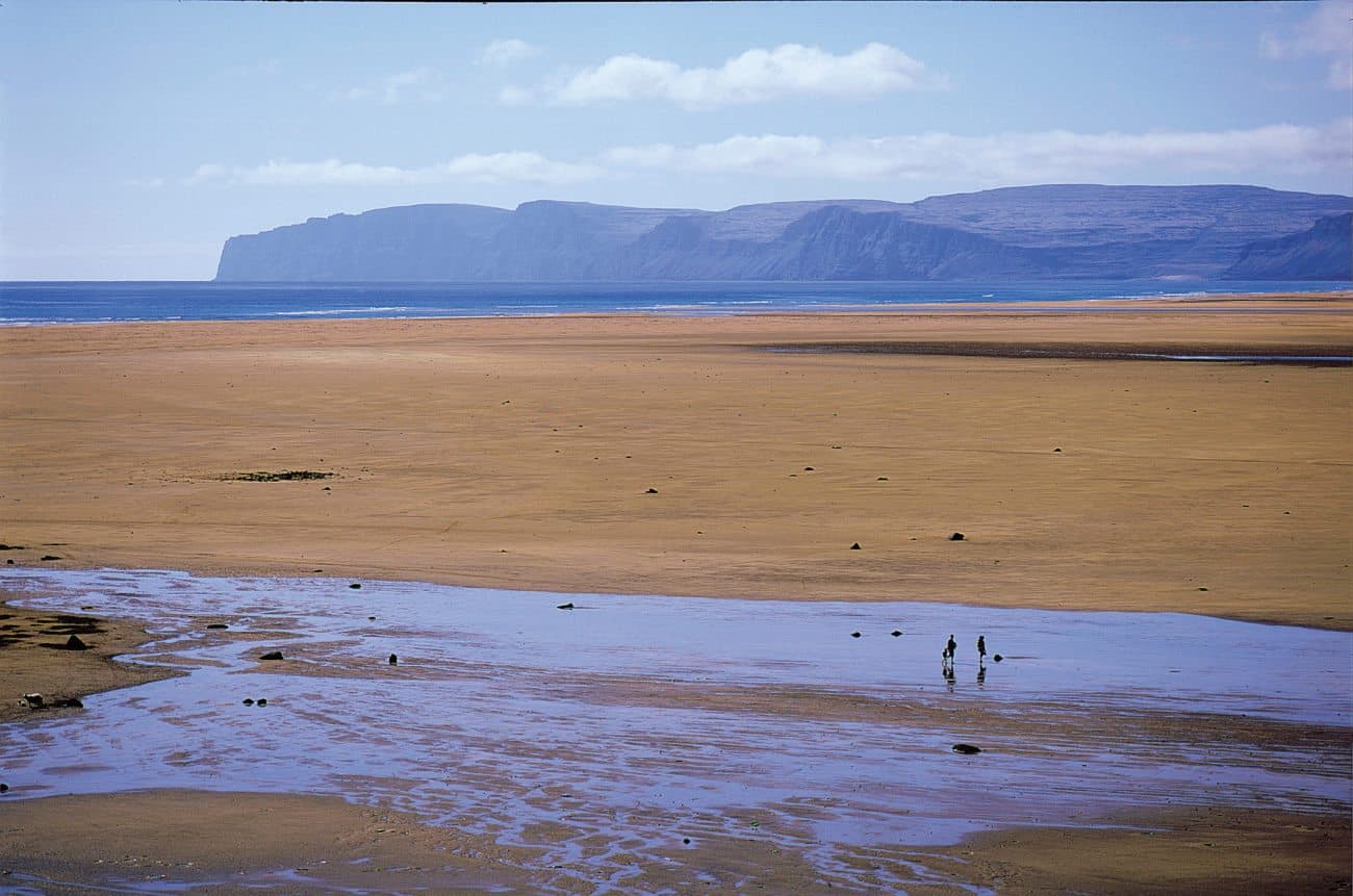
Once down, you will come to an intersection. Since the beach is very long it doesn’t matter if you choose to go left towards Melanes camping site or if you turn right. Raudisandur offers a spectacular view and countless numbers of seabirds and seals. The beach sand is a golden red color in the Latrabjarg area. The magnificent hues of the sand differ with daylight and weather. This is a great place to hunt for shells, as well as to spot seals and birds.
There’s a small coffee shop here, The French Café, which is open during the summer. You can enjoy the view over the beach with a nice cup of coffee and a slice of cake.
Follow Road 614 back to the intersection and make a left turn, following Road 612. Make another left turn when Road 612 intersects withRoad 62, and follow it to the Bardastrond area.
Bardastrond area
The Bardastrond area is characterized by shallow fjords and lush valleys. Due to how sparsely populated the area is, it is a favorite among many Icelanders. In many places in the Westfjords there isn’t a good mobile connection, and this is especially true for the Bardastrond area — in particular the eastern part.
Road 62 crosses Kleifaheidi heath. The heath reaches over 400 meters(1312 feet) above sea level and, during the winter, closed due to heavy snow. As you are about to reach the highest point you will pass by a statue to your left. This statue was erected by the men who built the road in 1947 and, as the story goes, is supposed to be a member of the Icelandic Parliament. This also makes a nice stop, since the view from the statue is spectacular.
As you start descending from the heath, you will enter the Bardastrond area. The road is no longer gravel, and you will pass many beautiful vales and valleys. Keep following Road 62 until you reach Birkimelur pool.
Birkimelur
This small pool is a great stop. You can enjoy a relaxing bath in the small pool, which has a superb view of the ocean and the surrounding mountains. There’s also a small circular pool just by the seaside, which is also very nice. Poolside amenities are a bit rustic, so to speak, but it only makes the experience all the more fun.
Once you’ve bathed, keep following road 62 towards Brjanslaekur ferry.
Brjanslaekur
The Brjanslaekur ferry by Vatnsfjordur fjord can take you across Breidafjordur fjord, stopping at Flatey Island. We certainly recommend this route; the ferry ride is smooth and easy, though it takes a couple of hours. Please be advised to check the ferry schedule beforehand. If you have to wait, there is a small coffee shop close to the ferry, or you can make a short detour to Flokalundur. Keep following Road 62 for a few minutes.
If you wish to drive all the way back to Reykjavik, keep following Road 62 until it intersects with Road 60 at Flokalundur. Follow Road 60 until it intersects with Road 1 in Nordurardalur valley. Make a left turn and follow Road 1 in the direction of Reykjavik.
On the drive you’ll pass through Vatnsfjordur, a shallow fjord that appears in the Saga of Gisli. The outlaw had been hiding in one of the many islands of Breidafjordur bay, but his pursuers found him. He escaped by rowing to shore, where he landed on the eastern banks of Vatnsfjordur and started running. His pursuers were breathing down his neck, so he decided to cross the fjord by swimming over to the western bank. Thus he managed to escape the bounty hunters– at least for the time being.
Flokalundur – detour
Flokalundur has a small camping ground and a nice little hotel. Flokalundur is where, according to the Book of Settlements, Iceland was named. As the story goes, a Norseman called Hrafna-Floki, or Raven-Floki, came to this land and saw that every river was filled with fish, the woods were good and the land was rich. So, he became careless and didn’t take the time to gather the food and shelter needed for his people and livestock to survive winter. But winter did come and, oh, did it come! And it was hard and long (though, thankfully, no Whitewalkers!). Floki’s livestock perished, and his family was starving. Eventually Floki decided to hike to the top of a nearby mountain to see if he could see any signs that spring was coming. To his dismay, all he saw was ice and more ice, glaciers and even sea ice. He cursed and said that this land would now be known as Iceland to deter anyone from ever coming to this damned land.
Not far from Flokalundur is a small geothermal pool. Just follow Road 60 for a few minutes; the pool is to the right. If you have time to spare, it’s nice to have a little dip in it.
Once you’ve explored Flokalundur, either keep following Road 60 to Reykjavik or return to Brjanslaekur ferry.
Flatey
Flatey is the only inhabited island of the 3,000 small islets dotting the dramatic Breidafjordur Bay. The island is significant for its combination of natural features and historical heritage.
Nature lovers and bird watchers flock to the island for the unique volcanic scenery that provides plenty of nesting places for the large number of bird species found there. The area supports over 230 recorded species of vascular plants and around 50 regular breeding bird species, e.g. arctic tern and eider duck.
Flatey is a perfect pit stop for any birder. Many tourists leave their cars behind at Brjanslaekur and make a stop in Flatey simply to enjoy the island where time stands still. We fully recommend that you take the time to explore the island, since it is remarkable and very interesting.
The ferry disembarks in Stykkisholmur village.
Back to Reykjavik
Follow Road 54 from Stykkisholmur, make a left turn at the intersection and follow Road 56 south to Borgarnes village. From there, follow Road 1 to Reykjavik.