
Geology of Iceland

Iceland has in recent years become one of the most popular destinations for nature seeking travelers. Many of which come for the Northern Lights or the Midnight Sun. Whilst others are here to enjoy the waterfalls, glaciers or the small charming fishing villages. Iceland is famous for its delicious local cuisine, its quirky capital and astonishing landscapes. But Iceland also gets a fair amount of visitors each year that are here for the sole purpose of exploring its geological features.
Iceland has some incredibly unique geological sites and the country has extensive volcanic and geothermal activity. It is located right in the center of the Mid-Atlantic Ridge which spreads apart the continental Eurasian Plate and the North American Plate. The movement that the ridge causes create an opportunity for the magma that resides underneath to rise. This magma upwelling is called the Icelandic Plume.
Put in a very simple way, the movement caused by the Mid-Atlantic Ridge is the main reason for the volcanic activity we know so well in Iceland. Additionally its hot springs, geysers and other natural wonders. In this blog, we will explore the geology of Iceland beyond its famous volcanoes and digging deeper than usual. Let’s start at the beginning.
The Formation of Iceland
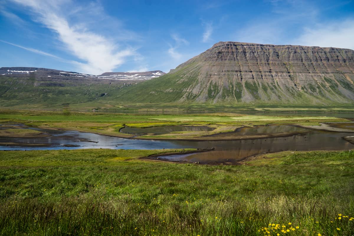
Iceland’s formation period is most commonly split into three parts. The oldest is the Tertiary Granite formation which took place around 16-18 million years ago. The period began with the magma plume which rose from the sea and hardened into the first parts of Iceland. These parts you can visit for example in the Westfjords.
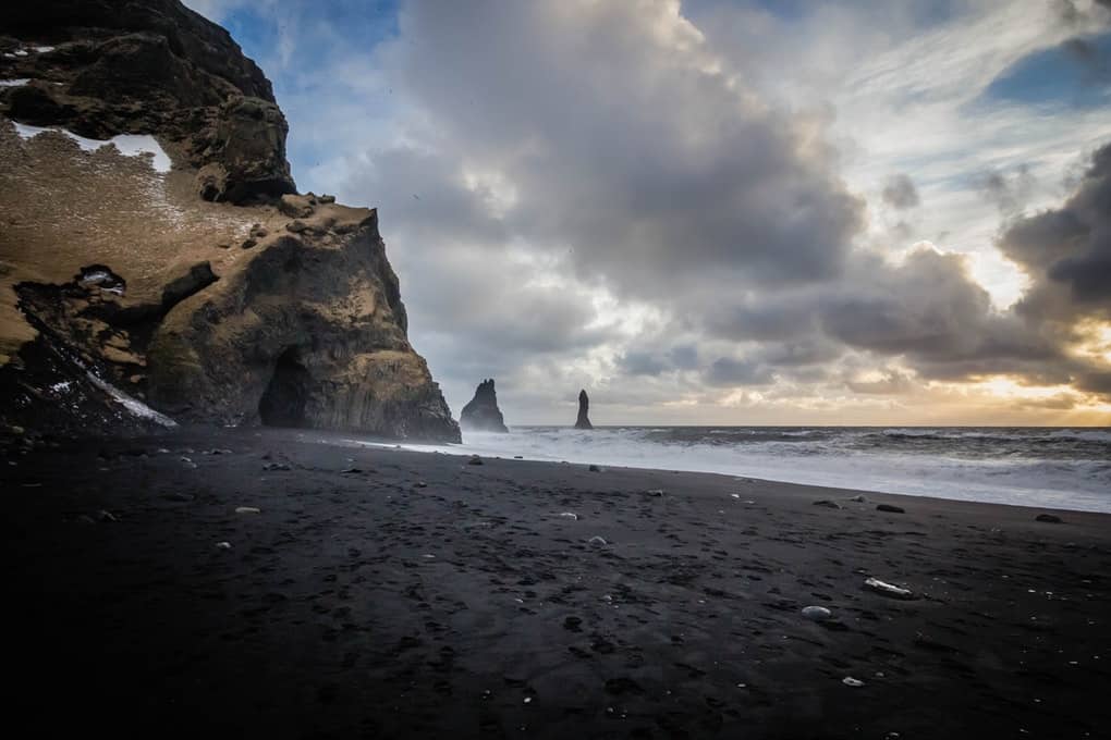
The second formation period took place during an ice age about 3 million years ago. This is when the famous tuff and dolerite mountains and cliffs came to be. The tuff formed when the volcanic eruption occurred underneath the ice caps. But the dolerite formed during warmer periods. Famous tuff mountains in Iceland are for example the Blue Mountains near Reykjavik, Valahnukur inside Thorsmork and Reynisfjall at Reynisfjara Black Sand Beach.
The third and the last formation stage took place when the ice started melting about 10.000 years ago. This is when the “modern lava” started flowing. Such as the lava field you see when driving in from the airport. Other examples include Thingvellir National Park and the lava field surrounding Langjokull glacier.
Geological Facts About Iceland
- Iceland’s formation is split into three parts: The beginning, during and after the last ice age.
- About a third of the basaltic lava erupted in recorded history have been produced by Icelandic eruptions.
- The oldest rock you can see today in Iceland above sea level is 16 million years old. The older ones have fallen into the sea.
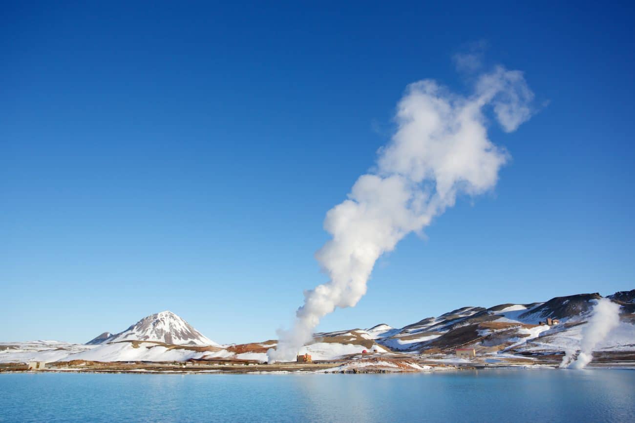
- Five major geothermal power plants exist in Iceland.
- Over 10% of Iceland’s terrain is covered in glaciers. Thereof 8% covered by Vatnajokull Glacier, the largest glacier in Europe.
- From 1963-67 a new island formed right off the South Coast of Iceland. The island which was named Surtsey and remains one of the best researched newly formed islands in the world.
- The English word geyser is taken from the once-powerful Icelandic Geysir, like the famous one seen in the Golden Circle.
Iceland’s Geological Features
- Volcanoes
- Craters
- Geysers
- Hot Springs
- Fumaroles
- Glaciers
- The Continental Plates
Different Ways Icelanders Make Use of The Geothermal Energy
Luckily, there are many positive ways to make use of geothermal activity in Iceland. The Icelandic plume brings extensive heat, enough to harvest into electricity, heating for houses and even our darling geothermal pools. There are many ways Icelanders make use of their geothermal energy.
The 6 Must-See Places in Iceland if You are Into Geology
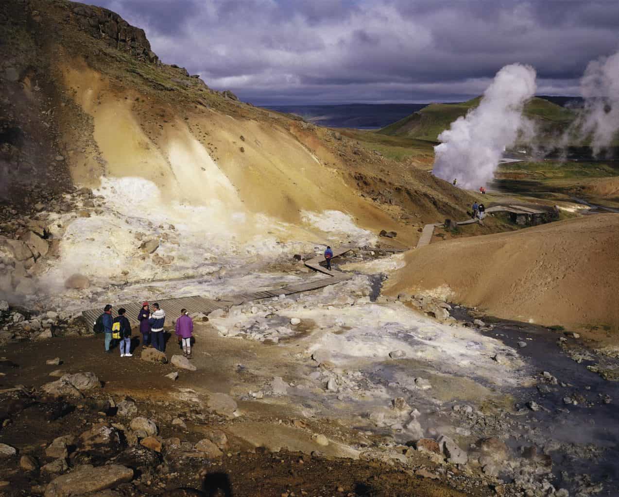
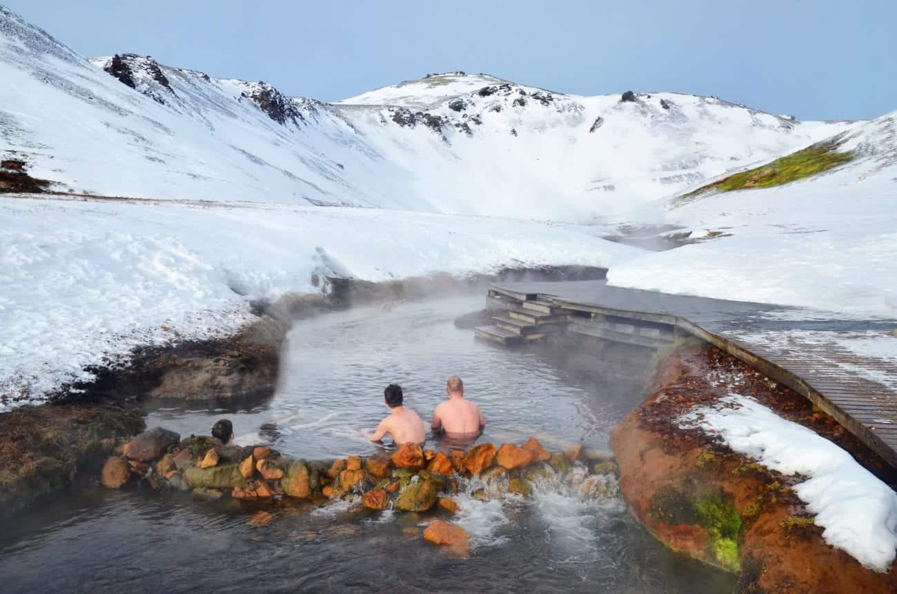
6. Reykjadalur, i.e. The Smokey Valley
Reykjadalur, more commonly known to those non-Icelandic speaking as the Smokey Valley. Located only about 45 minutes away from the capital this place is a pure geology buff’s utopia. From the town of Hveragerdi, which name means literally geyser garden, you can hike into the valley. All around you are steaming hot springs and tiny bubbling mud pools with surrounding multicolored algae, silica and sulfur. The area is incredibly colorful and uniquely characterized by the smoky (well, really steamy) pillars rising all around the paths. It is easy to see where to follow the tracks into the valley. Making this an ideal hike for Iceland visitors. However, you can easily join tours to get more geology information whilst hiking and even visit by horse!
We strongly advise to stay on track and not go wandering around. The ground simply isn’t safe and people have fallen into grass-hidden hot pools.
The hike up is about 1 hour and what awaits you is the most magical bathing area. The trail up follows a river that gets hotter the higher you go. Once all the way up the water is about jacuzzi temperature and ideal for bathing. This is a bathing experience you’ll never forget.
5. Asbyrgi
Asbyrgi is an incredibly beautiful depression in the northeastern part of Iceland. Steeped in folklore this place was thought to have formed when Sleipnir, the eight-legged horse of the pagan god Odin stepped down. Leaving this gorgeous horseshoe-shaped formation we admire today.
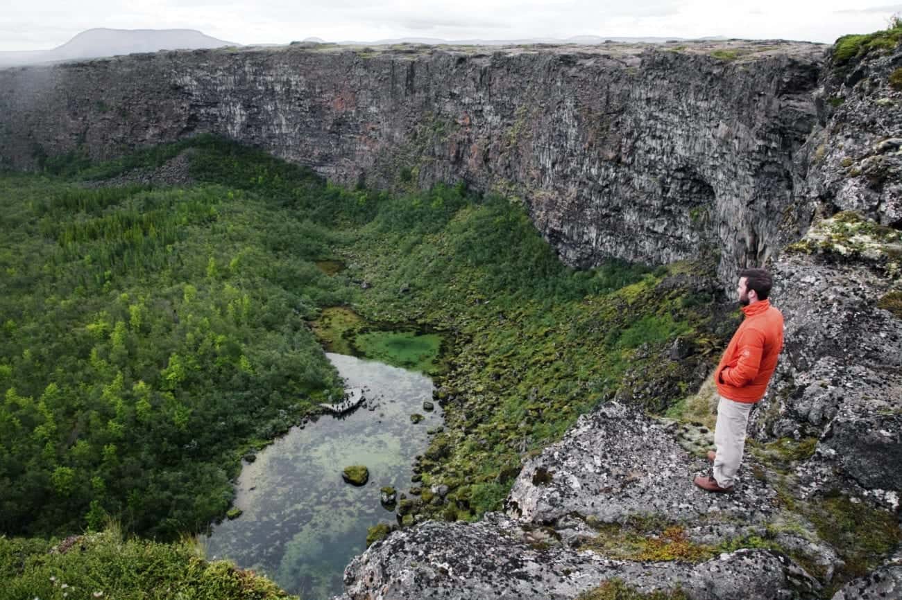
Nowadays, however, the explanation is a little more science-y. Geologists believe that Asbyrgi Canyon began to form roughly eight to ten million years ago. This was just after the last ice age when Iceland was still very much taking its current form. A volcanic eruption under one of Vatnajokull’s ice caps set of a catastrophic flood sculpting the depression. Much later, about 3000 years ago these events recurred, sculpting the grandiose canyon into the spectacle it is today.

Beautiful birch grows all around in Asbyrgi with small ponds decorating the scene in between. All of which guarded by steep and stunning basalt rock cliffs towering over the location. Asbyrgi is a real must-see and offers excellent camping!
4. The Blue Lagoon
A place that needs no introduction. The Blue Lagoon is unquestionably Iceland’s most famous landmark. Located on the geothermally active Reykjanes Peninsula and found by accident – it’s actually run-off from the nearby geothermal plant – this turquoise blue water spring located in the black lava will amaze anyone who sees it. The facilities have been upgraded greatly in the last decade. Adding an in-water bar, restaurants, in-water massages, a hotel and more but the core stays the same.
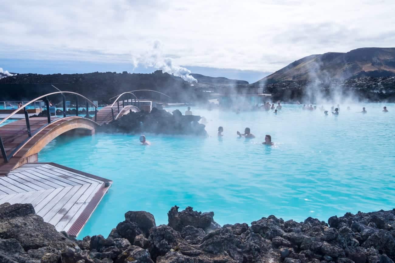
The color is created by the algae and silica in the water, medically proven to cure psoriasis and some types of eczema. This place truly has natural healing powers and anyone who baths there will feel its rejuvenating effects. One dip in the Blue Lagoon and you’ll be as refreshed as ever, one layer of a mask of its natural silica and your skin will feel like a baby’s bottom.
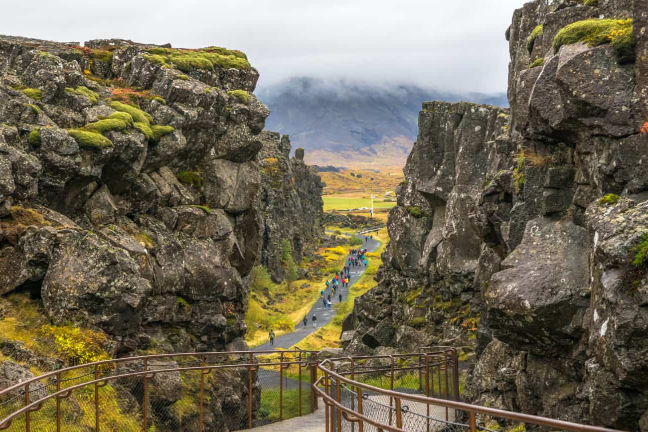
3. The Golden Circle: Thingvellir and Geysir
The Golden Circle is made up of three locations. Those locations are Thingvellir National Park, Geysir and Gullfoss. The waterfall, Gullfoss, is incredibly beautiful and well worth the visit but for the unique geological aspect, we will focus on Thingvellir and Geysir.
Thingvellir is probably the most famous geological location in Iceland. It is not only awe-inspiring in beauty and history but also is it the northeast-elongated graben that represents the Mid-Atlantic ridge. Moreover is Thingvellir the only expression of the Mid-Atlantic Ridge found above sea-level! If you visit you can go walking in between the continental plates, switching between them is only one step. For those even more adventurous the rift opened up a fissure in an earthquake a while back that then filled with glacial water. Nowadays people like to join tours to go snorkeling or diving in between, floating in between the plates!
Geysir is located in Haukadalur, a great geothermal field filled with alkaline water. Geysir is not dormant, due to an earthquake that shook it a little hard but its baby brother, Strokkur picks up the slack. Its hot spring eruption are like Geysir, driven by heat from a magma body located about 2-3 km beneath the surface. The pressure from the overlying water columns causes the water below to start boiling to temperatures over 100 degrees. By this point, it converts to steam. The decreasing pressure with proximity to the geyser’s surface then results in flash production of steam coming from the amazingly hot water which then drives the explosive eruption we know and love so much. The flash production in Strokkur causes it to be so frequent, every 4 to 10 minutes.
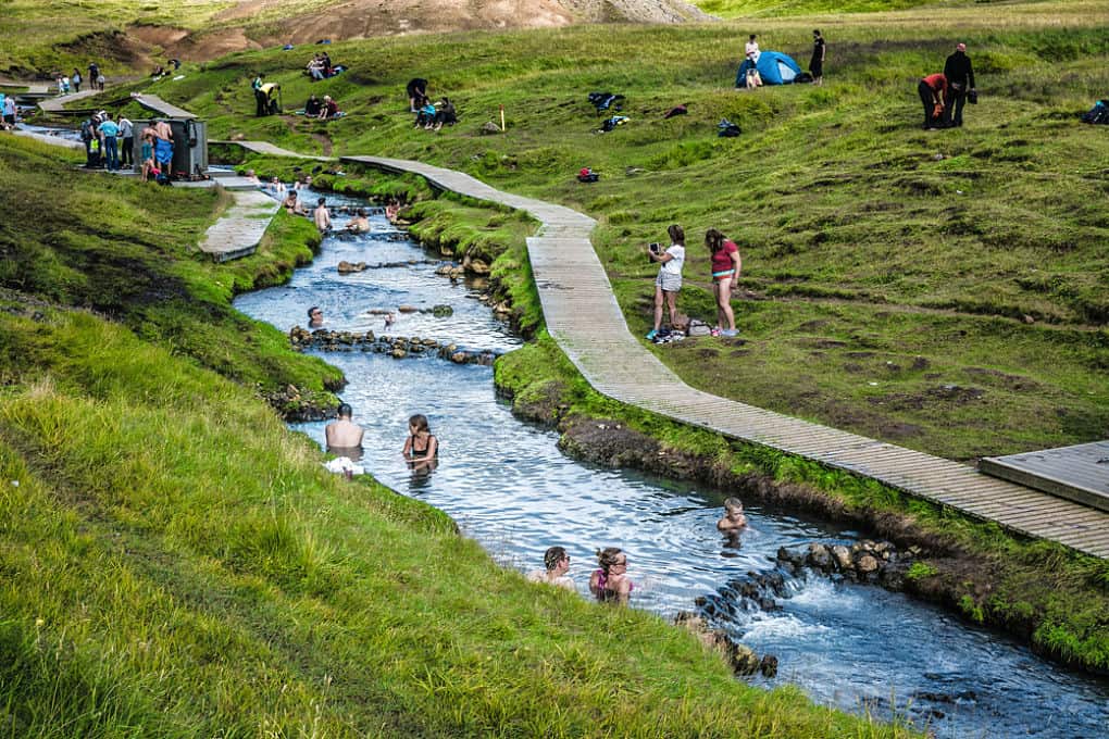
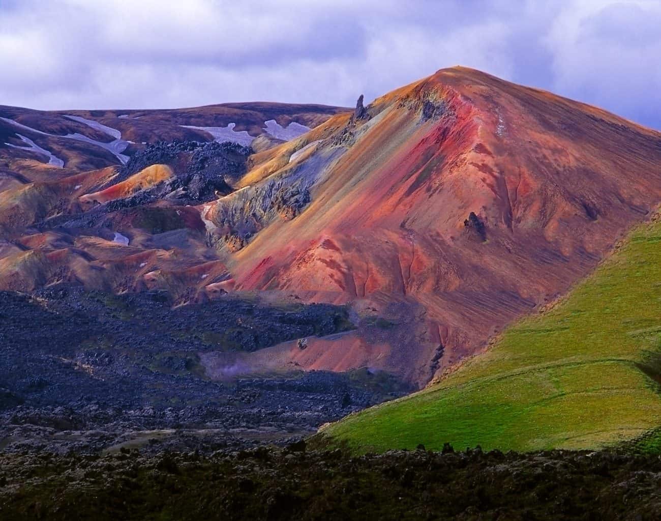
2. Landmannalaugar
Landmannalaugar is a beautiful place in the Fjallabak Nature Reserve. Its name comes from the settlers who used to visit to bathe in its pools (laugar). Still today these alluring pools have this and are visited by people from all over the world. The pools are located right at the edge of a lava field, Laugahraun, which formed in an eruption in 1477. The area as a whole is still very volcanically active and one of the more famous mountains there, the pastel Brennisteinalda last erupted in 1961.
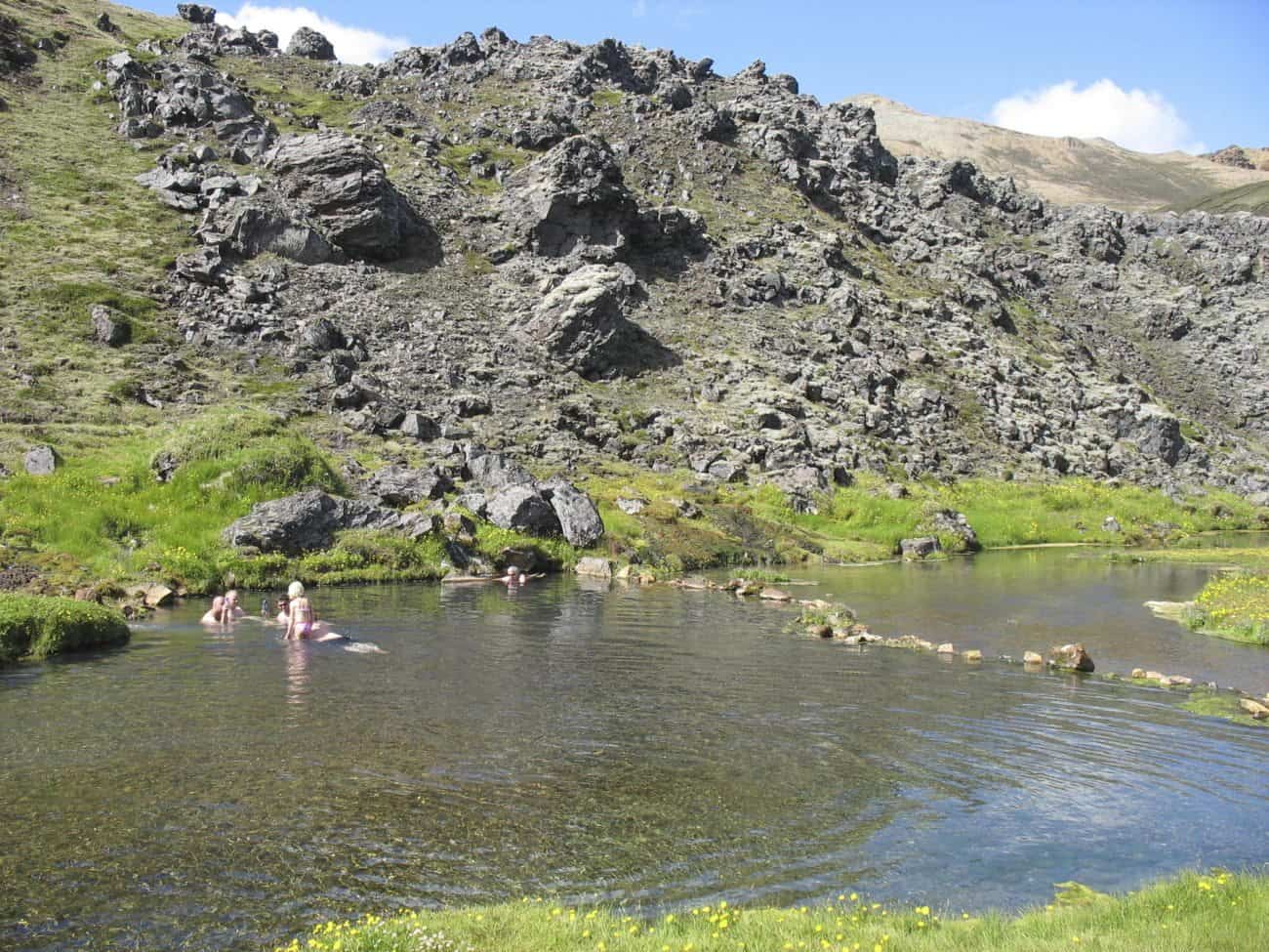
The hiking trails, the lava fields, the black obsidian rocks, the hot pools and the heavenly beauty that awaits you in Landmannalaugar is hard to explain. This place surely belongs on a bucket list for any geology enthusiast out there! Plan your visit.
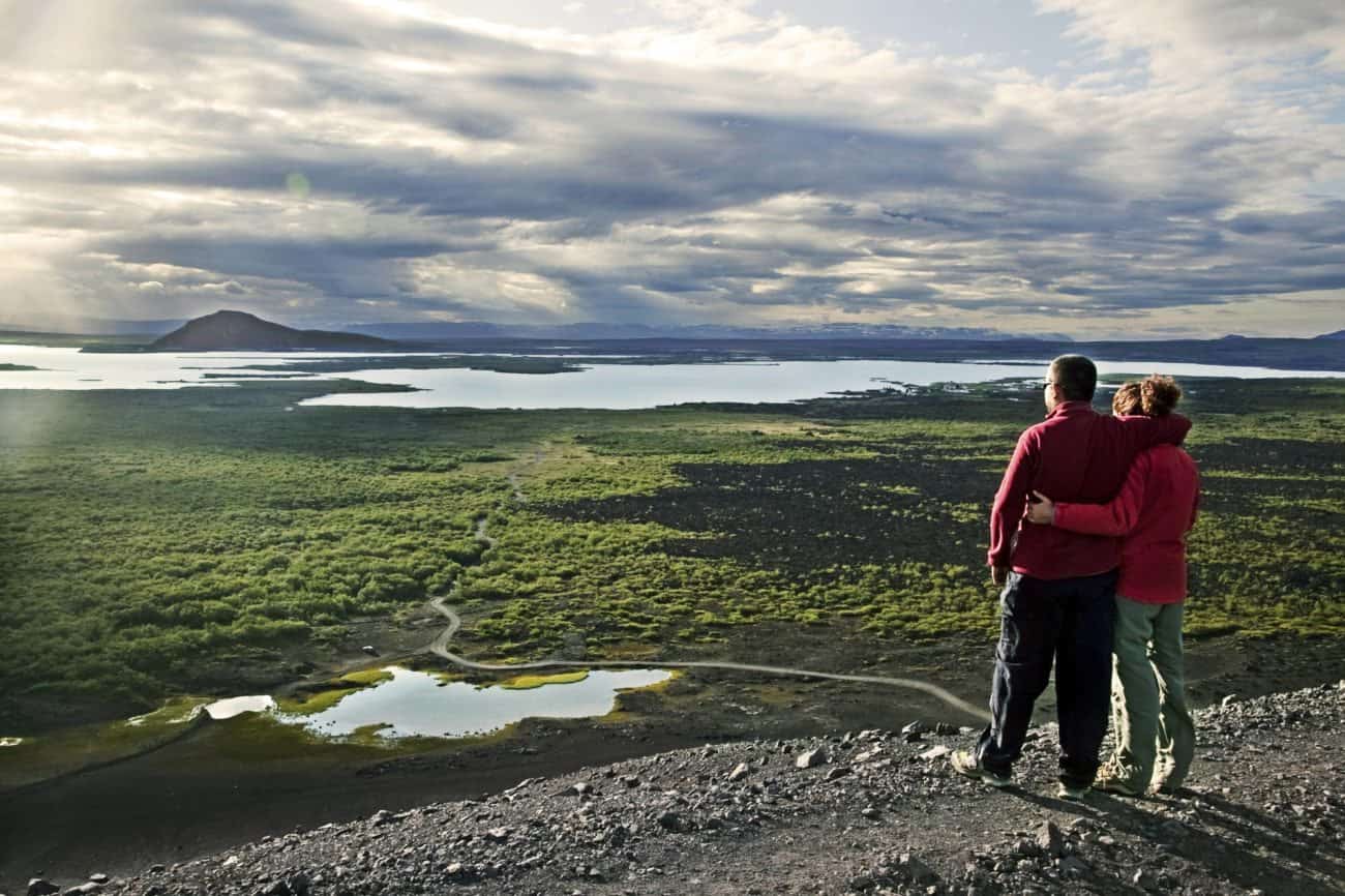
1. Myvatn
Lake Myvatn per sei isn’t the geological wonder that we are talking about. Whereas Myvatn and its surrounding areas as a whole are astonishingly unique and remarkable.
The lake formed in a large basaltic lava eruption which poured from a nearby fissure about 2,300 years ago. At the time a large lake was already present. So ,when the hot, glowing lava met the water some of the water-logged lake sediment got trapped underneath it. This collision caused minor explosions with parts of the lava and water spouting into the air. These repeated explosions took place around the area and the craters and rock pillars we now know started to build up and form.
When some time had passed, some of the water from the lakes had dried up, leaving behind forests of lava rock pillars. The most famous one is Dimmuborgir, a noteworthy location in the area and home to some unbelievably beautiful rock formations.
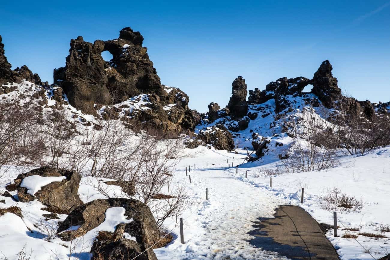
Today Myvatn’s surrounding landscape is dominated by volcanic landforms, such as craters, lava pillars and pseudocraters. Any visitor can see all the different effects the volcanic activity has had in the Myvatn area. For example, through the rhyolite mountains, the bubbling fumaroles and mud pools, the deep light blue craters and the moon-like landscapes. Myvatn and its surrounding area win every time if you are looking for a place to tickle you geology curiosity! Do you want to visit the amazing Myvatn area? Here’s our suggested itinerary.
